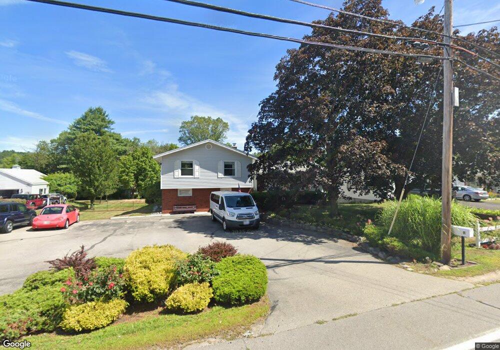
10 Dover Point Rd Dover, NH 03820
Dover Point NeighborhoodEstimated Value: $546,071 - $671,000
3
Beds
2
Baths
2,185
Sq Ft
$274/Sq Ft
Est. Value
About This Home
This home is located at 10 Dover Point Rd, Dover, NH 03820 and is currently estimated at $598,018, approximately $273 per square foot. 10 Dover Point Rd is a home located in Strafford County with nearby schools including Garrison School, Dover Middle School, and Dover Senior High School.
Ownership History
Date
Name
Owned For
Owner Type
Purchase Details
Closed on
Mar 11, 1999
Sold by
Farr Gerald A and Farr Sharon
Bought by
Heller Karl F and Heller Janet R
Current Estimated Value
Home Financials for this Owner
Home Financials are based on the most recent Mortgage that was taken out on this home.
Original Mortgage
$149,750
Interest Rate
6.73%
Purchase Details
Closed on
Jul 18, 1997
Sold by
Hatch Mark Oaks
Bought by
Farr Gerald A and Farr Sharon D
Home Financials for this Owner
Home Financials are based on the most recent Mortgage that was taken out on this home.
Original Mortgage
$120,000
Interest Rate
7.79%
Create a Home Valuation Report for This Property
The Home Valuation Report is an in-depth analysis detailing your home's value as well as a comparison with similar homes in the area
Home Values in the Area
Average Home Value in this Area
Purchase History
| Date | Buyer | Sale Price | Title Company |
|---|---|---|---|
| Heller Karl F | $149,900 | -- | |
| Farr Gerald A | $135,000 | -- |
Source: Public Records
Mortgage History
| Date | Status | Borrower | Loan Amount |
|---|---|---|---|
| Open | Farr Gerald A | $218,233 | |
| Closed | Farr Gerald A | $228,000 | |
| Closed | Farr Gerald A | $149,750 | |
| Previous Owner | Farr Gerald A | $120,000 |
Source: Public Records
Tax History
| Year | Tax Paid | Tax Assessment Tax Assessment Total Assessment is a certain percentage of the fair market value that is determined by local assessors to be the total taxable value of land and additions on the property. | Land | Improvement |
|---|---|---|---|---|
| 2024 | $9,361 | $515,200 | $168,800 | $346,400 |
| 2023 | $8,365 | $447,300 | $149,200 | $298,100 |
| 2022 | $8,400 | $423,400 | $149,200 | $274,200 |
| 2021 | $7,914 | $364,700 | $125,600 | $239,100 |
| 2020 | $7,999 | $321,900 | $125,600 | $196,300 |
| 2019 | $7,716 | $306,300 | $113,900 | $192,400 |
| 2018 | $7,194 | $288,700 | $102,100 | $186,600 |
| 2017 | $6,923 | $267,600 | $86,400 | $181,200 |
| 2016 | $6,462 | $245,800 | $80,800 | $165,000 |
| 2015 | $6,112 | $229,700 | $68,700 | $161,000 |
| 2014 | $5,974 | $229,700 | $68,700 | $161,000 |
| 2011 | $6,426 | $255,800 | $72,500 | $183,300 |
Source: Public Records
Map
Nearby Homes
- 15 Teresa Dr
- 6 Hayden Dr
- 55 Pointe Place Unit 108
- 55 Pointe Place Unit 101
- 55 Pointe Place Unit 201
- 55 Pointe Place Unit 304
- 6 Revolution Dr
- 51 Constitution Way
- 13 Stark Ave
- 99 Back River Rd
- 14 Independence Dr
- 1 Independence Dr
- 20 Lenox Dr Unit c
- 22 Lenox Dr Unit D
- 16 Polly Ann Park
- 29 Lenox Dr Unit B
- 16 Lenox Dr Unit C
- 15 Lenox Dr Unit A
- 26 Lenox Dr Unit D
- 23 Lenox Dr Unit A
- 8 Dover Point Rd
- 12 Dover Point Rd
- 6 Dover Point
- 6a Dover Point Rd
- 14 Dover Point Rd
- 16 Dover Point Rd
- 9 Applevale Dr
- 13 Dover Point Rd
- 13 Applevale Dr
- 7 Applevale Dr
- 11 Applevale Dr
- 5 Applevale Dr
- 15 Applevale Dr
- 21 Village Dr
- 19 Village Dr
- 23 Village Dr
- 23 Village Dr
- 17 Applevale Dr
- 25 Village Dr
- 3 Applevale Dr
Your Personal Tour Guide
Ask me questions while you tour the home.