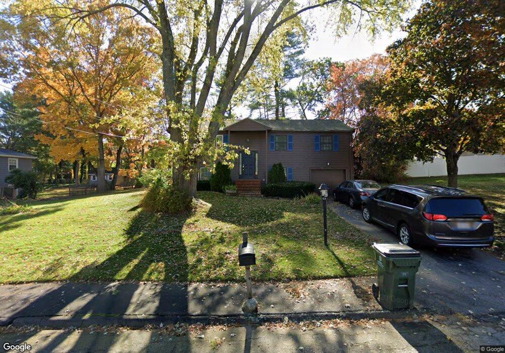
10 Hawthorne Dr Unit D Franklin, MA 02038
Estimated Value: $475,000 - $540,000
3
Beds
3
Baths
1,800
Sq Ft
$282/Sq Ft
Est. Value
About This Home
This home is located at 10 Hawthorne Dr Unit D, Franklin, MA 02038 and is currently estimated at $506,933, approximately $281 per square foot. 10 Hawthorne Dr Unit D is a home located in Norfolk County with nearby schools including Helen Keller Elementary School, Annie Sullivan Middle School, and Franklin High School.
Ownership History
Date
Name
Owned For
Owner Type
Purchase Details
Closed on
Nov 14, 2011
Sold by
Kumar Jeetendra and Prasad Manisha
Bought by
Prasad Manisha
Current Estimated Value
Home Financials for this Owner
Home Financials are based on the most recent Mortgage that was taken out on this home.
Original Mortgage
$179,000
Outstanding Balance
$71,071
Interest Rate
4.01%
Mortgage Type
Purchase Money Mortgage
Estimated Equity
$435,862
Purchase Details
Closed on
Dec 30, 2003
Sold by
Minicucci Robert and Minicucci Anne B
Bought by
Kumar Jeetendra and Prasad Manisha
Create a Home Valuation Report for This Property
The Home Valuation Report is an in-depth analysis detailing your home's value as well as a comparison with similar homes in the area
Purchase History
| Date | Buyer | Sale Price | Title Company |
|---|---|---|---|
| Prasad Manisha | -- | -- | |
| Kumar Jeetendra | $277,900 | -- |
Source: Public Records
Mortgage History
| Date | Status | Borrower | Loan Amount |
|---|---|---|---|
| Open | Prasad Manisha | $179,000 | |
| Previous Owner | Kumar Jeetendra | $186,000 | |
| Previous Owner | Kumar Jeetendra | $192,000 | |
| Previous Owner | Kumar Jeetendra | $197,000 |
Source: Public Records
Tax History
| Year | Tax Paid | Tax Assessment Tax Assessment Total Assessment is a certain percentage of the fair market value that is determined by local assessors to be the total taxable value of land and additions on the property. | Land | Improvement |
|---|---|---|---|---|
| 2025 | $5,715 | $491,800 | $0 | $491,800 |
| 2024 | $5,166 | $438,200 | $0 | $438,200 |
| 2023 | $5,148 | $409,200 | $0 | $409,200 |
| 2022 | $4,918 | $350,000 | $0 | $350,000 |
| 2021 | $4,706 | $321,200 | $0 | $321,200 |
| 2020 | $5,118 | $352,700 | $0 | $352,700 |
| 2019 | $4,197 | $286,300 | $0 | $286,300 |
| 2018 | $3,854 | $263,100 | $0 | $263,100 |
| 2017 | $3,447 | $236,400 | $0 | $236,400 |
| 2016 | $3,429 | $236,500 | $0 | $236,500 |
| 2015 | $3,548 | $239,100 | $0 | $239,100 |
| 2014 | $3,276 | $226,700 | $0 | $226,700 |
Source: Public Records
Map
Nearby Homes
- 204 Lincoln St
- 17 Longhill Rd
- 41 Kimberlee Ave
- 100 Daniels St
- 91 Oliver Pond Cir Unit 3
- 83 Oliver Pond Cir Unit 7
- 70 Oak St
- 14 Pleasant St Unit B
- 24 Shayne Rd Unit 110
- 254 Daniels St
- 27 Dover Cir
- 88 Crescent St
- 30 Longobardi Dr Unit 30
- 99 Leland Rd
- 10 Populatic Street Extension
- 120 Union St Unit 1
- 29 Elm St
- 1801 Franklin Crossing Rd Unit 1801
- 90 E Central St Unit 103
- 90 E Central St Unit 106
- 10 Hawthorne Dr
- 10 Hawthorne Dr Unit D
- 12 Hawthorne Dr Unit D
- 8 Hawthorne Dr
- 16 Hawthorne Dr
- 11 Midland Ave
- 20 Hawthorne Dr
- 9 Hawthorne Dr Unit C,9
- 11 Hawthorne Dr
- 9 Midland Ave
- 6 Hawthorne Dr
- 9 Hawthorne Dr
- 7 Hawthorne Dr Unit B
- 7 Hawthorne Dr
- 13 Hawthorne Dr
- 7 Midland Ave
- 19 Hawthorne Dr
- 17 Hawthorne Dr
- 17 Hawthorne Dr Unit 17D
- 4 Hawthorne Dr
Your Personal Tour Guide
Ask me questions while you tour the home.