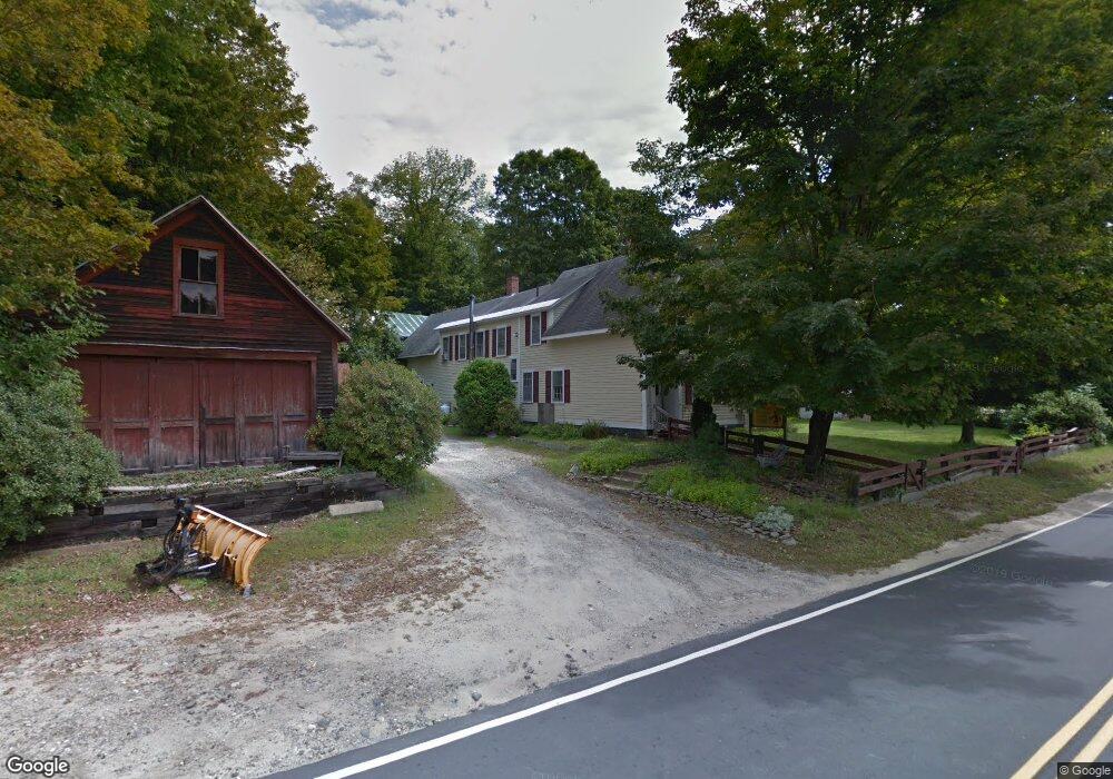
10 Mae Campton, NH 03223
Estimated Value: $357,000 - $579,000
3
Beds
2
Baths
2,136
Sq Ft
$222/Sq Ft
Est. Value
About This Home
This home is located at 10 Mae, Campton, NH 03223 and is currently estimated at $474,760, approximately $222 per square foot. 10 Mae is a home located in Grafton County with nearby schools including Campton Elementary School and Plymouth Regional High School.
Ownership History
Date
Name
Owned For
Owner Type
Purchase Details
Closed on
Aug 10, 2011
Sold by
Us Bank Na
Bought by
Avery Michael J and Tallman Julie M
Current Estimated Value
Home Financials for this Owner
Home Financials are based on the most recent Mortgage that was taken out on this home.
Original Mortgage
$108,000
Outstanding Balance
$74,568
Interest Rate
4.51%
Mortgage Type
Purchase Money Mortgage
Estimated Equity
$400,192
Purchase Details
Closed on
Sep 7, 2010
Sold by
Angus Cheryl and Us Bank Na
Bought by
Us Bank Na
Create a Home Valuation Report for This Property
The Home Valuation Report is an in-depth analysis detailing your home's value as well as a comparison with similar homes in the area
Home Values in the Area
Average Home Value in this Area
Purchase History
| Date | Buyer | Sale Price | Title Company |
|---|---|---|---|
| Avery Michael J | $135,000 | -- | |
| Us Bank Na | $159,900 | -- |
Source: Public Records
Mortgage History
| Date | Status | Borrower | Loan Amount |
|---|---|---|---|
| Open | Us Bank Na | $108,000 | |
| Previous Owner | Us Bank Na | $209,950 |
Source: Public Records
Tax History Compared to Growth
Tax History
| Year | Tax Paid | Tax Assessment Tax Assessment Total Assessment is a certain percentage of the fair market value that is determined by local assessors to be the total taxable value of land and additions on the property. | Land | Improvement |
|---|---|---|---|---|
| 2024 | $6,072 | $352,600 | $230,800 | $121,800 |
| 2023 | $5,225 | $181,600 | $103,200 | $78,400 |
| 2022 | $4,589 | $181,600 | $103,200 | $78,400 |
| 2021 | $4,535 | $181,600 | $103,200 | $78,400 |
| 2020 | $4,407 | $181,600 | $103,200 | $78,400 |
| 2019 | $4,215 | $181,600 | $103,200 | $78,400 |
| 2018 | $4,110 | $161,000 | $90,600 | $70,400 |
| 2017 | $4,529 | $166,700 | $90,600 | $76,100 |
| 2016 | $3,982 | $166,700 | $90,600 | $76,100 |
| 2015 | $3,819 | $166,700 | $90,600 | $76,100 |
| 2014 | -- | $166,700 | $90,600 | $76,100 |
| 2013 | $3,550 | $177,600 | $88,400 | $89,200 |
Source: Public Records
Map
Nearby Homes
- 399 Nh Route 49
- 182 Pinnacle Rd Unit 6
- 99 Pinnacle Rd
- 1354 Nh Route 175
- 13 Overlook Rd
- 20 Merrill Rd
- 35 Mad River Rd
- 32 Merrill Rd
- 383 Owl St
- 0 Richardson Trail Unit 9 5058146
- 12 Streamside Rd Unit 9
- 12 Streamside Rd Unit 7
- 8 Streamside Rd Unit 3
- 8 Panaway Dr
- 0 Myrtle St Unit 2 5029940
- 101 Mad River Rd
- 90 Sunset Cir
- Lot 1 Pegwood Rd
- 17 Rising Ridge Rd Unit 3
- 15 Rising Ridge Rd
- 26 Mae St
- 1246 New Hampshire Route 175
- 1249 Nh Route 175
- 1242 Nh Route 175
- 1270 Nh Route 175
- 420 Nh Route 49
- 420 New Hampshire 49
- 1276 Nh Route 175
- 17 Nh Route 49 Unit 3
- 433 Nh Route 49
- 433 Nh Route 49
- 1257 Nh Route 175
- 7 Nh Route 49 Unit 7
- 18/9/5-1 Rte 49
- 12 Pond Rd
- 441 Nh Route 49
- 441 New Hampshire 49 Unit 2
- 1217 Nh Route 175
- 2 Nh Route 49 Unit 2
- 1217 New Hampshire 175