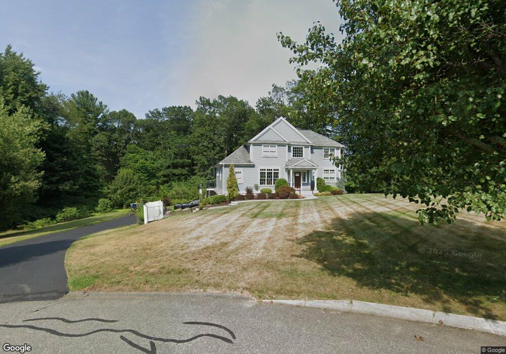
10 Nathan Ln Middleton, MA 01949
Estimated Value: $1,282,000 - $1,424,690
--
Bed
1
Bath
2,671
Sq Ft
$499/Sq Ft
Est. Value
About This Home
This home is located at 10 Nathan Ln, Middleton, MA 01949 and is currently estimated at $1,333,897, approximately $499 per square foot. 10 Nathan Ln is a home located in Essex County with nearby schools including Howe-Manning Elementary School, Fuller Meadow Elementary School, and Masconomet Regional Middle School.
Ownership History
Date
Name
Owned For
Owner Type
Purchase Details
Closed on
Jul 23, 2018
Sold by
Peluso Michael E and Peluso Michele A
Bought by
Peluso Nt and Peluso
Current Estimated Value
Purchase Details
Closed on
Aug 30, 2016
Sold by
Bramante Roberta
Bought by
Peluso Michael and Peluso Michele
Home Financials for this Owner
Home Financials are based on the most recent Mortgage that was taken out on this home.
Original Mortgage
$75,000
Interest Rate
5%
Mortgage Type
Adjustable Rate Mortgage/ARM
Purchase Details
Closed on
Nov 3, 2008
Sold by
Bramante Frank
Bought by
Bramante Roberta
Create a Home Valuation Report for This Property
The Home Valuation Report is an in-depth analysis detailing your home's value as well as a comparison with similar homes in the area
Home Values in the Area
Average Home Value in this Area
Purchase History
| Date | Buyer | Sale Price | Title Company |
|---|---|---|---|
| Peluso Nt | -- | -- | |
| Peluso Nt | -- | -- | |
| Peluso Michael | $350,000 | -- | |
| Peluso Michael | $350,000 | -- | |
| Bramante Roberta | $280,000 | -- |
Source: Public Records
Mortgage History
| Date | Status | Borrower | Loan Amount |
|---|---|---|---|
| Previous Owner | Peluso Michael | $75,000 |
Source: Public Records
Tax History Compared to Growth
Tax History
| Year | Tax Paid | Tax Assessment Tax Assessment Total Assessment is a certain percentage of the fair market value that is determined by local assessors to be the total taxable value of land and additions on the property. | Land | Improvement |
|---|---|---|---|---|
| 2025 | $16,638 | $1,399,300 | $624,900 | $774,400 |
| 2024 | $16,561 | $1,404,700 | $640,900 | $763,800 |
| 2023 | $15,076 | $1,171,400 | $600,900 | $570,500 |
| 2022 | $12,648 | $954,600 | $428,800 | $525,800 |
| 2021 | $12,248 | $892,700 | $386,800 | $505,900 |
| 2020 | $12,235 | $898,300 | $386,800 | $511,500 |
| 2019 | $11,794 | $861,500 | $360,800 | $500,700 |
| 2018 | $11,397 | $816,400 | $360,800 | $455,600 |
| 2017 | $4,754 | $340,800 | $340,800 | $0 |
| 2016 | $4,734 | $340,800 | $340,800 | $0 |
Source: Public Records
Map
Nearby Homes
- 22 Locust St
- 36 Village Rd Unit 713
- 36 Village Rd Unit 712
- 36 Village Rd Unit 601
- 38 Village Rd Unit 201
- 38 Village Rd Unit 608
- 6 Masi Meadow Ln Unit B
- 8 Masi Meadow Ln Unit A
- 40 Village Rd Unit 1108
- 40 Village Rd Unit 1601
- 10 Oak St
- 1 Mill Terrace
- 200 North St Unit 31A
- 200 North St
- 3 Useadoor St
- 78 Mill St
- 519 Maple St
- 47 Maple St Unit A
- 49 Maple St Unit B
- 3 Warren Dr