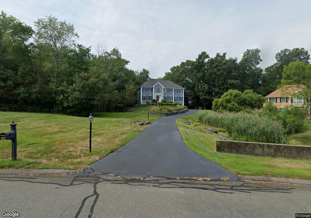
10 Nichols Ln Middleton, MA 01949
Estimated Value: $1,208,124 - $1,312,000
4
Beds
3
Baths
3,022
Sq Ft
$419/Sq Ft
Est. Value
About This Home
This home is located at 10 Nichols Ln, Middleton, MA 01949 and is currently estimated at $1,265,531, approximately $418 per square foot. 10 Nichols Ln is a home located in Essex County with nearby schools including Howe-Manning Elementary School, Fuller Meadow Elementary School, and Masconomet Regional Middle School.
Ownership History
Date
Name
Owned For
Owner Type
Purchase Details
Closed on
Aug 29, 2025
Sold by
Donovan C P C and Donovan Margaret R
Bought by
Donovan Ft and Donovan
Current Estimated Value
Purchase Details
Closed on
Aug 29, 1997
Sold by
Cedar Rt and Barbagallo
Bought by
Donovan C Patrick C and Donovan Margaret R
Purchase Details
Closed on
Mar 17, 1997
Sold by
First City Dev Corp
Bought by
Cedar Rt and Barbagallo
Create a Home Valuation Report for This Property
The Home Valuation Report is an in-depth analysis detailing your home's value as well as a comparison with similar homes in the area
Home Values in the Area
Average Home Value in this Area
Purchase History
| Date | Buyer | Sale Price | Title Company |
|---|---|---|---|
| Donovan Ft | -- | -- | |
| Donovan Ft | -- | -- | |
| Donovan C Patrick C | $369,900 | -- | |
| Cedar Rt | $120,000 | -- |
Source: Public Records
Mortgage History
| Date | Status | Borrower | Loan Amount |
|---|---|---|---|
| Previous Owner | Cedar Rt | $133,000 | |
| Previous Owner | Cedar Rt | $100,000 |
Source: Public Records
Tax History
| Year | Tax Paid | Tax Assessment Tax Assessment Total Assessment is a certain percentage of the fair market value that is determined by local assessors to be the total taxable value of land and additions on the property. | Land | Improvement |
|---|---|---|---|---|
| 2025 | $13,118 | $1,103,300 | $435,300 | $668,000 |
| 2024 | $12,567 | $1,065,900 | $407,300 | $658,600 |
| 2023 | $12,009 | $933,100 | $445,300 | $487,800 |
| 2022 | $10,616 | $801,200 | $352,500 | $448,700 |
| 2021 | $10,499 | $765,200 | $334,500 | $430,700 |
| 2020 | $10,669 | $780,200 | $344,500 | $435,700 |
| 2019 | $10,722 | $755,900 | $328,500 | $427,400 |
| 2018 | $10,256 | $734,700 | $322,500 | $412,200 |
| 2017 | $9,528 | $683,000 | $276,500 | $406,500 |
| 2016 | $9,177 | $660,700 | $260,500 | $400,200 |
| 2015 | $9,023 | $654,800 | $256,500 | $398,300 |
Source: Public Records
Map
Nearby Homes
- 36 Village Rd Unit 506
- 38 Village Rd Unit 515
- 40 Village Rd Unit 1210
- 40 Village Rd Unit 1006
- 244 Rowley Bridge Rd
- 35 East St
- 200 North St
- 200 North St Unit 31A
- 207 Rowley Bridge Rd
- 466 Newbury St Unit 20
- 180 Rowley Bridge Rd
- 10 Oak St
- 2 Iroquois Rd
- 19 Bridle Spur Ln
- 47 Maple St Unit A
- 78 North St
- 11 Spring St
- 3 Warren Dr
- 15 Rowell Ln Unit 15
- 1 Mills Point Unit 1
Your Personal Tour Guide
Ask me questions while you tour the home.