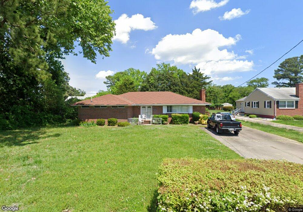
10 Pratt St Hampton, VA 23669
Newtown-Crown Point NeighborhoodEstimated Value: $294,306 - $343,000
3
Beds
2
Baths
2,070
Sq Ft
$153/Sq Ft
Est. Value
About This Home
This home is located at 10 Pratt St, Hampton, VA 23669 and is currently estimated at $317,327, approximately $153 per square foot. 10 Pratt St is a home located in Hampton City with nearby schools including Hunter B. Andrews PK-8 School, C. Alton Lindsay Middle School, and Phoebus High School.
Ownership History
Date
Name
Owned For
Owner Type
Purchase Details
Closed on
Sep 30, 1999
Sold by
Denson Jacqueline C
Bought by
Savage Warren J
Current Estimated Value
Home Financials for this Owner
Home Financials are based on the most recent Mortgage that was taken out on this home.
Original Mortgage
$96,063
Outstanding Balance
$29,050
Interest Rate
7.85%
Estimated Equity
$288,277
Create a Home Valuation Report for This Property
The Home Valuation Report is an in-depth analysis detailing your home's value as well as a comparison with similar homes in the area
Home Values in the Area
Average Home Value in this Area
Purchase History
| Date | Buyer | Sale Price | Title Company |
|---|---|---|---|
| Savage Warren J | $96,898 | -- |
Source: Public Records
Mortgage History
| Date | Status | Borrower | Loan Amount |
|---|---|---|---|
| Open | Savage Warren J | $96,063 |
Source: Public Records
Tax History
| Year | Tax Paid | Tax Assessment Tax Assessment Total Assessment is a certain percentage of the fair market value that is determined by local assessors to be the total taxable value of land and additions on the property. | Land | Improvement |
|---|---|---|---|---|
| 2025 | $3,245 | $283,100 | $84,000 | $199,100 |
| 2024 | $2,966 | $257,900 | $75,600 | $182,300 |
| 2023 | $2,666 | $229,800 | $75,600 | $154,200 |
| 2022 | $2,578 | $218,500 | $67,200 | $151,300 |
| 2021 | $2,326 | $177,100 | $47,000 | $130,100 |
| 2020 | $1,959 | $158,000 | $47,100 | $110,900 |
| 2019 | $1,959 | $158,000 | $47,100 | $110,900 |
| 2018 | $2,026 | $155,800 | $47,100 | $108,700 |
| 2017 | $2,026 | $0 | $0 | $0 |
| 2016 | $2,026 | $155,800 | $0 | $0 |
| 2015 | $2,026 | $0 | $0 | $0 |
| 2014 | $2,166 | $167,900 | $47,100 | $120,800 |
Source: Public Records
Map
Nearby Homes
- 27 Trail St
- 137 Clyde St
- 29 Moss Ave
- 4207 Chesapeake Ave
- 44 Henry St
- 39 W Sunset Rd
- 19 Capps Qtrs Unit 1
- 19 Capps Qtrs
- 6 Capps Qtrs Unit 2
- 106 Clyde St
- 163 Columbia Ave
- 159 Columbia Ave
- 3829 Roads View Ave
- 4 Cedar Point Dr
- 4408 Victoria Blvd
- 3614 Matoaka Rd
- 19 Capps Quarters Unit 1
- 410 Worster Ave
- 241 Newport News Ave
- 116 Linden Ave
Your Personal Tour Guide
Ask me questions while you tour the home.