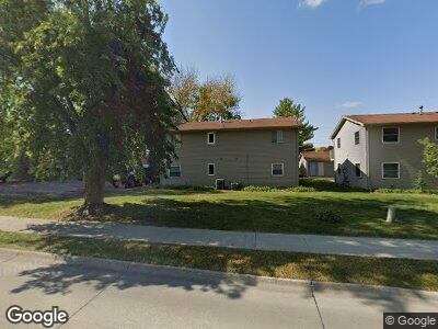
1001 N Dakota Ave Ames, IA 50014
Sawyer West NeighborhoodEstimated Value: $258,326 - $325,000
6
Beds
2
Baths
2,240
Sq Ft
$126/Sq Ft
Est. Value
About This Home
This home is located at 1001 N Dakota Ave, Ames, IA 50014 and is currently estimated at $281,832, approximately $125 per square foot. 1001 N Dakota Ave is a home located in Story County with nearby schools including Sawyer Elementary School, Ames Middle School, and Ames High School.
Ownership History
Date
Name
Owned For
Owner Type
Purchase Details
Closed on
Oct 23, 2024
Sold by
Cbac Llc
Bought by
Maples William M and Tang Stephanie Mofen
Current Estimated Value
Home Financials for this Owner
Home Financials are based on the most recent Mortgage that was taken out on this home.
Original Mortgage
$198,750
Outstanding Balance
$198,164
Interest Rate
6.09%
Mortgage Type
New Conventional
Estimated Equity
$81,732
Create a Home Valuation Report for This Property
The Home Valuation Report is an in-depth analysis detailing your home's value as well as a comparison with similar homes in the area
Home Values in the Area
Average Home Value in this Area
Purchase History
| Date | Buyer | Sale Price | Title Company |
|---|---|---|---|
| Maples William M | $265,000 | None Listed On Document |
Source: Public Records
Mortgage History
| Date | Status | Borrower | Loan Amount |
|---|---|---|---|
| Open | Maples William M | $198,750 |
Source: Public Records
Tax History Compared to Growth
Tax History
| Year | Tax Paid | Tax Assessment Tax Assessment Total Assessment is a certain percentage of the fair market value that is determined by local assessors to be the total taxable value of land and additions on the property. | Land | Improvement |
|---|---|---|---|---|
| 2024 | $3,702 | $260,600 | $38,800 | $221,800 |
| 2023 | $2,610 | $260,600 | $38,800 | $221,800 |
| 2022 | $2,578 | $155,100 | $38,800 | $116,300 |
| 2021 | $2,590 | $155,100 | $38,800 | $116,300 |
| 2020 | $2,552 | $147,200 | $36,800 | $110,400 |
| 2019 | $2,552 | $147,200 | $36,800 | $110,400 |
| 2018 | $2,572 | $147,200 | $36,800 | $110,400 |
| 2017 | $2,572 | $147,200 | $36,800 | $110,400 |
| 2016 | $2,438 | $138,400 | $28,200 | $110,200 |
| 2015 | $2,438 | $138,400 | $28,200 | $110,200 |
| 2014 | $2,486 | $138,400 | $28,200 | $110,200 |
Source: Public Records
Map
Nearby Homes
- 802 Phoenix Cir
- 4311 Ontario St
- 1301 Florida Ave
- 1307 Florida Ave
- 4713 Ontario St
- 4716 Hutchison St
- 4010 Arkansas Dr
- 4011 Arkansas Dr
- 4704 Toronto St
- 4003 Arkansas Dr
- 1308 Idaho Ave
- 4300 Timber Ridge Dr
- 1105 Oklahoma Dr
- 4209 Toronto St
- 1513 Ohio Ave
- 1422 Idaho Ave
- 4015 Toronto St
- 1510 Indiana Ave
- 3722 Ross Rd
- 5119 Tabor Dr
- 1001 N Dakota Ave
- 909 N Dakota Ave
- 1009 & 1011 North Dakota
- 1000 & 1002 Delaware
- 1000 Delaware Ave
- 907 North Dakota Ave
- 1010 Delaware Ave
- 910 Delaware Ave
- 907 N Dakota Ave
- 1018 Delaware Ave
- 905 North Dakota Ave
- 905 N Dakota Ave Unit A
- 905 N Dakota Ave
- 906 Delaware Ave
- 913 Yuma Cir
- 911 Yuma Cir
- 915 Yuma Cir
- 1110 Delaware Ave
- 4418 Ross Rd
- 4412 Ross Rd