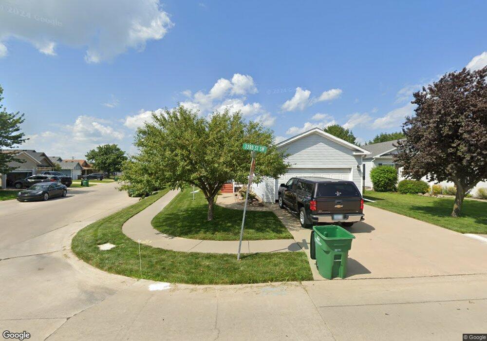
1002 33rd St SW Bondurant, IA 50035
Estimated Value: $192,000 - $239,000
3
Beds
2
Baths
1,447
Sq Ft
$151/Sq Ft
Est. Value
About This Home
This home is located at 1002 33rd St SW, Bondurant, IA 50035 and is currently estimated at $218,667, approximately $151 per square foot. 1002 33rd St SW is a home located in Polk County with nearby schools including Morris Elementary School, Anderson Elementary School, and Bondurant-Farrar Junior High.
Ownership History
Date
Name
Owned For
Owner Type
Purchase Details
Closed on
Apr 11, 2006
Sold by
Chateau At Bondurant Llc
Bought by
Cannon Marvin D
Current Estimated Value
Home Financials for this Owner
Home Financials are based on the most recent Mortgage that was taken out on this home.
Original Mortgage
$108,000
Outstanding Balance
$59,512
Interest Rate
5.75%
Mortgage Type
Fannie Mae Freddie Mac
Estimated Equity
$159,155
Create a Home Valuation Report for This Property
The Home Valuation Report is an in-depth analysis detailing your home's value as well as a comparison with similar homes in the area
Home Values in the Area
Average Home Value in this Area
Purchase History
| Date | Buyer | Sale Price | Title Company |
|---|---|---|---|
| Cannon Marvin D | $107,500 | Itc |
Source: Public Records
Mortgage History
| Date | Status | Borrower | Loan Amount |
|---|---|---|---|
| Open | Cannon Marvin D | $108,000 |
Source: Public Records
Tax History Compared to Growth
Tax History
| Year | Tax Paid | Tax Assessment Tax Assessment Total Assessment is a certain percentage of the fair market value that is determined by local assessors to be the total taxable value of land and additions on the property. | Land | Improvement |
|---|---|---|---|---|
| 2025 | $2,210 | $147,700 | $52,000 | $95,700 |
| 2024 | $2,210 | $140,800 | $46,600 | $94,200 |
| 2023 | $2,476 | $140,800 | $46,600 | $94,200 |
| 2022 | $2,462 | $124,200 | $40,600 | $83,600 |
| 2021 | $2,718 | $124,200 | $40,600 | $83,600 |
| 2020 | $2,684 | $124,000 | $38,700 | $85,300 |
| 2019 | $2,738 | $124,000 | $38,700 | $85,300 |
| 2018 | $2,682 | $116,900 | $34,100 | $82,800 |
| 2017 | $2,538 | $116,900 | $34,100 | $82,800 |
| 2016 | $2,480 | $108,400 | $30,400 | $78,000 |
| 2015 | $2,480 | $108,400 | $30,400 | $78,000 |
| 2014 | $2,446 | $110,500 | $29,300 | $81,200 |
Source: Public Records
Map
Nearby Homes
- 817 33rd St SW
- 3214 Locust St SW
- 3504 Wolf Creek Rd SW
- 817 35th St SW
- 3401 Maple St SW
- 1013 10th Ave NW
- 944 Sunburst Ln
- 935 Breezewood Cir
- 1005 6th St NW
- 612 12th Ave NW
- 605 12th Ave NW
- 1006 6th St NW
- 512 3rd Ave NW
- 1634 Prairie Cir
- 1909 16th Cir SE
- 301 13th Ave NW
- 1605 2nd St NW
- 107 10th Ave SW
- 108 12th Ave SW
- 213 10th Ave SW
- 908 33rd St SW
- 3300 Wolf Creek Rd SW
- 3302 Wolf Creek Rd SW
- 3317 Wolf Creek Rd SW
- 3208 Wolf Creek Rd SW
- 906 33rd St SW
- 3316 Wolf Creek Rd SW
- 3206 Wolf Creek Rd SW
- 909 33rd St SW
- 904 33rd St SW
- 3321 Wolf Creek Rd SW
- 3320 Wolf Creek Rd SW
- 3306 Ash Dr SW
- 3307 Linden Dr SW
- 3311 Linden Dr SW
- 3204 Wolf Creek Rd SW
- 3303 Linden Dr SW
- 0 Ash Dr SW
- 3315 Linden Dr SW
- 3400 Ash Dr SW