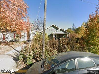
1004 Roosevelt Ave Ames, IA 50010
Roosevelt NeighborhoodEstimated Value: $215,000 - $237,818
2
Beds
2
Baths
854
Sq Ft
$266/Sq Ft
Est. Value
About This Home
This home is located at 1004 Roosevelt Ave, Ames, IA 50010 and is currently estimated at $226,955, approximately $265 per square foot. 1004 Roosevelt Ave is a home located in Story County with nearby schools including Meeker Elementary School, Ames Middle School, and Ames High School.
Ownership History
Date
Name
Owned For
Owner Type
Purchase Details
Closed on
Jul 13, 2007
Sold by
Gregg Sara Mills and Hayes Benjamin Shelton
Bought by
Stewart Timothy W
Current Estimated Value
Home Financials for this Owner
Home Financials are based on the most recent Mortgage that was taken out on this home.
Original Mortgage
$33,000
Interest Rate
6.73%
Mortgage Type
Stand Alone Second
Create a Home Valuation Report for This Property
The Home Valuation Report is an in-depth analysis detailing your home's value as well as a comparison with similar homes in the area
Home Values in the Area
Average Home Value in this Area
Purchase History
| Date | Buyer | Sale Price | Title Company |
|---|---|---|---|
| Stewart Timothy W | $132,000 | -- |
Source: Public Records
Mortgage History
| Date | Status | Borrower | Loan Amount |
|---|---|---|---|
| Open | Stewart Timothy W | $105,600 | |
| Closed | Stewart Timothy W | $118,750 | |
| Closed | Stewart Timothy W | $33,000 | |
| Closed | Stewart Timothy W | $99,000 |
Source: Public Records
Tax History Compared to Growth
Tax History
| Year | Tax Paid | Tax Assessment Tax Assessment Total Assessment is a certain percentage of the fair market value that is determined by local assessors to be the total taxable value of land and additions on the property. | Land | Improvement |
|---|---|---|---|---|
| 2024 | $2,834 | $210,000 | $36,200 | $173,800 |
| 2023 | $2,288 | $210,000 | $36,200 | $173,800 |
| 2022 | $2,260 | $144,900 | $36,200 | $108,700 |
| 2021 | $2,360 | $144,900 | $36,200 | $108,700 |
| 2020 | $2,324 | $142,800 | $35,700 | $107,100 |
| 2019 | $2,324 | $142,800 | $35,700 | $107,100 |
| 2018 | $2,342 | $142,800 | $35,700 | $107,100 |
| 2017 | $2,342 | $142,800 | $35,700 | $107,100 |
| 2016 | $2,308 | $139,800 | $34,000 | $105,800 |
| 2015 | $2,308 | $139,800 | $34,000 | $105,800 |
| 2014 | $2,170 | $129,500 | $31,500 | $98,000 |
Source: Public Records
Map
Nearby Homes
- 720 10th St
- 1107 Wilson Ave
- 1003 Clark Ave
- 1214 Curtiss Ave
- 808 Clark Ave Unit 810
- 808 Clark Ave
- 816 Brookridge Ave
- 1122 Clark Ave
- 1211 Burnett Ave
- 1119 Orchard Dr
- 208 N Maple Ave
- 700 Kellogg Ave
- 317 N Russell Ave
- 1531 Harding Ave
- 821 Duff Ave
- 120 S Maple Ave
- 1613 Clark Ave
- 712 Duff Ave
- 218 16th St
- 101 S Riverside Dr Unit 103
- 1004 Roosevelt Ave
- 1006 Roosevelt Ave
- 1012 Roosevelt Ave
- 924 Roosevelt Ave
- 1003 Harding Ave
- 1005 Harding Ave
- 1016 Roosevelt Ave
- 1011 Harding Ave
- 922 Roosevelt Ave
- 1003 Roosevelt Ave
- 808 10th St
- 1007 Roosevelt Ave
- 1015 Harding Ave
- 1009 Roosevelt Ave
- 1020 Roosevelt Ave
- 918 Roosevelt Ave
- 802 10th St
- 1015 Roosevelt Ave
- 1019 Harding Ave
- 717 10th St