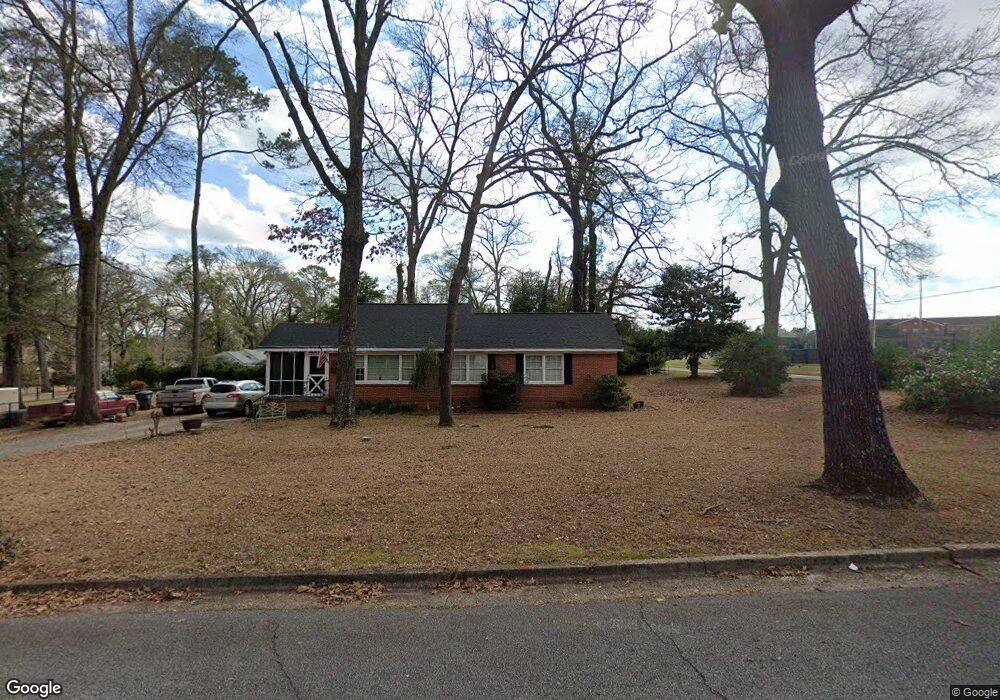
1005 Anthony Dr Americus, GA 31709
Estimated Value: $106,696 - $140,000
3
Beds
1
Bath
1,158
Sq Ft
$104/Sq Ft
Est. Value
About This Home
This home is located at 1005 Anthony Dr, Americus, GA 31709 and is currently estimated at $120,424, approximately $103 per square foot. 1005 Anthony Dr is a home located in Sumter County with nearby schools including Sumter County Primary School, Sumter County Elementary School, and Sumter County Middle School.
Ownership History
Date
Name
Owned For
Owner Type
Purchase Details
Closed on
Sep 26, 2002
Sold by
Ryan Christopher B
Bought by
Wingard David R
Current Estimated Value
Purchase Details
Closed on
Jun 7, 2002
Sold by
Parker Hubert Mark
Bought by
Ryan Christopher B
Purchase Details
Closed on
Sep 26, 2000
Sold by
Fathi Mashalah Mich
Bought by
Parker Hubert Mark
Purchase Details
Closed on
Apr 6, 2000
Sold by
Tye Brenda Jeanne
Bought by
Fathi Mashalah Mich
Purchase Details
Closed on
Dec 31, 1986
Sold by
Cook E D Jr Mr
Bought by
Tye Brenda Jeanne
Purchase Details
Closed on
Aug 1, 1952
Bought by
Cook E D Jr Mr
Create a Home Valuation Report for This Property
The Home Valuation Report is an in-depth analysis detailing your home's value as well as a comparison with similar homes in the area
Purchase History
| Date | Buyer | Sale Price | Title Company |
|---|---|---|---|
| Wingard David R | $75,000 | -- | |
| Ryan Christopher B | $64,000 | -- | |
| Parker Hubert Mark | $58,000 | -- | |
| Fathi Mashalah Mich | $53,500 | -- | |
| Tye Brenda Jeanne | $40,000 | -- | |
| Cook E D Jr Mr | -- | -- |
Source: Public Records
Tax History
| Year | Tax Paid | Tax Assessment Tax Assessment Total Assessment is a certain percentage of the fair market value that is determined by local assessors to be the total taxable value of land and additions on the property. | Land | Improvement |
|---|---|---|---|---|
| 2025 | $1,098 | $24,344 | $3,800 | $20,544 |
| 2024 | $1,098 | $24,344 | $3,800 | $20,544 |
| 2023 | $1,074 | $24,344 | $3,800 | $20,544 |
| 2022 | $736 | $24,344 | $3,800 | $20,544 |
| 2021 | $1,076 | $24,344 | $3,800 | $20,544 |
| 2020 | $1,101 | $24,344 | $3,800 | $20,544 |
| 2019 | $1,165 | $24,344 | $3,800 | $20,544 |
| 2018 | $766 | $24,344 | $3,800 | $20,544 |
| 2017 | $766 | $24,344 | $3,800 | $20,544 |
| 2016 | $1,068 | $24,160 | $3,800 | $20,360 |
| 2015 | $797 | $26,040 | $3,800 | $22,240 |
| 2014 | $799 | $26,040 | $3,800 | $22,240 |
| 2013 | -- | $26,040 | $3,800 | $22,240 |
Source: Public Records
Map
Nearby Homes
- 310 Wildwood Cir
- 1101 E Furlow St
- 620 E Furlow St
- 501 Varsity Dr
- 1105 Elm Ave
- 518 E Furlow St
- 203 Burke St
- 1202 S Lee St
- TBD Grande Ave
- 1720 E Lamar St
- 522 S Lee St
- 621 E Church St
- 211 Horne St
- 501 S Lee St
- 525 Hancock Dr
- 219 Murphy Mill Rd
- 533 Harrold Ave
- 305 E Church St
- 419 W Furlow St
- Lot 5 Lake Jennifer Dr
- 301 Wildwood Cir
- 303 Wildwood Cir
- 1002 Anthony Dr
- 207 Wildwood Cir
- 305 Wildwood Cir
- 302 Wildwood Cir
- 300 Wildwood Cir
- 205 Wildwood Cir
- 304 Wildwood Cir
- 104 Edgewood Dr
- 306 Wildwood Cir
- 204 Wildwood Cir
- 309 Wildwood Cir
- 203 Wildwood Cir
- 308 Wildwood Cir
- 101 Edgewood Dr
- 205 Ridgeway Dr
- 209 Ridgeway Dr
- 102 Edgewood Dr
- 203 Ridgeway Dr
Your Personal Tour Guide
Ask me questions while you tour the home.