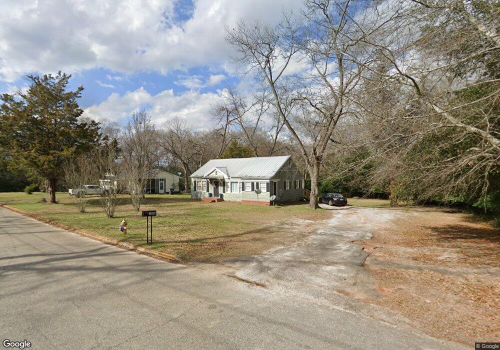
1008 Denham Dr Americus, GA 31709
Estimated Value: $76,000 - $106,000
3
Beds
1
Bath
1,032
Sq Ft
$87/Sq Ft
Est. Value
About This Home
This home is located at 1008 Denham Dr, Americus, GA 31709 and is currently estimated at $89,554, approximately $86 per square foot. 1008 Denham Dr is a home located in Sumter County with nearby schools including Sumter County Primary School, Sumter County Elementary School, and Sumter County Middle School.
Ownership History
Date
Name
Owned For
Owner Type
Purchase Details
Closed on
Jan 29, 2013
Sold by
Harrod James E
Bought by
Hamlin Greg
Current Estimated Value
Purchase Details
Closed on
Apr 25, 2005
Sold by
Davis Bradley T
Bought by
Harrod James E
Home Financials for this Owner
Home Financials are based on the most recent Mortgage that was taken out on this home.
Original Mortgage
$40,541
Interest Rate
5.99%
Mortgage Type
New Conventional
Purchase Details
Closed on
Oct 12, 2001
Sold by
Mckay Janet Brown
Bought by
Davis Bradley
Purchase Details
Closed on
Dec 27, 1988
Bought by
Mckay Janet Brown
Create a Home Valuation Report for This Property
The Home Valuation Report is an in-depth analysis detailing your home's value as well as a comparison with similar homes in the area
Purchase History
| Date | Buyer | Sale Price | Title Company |
|---|---|---|---|
| Hamlin Greg | $30,000 | -- | |
| Harrod James E | $46,000 | -- | |
| Davis Bradley | $38,000 | -- | |
| Mckay Janet Brown | -- | -- |
Source: Public Records
Mortgage History
| Date | Status | Borrower | Loan Amount |
|---|---|---|---|
| Previous Owner | Harrod James E | $40,541 |
Source: Public Records
Tax History
| Year | Tax Paid | Tax Assessment Tax Assessment Total Assessment is a certain percentage of the fair market value that is determined by local assessors to be the total taxable value of land and additions on the property. | Land | Improvement |
|---|---|---|---|---|
| 2025 | $879 | $19,480 | $1,880 | $17,600 |
| 2024 | $879 | $19,480 | $1,880 | $17,600 |
| 2023 | $859 | $19,480 | $1,880 | $17,600 |
| 2022 | $589 | $19,480 | $1,880 | $17,600 |
| 2021 | $861 | $19,480 | $1,880 | $17,600 |
| 2020 | $1,041 | $19,480 | $1,880 | $17,600 |
| 2019 | $932 | $19,480 | $1,880 | $17,600 |
| 2018 | $613 | $19,480 | $1,880 | $17,600 |
| 2017 | $613 | $19,480 | $1,880 | $17,600 |
| 2016 | $861 | $19,480 | $1,880 | $17,600 |
| 2015 | $677 | $22,124 | $1,880 | $20,244 |
| 2014 | $368 | $22,124 | $1,880 | $20,244 |
| 2013 | -- | $22,124 | $1,880 | $20,244 |
Source: Public Records
Map
Nearby Homes
- 108 Springfield Ave
- 1101 E Furlow St
- 620 E Furlow St
- 310 Wildwood Cir
- 501 Varsity Dr
- 518 E Furlow St
- 1720 E Lamar St
- 423 E Hill St
- 1105 Elm Ave
- 203 Burke St
- 621 E Church St
- 211 Horne St
- 522 S Lee St
- 1202 S Lee St
- 501 S Lee St
- 305 E Church St
- TBD Grande Ave
- 525 Hancock Dr
- 113 Clearview Cir
- 533 Harrold Ave
- 1006 Denham Dr
- 1102 Denham Dr
- 109 Springfield Ave
- 105 Springfield Ave
- 104 Springfield Ave
- 110 Woodland Ave
- 103 Springfield Ave
- 108 Woodland Ave
- 101 Springfield Ave
- 106 Woodland Ave
- 958 Felder St
- 704 Tripp St
- 104 Woodland Ave
- 111 Woodland Ave
- 1002 Felder St
- 109 Woodland Ave
- 1004 Felder St
- 107 Woodland Ave
- 1015 E Furlow St
- 105 Woodland Ave
Your Personal Tour Guide
Ask me questions while you tour the home.