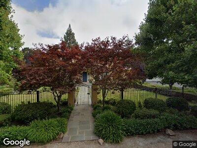
101 Hawthorne Dr Atherton, CA 94027
Lindenwood NeighborhoodEstimated Value: $7,579,000 - $12,116,955
5
Beds
6
Baths
7,734
Sq Ft
$1,270/Sq Ft
Est. Value
About This Home
This home is located at 101 Hawthorne Dr, Atherton, CA 94027 and is currently estimated at $9,824,318, approximately $1,270 per square foot. 101 Hawthorne Dr is a home located in San Mateo County with nearby schools including Encinal Elementary School, Hillview Middle School, and Menlo-Atherton High School.
Ownership History
Date
Name
Owned For
Owner Type
Purchase Details
Closed on
Mar 26, 2007
Sold by
Larabie Marie R
Bought by
Liang Haixiang and Zhai Ruixia
Current Estimated Value
Purchase Details
Closed on
Jul 1, 1996
Sold by
Larabie Marie R
Bought by
Larabie Marie R
Purchase Details
Closed on
Aug 16, 1995
Sold by
Larabie Robert D and Larabie Marie R
Bought by
Larabie Robert D and Larabie Marie R
Create a Home Valuation Report for This Property
The Home Valuation Report is an in-depth analysis detailing your home's value as well as a comparison with similar homes in the area
Home Values in the Area
Average Home Value in this Area
Purchase History
| Date | Buyer | Sale Price | Title Company |
|---|---|---|---|
| Liang Haixiang | $1,765,500 | First American Title Company | |
| Larabie Marie R | -- | -- | |
| Larabie Robert D | -- | -- |
Source: Public Records
Mortgage History
| Date | Status | Borrower | Loan Amount |
|---|---|---|---|
| Open | Liang Haixiang | $1,700,000 |
Source: Public Records
Tax History Compared to Growth
Tax History
| Year | Tax Paid | Tax Assessment Tax Assessment Total Assessment is a certain percentage of the fair market value that is determined by local assessors to be the total taxable value of land and additions on the property. | Land | Improvement |
|---|---|---|---|---|
| 2023 | $97,938 | $8,609,824 | $4,056,456 | $4,553,368 |
| 2022 | $93,820 | $8,441,005 | $3,976,918 | $4,464,087 |
| 2021 | $92,272 | $8,275,496 | $3,898,940 | $4,376,556 |
| 2020 | $91,554 | $8,190,642 | $3,858,962 | $4,331,680 |
| 2019 | $90,491 | $8,030,043 | $3,783,297 | $4,246,746 |
| 2018 | $88,305 | $7,872,592 | $3,709,115 | $4,163,477 |
| 2017 | $87,826 | $7,718,229 | $3,636,388 | $4,081,841 |
| 2016 | $85,844 | $7,566,892 | $3,565,087 | $4,001,805 |
| 2015 | $85,138 | $7,453,232 | $3,511,537 | $3,941,695 |
| 2014 | $83,595 | $7,307,234 | $3,442,751 | $3,864,483 |
Source: Public Records
Map
Nearby Homes
- 101 Hawthorne Dr
- 44 James Ave
- 123 Hawthorne Dr
- 28 James Ave
- 97 Hawthorne Dr
- 19 Laburnum Rd
- 98 Hawthorne Dr
- 122 Hawthorne Dr
- 52 James Ave
- 49 James Ave
- 27 Laburnum Rd
- 95 Heather Dr
- 51 Hawthorne Dr
- 73 Hawthorne Dr
- 20 James Ave
- 137 Hawthorne Dr
- 88 Hawthorne Dr
- 134 Hawthorne Dr
- 171 Linden Ave
- 117 Heather Dr