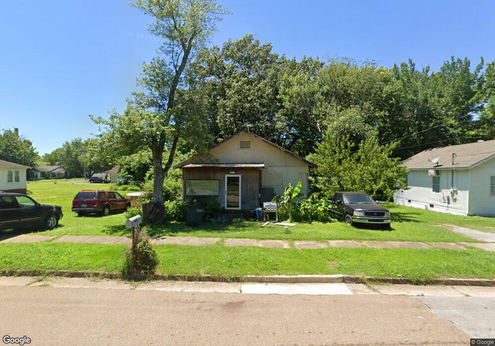
1012 N Division St Union City, TN 38261
Estimated Value: $58,120 - $95,000
--
Bed
2
Baths
1,456
Sq Ft
$51/Sq Ft
Est. Value
About This Home
This home is located at 1012 N Division St, Union City, TN 38261 and is currently estimated at $74,373, approximately $51 per square foot. 1012 N Division St is a home located in Obion County with nearby schools including Union City Elementary School, Union City Middle School, and Union City High School.
Ownership History
Date
Name
Owned For
Owner Type
Purchase Details
Closed on
Apr 1, 2014
Sold by
Buchanan James R
Bought by
Hill James F and Hill Ashley P
Current Estimated Value
Purchase Details
Closed on
Dec 12, 2006
Bought by
Buchanan James R
Purchase Details
Closed on
Jul 26, 2006
Bought by
Jackson William Warren
Purchase Details
Closed on
Jul 29, 2005
Bought by
Suter James W and Suter Virginia A
Purchase Details
Closed on
Nov 19, 1998
Bought by
Taylor Rodney K
Purchase Details
Closed on
Dec 1, 1983
Bought by
Suter James W
Create a Home Valuation Report for This Property
The Home Valuation Report is an in-depth analysis detailing your home's value as well as a comparison with similar homes in the area
Home Values in the Area
Average Home Value in this Area
Purchase History
| Date | Buyer | Sale Price | Title Company |
|---|---|---|---|
| Hill James F | $13,392 | -- | |
| Buchanan James R | $7,500 | -- | |
| Jackson William Warren | -- | -- | |
| Suter James W | -- | -- | |
| Taylor Rodney K | $275,000 | -- | |
| Suter James W | $26,000 | -- |
Source: Public Records
Tax History Compared to Growth
Tax History
| Year | Tax Paid | Tax Assessment Tax Assessment Total Assessment is a certain percentage of the fair market value that is determined by local assessors to be the total taxable value of land and additions on the property. | Land | Improvement |
|---|---|---|---|---|
| 2025 | -- | $7,050 | $0 | $0 |
| 2024 | -- | $6,650 | $1,800 | $4,850 |
| 2023 | $186 | $6,650 | $1,800 | $4,850 |
| 2022 | $80 | $5,000 | $2,250 | $2,750 |
| 2021 | $78 | $5,000 | $2,250 | $2,750 |
| 2020 | $80 | $5,000 | $2,250 | $2,750 |
| 2019 | $186 | $5,000 | $2,250 | $2,750 |
| 2018 | $185 | $5,000 | $2,250 | $2,750 |
| 2017 | $159 | $4,175 | $1,500 | $2,675 |
| 2016 | $159 | $4,175 | $1,500 | $2,675 |
| 2015 | $158 | $4,175 | $1,500 | $2,675 |
| 2014 | $158 | $4,175 | $1,500 | $2,675 |
Source: Public Records
Map
Nearby Homes
- 922 N Division St
- 501 N 1st St
- 724 E Martin Luther King
- 1009 E Cheatham St
- 841 Mosswood Dr
- 0 Mosswood Dr Unit RRA45928
- 0 Mosswood Dr Unit 44704
- 803 E Main St
- 817 Exchange St
- 1414 Forest Dr
- 903 Sherwood Dr
- 610 Perkins St
- 616 S 3rd St
- 605 S 5th St
- 1449 Forest Dr
- 901 S Home St
- 633 E Jackson St
- 422-426 430 W Jackson St
- 1129 S 4th St
- 0 S Miles Ave Unit 41030
- 1008 N Division St
- 1016 N Division St
- 1004 N Division St
- 1020 N Division St
- 306 E Todd St
- 1009 Baker St
- 1013 Baker St
- 1024 N Division St
- 491015 Baker St
- 1013 N Division St
- 1007 N Division St
- 304 E Todd St
- 1015 N Division St
- 1003 N Division St
- 1019 N Division St
- 1021 Baker St
- 1028 N Division St
- 916 N Division St
- 1025 N Division St
- 923 N Division St Unit 925