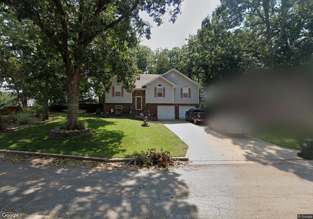
1014 Daniels St Aurora, MO 65605
Estimated Value: $278,087 - $332,000
4
Beds
3
Baths
2,080
Sq Ft
$147/Sq Ft
Est. Value
About This Home
This home is located at 1014 Daniels St, Aurora, MO 65605 and is currently estimated at $305,272, approximately $146 per square foot. 1014 Daniels St is a home located in Lawrence County with nearby schools including Pate Early Childhood Center, Robinson Elementary School, and Robinson Intermediate School.
Ownership History
Date
Name
Owned For
Owner Type
Purchase Details
Closed on
May 26, 2009
Sold by
Horner Tracey L
Bought by
Jenkins Rocky A and Jenkins Sherri L
Current Estimated Value
Home Financials for this Owner
Home Financials are based on the most recent Mortgage that was taken out on this home.
Original Mortgage
$148,877
Outstanding Balance
$93,707
Interest Rate
4.7%
Estimated Equity
$211,565
Create a Home Valuation Report for This Property
The Home Valuation Report is an in-depth analysis detailing your home's value as well as a comparison with similar homes in the area
Home Values in the Area
Average Home Value in this Area
Purchase History
| Date | Buyer | Sale Price | Title Company |
|---|---|---|---|
| Jenkins Rocky A | -- | -- | |
| Jenkins Rocky A | -- | Gat |
Source: Public Records
Mortgage History
| Date | Status | Borrower | Loan Amount |
|---|---|---|---|
| Open | Jenkins Rocky A | $148,877 | |
| Closed | Jenkins Rocky A | $148,877 |
Source: Public Records
Tax History
| Year | Tax Paid | Tax Assessment Tax Assessment Total Assessment is a certain percentage of the fair market value that is determined by local assessors to be the total taxable value of land and additions on the property. | Land | Improvement |
|---|---|---|---|---|
| 2025 | $1,724 | $34,450 | $3,780 | $30,670 |
| 2024 | $1,585 | $31,430 | $3,780 | $27,650 |
| 2023 | $1,577 | $31,430 | $3,780 | $27,650 |
| 2022 | $1,357 | $28,610 | $3,780 | $24,830 |
| 2021 | $1,359 | $27,070 | $3,780 | $23,290 |
| 2020 | $1,347 | $26,580 | $3,290 | $23,290 |
| 2019 | $1,324 | $26,580 | $3,290 | $23,290 |
| 2018 | $1,322 | $26,580 | $3,290 | $23,290 |
| 2017 | $1,315 | $26,580 | $3,290 | $23,290 |
| 2016 | -- | $24,300 | $3,290 | $21,010 |
| 2015 | -- | $24,300 | $3,290 | $21,010 |
| 2014 | -- | $24,300 | $3,290 | $21,010 |
Source: Public Records
Map
Nearby Homes
- 1019 Daniels St
- 1100 Chicory Ln
- 1301 S Tyler Ave
- 1813 Edgewood Dr
- 1407 Mary Ln
- 1220 Tyler St
- 906 W Pearl St
- 640 W Hadley St
- 1006 Baretta Ct
- 1104 Cowan Dr
- 923 Rosemary Ave
- 609 Lakeview Dr
- 720 W South St
- 224 W Springfield St
- 220 W Springfield St Unit Package
- 611 S Harrison Ave
- 703 S Adams Ave
- 533 S Lincoln Ave
- 1305 S Jefferson Ave
- 314 Jasper St
- 1016 Daniels St
- 1512 Taylor St Unit 1313973
- 1512 Taylor St
- 938 Daniels St
- 1018 Daniels St
- 935 Daniels St
- 1020 Daniels St
- 1017 Daniels St
- 928 Daniels St
- 1510 Taylor St
- 1510 Taylor St Unit 60002247
- 1706 S Carnation Dr
- 1020B Chicory Ln
- 1520 S Carnation Dr
- 1022 Daniels St
- 918 Daniels St
- 1018 Nickolas St
- 925 Daniels St
- 1027 Chicory Ln
- 1023 Daniels St
Your Personal Tour Guide
Ask me questions while you tour the home.