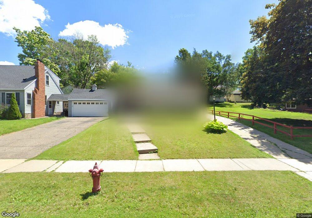
1018 Delaware Ave Saint Paul, MN 55118
Estimated Value: $358,000 - $392,000
4
Beds
2
Baths
1,760
Sq Ft
$215/Sq Ft
Est. Value
About This Home
This home is located at 1018 Delaware Ave, Saint Paul, MN 55118 and is currently estimated at $378,457, approximately $215 per square foot. 1018 Delaware Ave is a home located in Dakota County with nearby schools including Somerset Elementary School, Heritage E-STEM Magnet School, and Two Rivers High School.
Ownership History
Date
Name
Owned For
Owner Type
Purchase Details
Closed on
Aug 20, 2021
Sold by
Freitas Shanti
Bought by
Ringstad Kelsey and Wawro Daniel
Current Estimated Value
Home Financials for this Owner
Home Financials are based on the most recent Mortgage that was taken out on this home.
Original Mortgage
$334,650
Outstanding Balance
$303,842
Interest Rate
2.8%
Mortgage Type
New Conventional
Estimated Equity
$74,615
Purchase Details
Closed on
May 21, 2018
Sold by
Zavadil Monty C
Bought by
Freitas Shanti
Home Financials for this Owner
Home Financials are based on the most recent Mortgage that was taken out on this home.
Original Mortgage
$214,400
Interest Rate
4.4%
Mortgage Type
New Conventional
Purchase Details
Closed on
Dec 1, 2014
Sold by
Salisbury Mary Patricia and Salisbury Mary P
Bought by
Zavadil Monty C
Create a Home Valuation Report for This Property
The Home Valuation Report is an in-depth analysis detailing your home's value as well as a comparison with similar homes in the area
Home Values in the Area
Average Home Value in this Area
Purchase History
| Date | Buyer | Sale Price | Title Company |
|---|---|---|---|
| Ringstad Kelsey | $365,000 | On Site Title | |
| Freitas Shanti | $268,000 | Partners Title Llc | |
| Zavadil Monty C | $105,000 | Titlesmart Inc | |
| Ringstad Kelsey Kelsey | $365,000 | -- |
Source: Public Records
Mortgage History
| Date | Status | Borrower | Loan Amount |
|---|---|---|---|
| Open | Ringstad Kelsey | $334,650 | |
| Previous Owner | Freitas Shanti | $214,400 | |
| Closed | Ringstad Kelsey Kelsey | $334,650 |
Source: Public Records
Tax History Compared to Growth
Tax History
| Year | Tax Paid | Tax Assessment Tax Assessment Total Assessment is a certain percentage of the fair market value that is determined by local assessors to be the total taxable value of land and additions on the property. | Land | Improvement |
|---|---|---|---|---|
| 2024 | $3,804 | $311,900 | $59,100 | $252,800 |
| 2023 | $3,804 | $314,600 | $62,600 | $252,000 |
| 2022 | $3,230 | $285,400 | $62,400 | $223,000 |
| 2021 | $3,102 | $251,400 | $54,200 | $197,200 |
| 2020 | $2,946 | $240,000 | $51,600 | $188,400 |
Source: Public Records
Map
Nearby Homes
- 967 Cherokee Ave
- 1000 Winston Cir
- 606 Sutcliff Cir
- 1172 Ottawa Ave
- 1164 Dodd Rd
- 822 Smith Ave S
- 801 Cherokee Ave
- 1174 Dodd Rd
- 641 Sibley Memorial Hwy
- 8 Dorset Rd
- 1211 Galvin Ave
- 242 Annapolis St W
- 625 Ivy Falls Ave
- 259 Curtice St W
- 950 Bellows St
- 206 Winona St W
- 908 Bellows St
- 679 Maple Park Dr
- 1016 Bidwell St
- 663 Smith Ave S
- 1012 Delaware Ave
- 1028 Delaware Ave
- 1023 Cherokee Ave
- 1032 Delaware Ave
- 1002 Delaware Ave
- 1015 Cherokee Ave
- 1027 Cherokee Ave
- 1032 Delaware Ave
- 1033 Cherokee Ave
- 1023 Delaware Ave
- 1013 Delaware Ave
- 1007 Cherokee Ave
- 1005 Delaware Ave
- 1000 Delaware Ave
- 1037 Cherokee Ave
- 1036 Delaware Ave
- 1003 Delaware Ave
- 1003 Cherokee Ave
- 1029 Delaware Ave
- 1039 Cherokee Ave