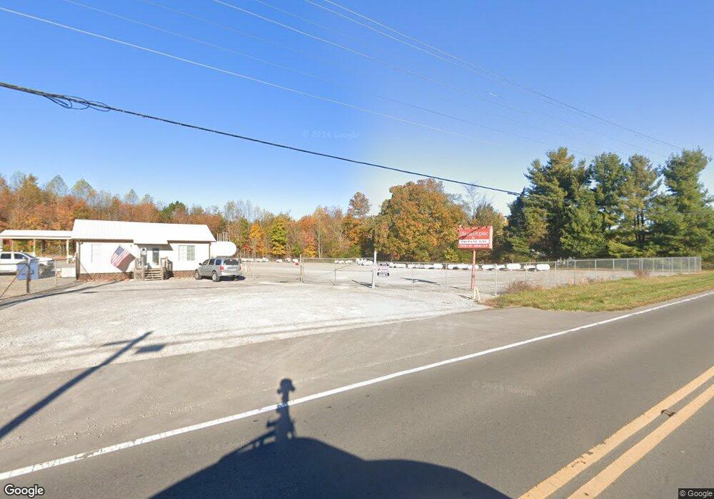
1019 Haley Rd Clarkrange, TN 38553
Estimated Value: $286,000 - $316,667
Studio
2
Baths
1,900
Sq Ft
$159/Sq Ft
Est. Value
About This Home
This home is located at 1019 Haley Rd, Clarkrange, TN 38553 and is currently estimated at $302,667, approximately $159 per square foot. 1019 Haley Rd is a home located in Fentress County.
Ownership History
Date
Name
Owned For
Owner Type
Purchase Details
Closed on
Apr 17, 2025
Sold by
Barnthouse Craig A
Bought by
Barnthouse Family Trust and Barnthouse
Current Estimated Value
Purchase Details
Closed on
Apr 15, 2024
Sold by
Cormier David
Bought by
Barnthouse Craig A
Home Financials for this Owner
Home Financials are based on the most recent Mortgage that was taken out on this home.
Original Mortgage
$110,000
Interest Rate
6.94%
Mortgage Type
New Conventional
Purchase Details
Closed on
Jun 18, 2010
Sold by
Weaver Melvin
Bought by
Cormier David G
Purchase Details
Closed on
Sep 27, 2002
Bought by
Weaver Melvin
Purchase Details
Closed on
Sep 2, 1997
Bought by
Larue William Shane and Larue Pamela S
Create a Home Valuation Report for This Property
The Home Valuation Report is an in-depth analysis detailing your home's value as well as a comparison with similar homes in the area
Purchase History
| Date | Buyer | Sale Price | Title Company |
|---|---|---|---|
| Barnthouse Family Trust | -- | None Listed On Document | |
| Barnthouse Family Trust | -- | None Listed On Document | |
| Barnthouse Craig A | $260,000 | None Listed On Document | |
| Cormier David G | $133,000 | -- | |
| Weaver Melvin | $118,000 | -- | |
| Larue William Shane | $95,000 | -- |
Source: Public Records
Mortgage History
| Date | Status | Borrower | Loan Amount |
|---|---|---|---|
| Previous Owner | Barnthouse Craig A | $110,000 |
Source: Public Records
Tax History
| Year | Tax Paid | Tax Assessment Tax Assessment Total Assessment is a certain percentage of the fair market value that is determined by local assessors to be the total taxable value of land and additions on the property. | Land | Improvement |
|---|---|---|---|---|
| 2025 | $760 | $56,300 | $0 | $0 |
| 2024 | $760 | $56,300 | $8,825 | $47,475 |
| 2023 | $760 | $56,300 | $8,825 | $47,475 |
| 2022 | $649 | $33,975 | $5,225 | $28,750 |
| 2021 | $649 | $33,975 | $5,225 | $28,750 |
| 2020 | $649 | $33,975 | $5,225 | $28,750 |
| 2019 | $649 | $33,975 | $5,225 | $28,750 |
| 2018 | $649 | $33,975 | $5,225 | $28,750 |
| 2017 | $671 | $33,825 | $4,675 | $29,150 |
| 2016 | $671 | $33,825 | $4,675 | $29,150 |
| 2015 | $671 | $33,824 | $0 | $0 |
| 2014 | $655 | $33,035 | $0 | $0 |
Source: Public Records
Map
Nearby Homes
- 6604 S York Hwy
- 1039 Old Martha Washington Rd
- 0 Old Martha Washington Rd
- 2019 Martha Washington Rd
- 2047 Todd Rd
- 6940 S York Hwy
- 1188 Clarkrange Monterey Hwy
- 2570 Martha Washington Rd
- 1383 Old Bean Shed Rd
- 106 MacA Ridge Cir
- 164 Green Acres
- 4.47 ac 523 Ferry Bend Tr
- 447 523 Ferry Bend Tr
- 515 Ferry Bend Trail
- 523 Ferry Bend Trail
- 4.47 ac 523 Ferry Bend Trail
- 469 Ferry Bend Trail
- 145 Rhum Rd
- 6105 S York Hwy
- 3695 Martha Washington Rd
