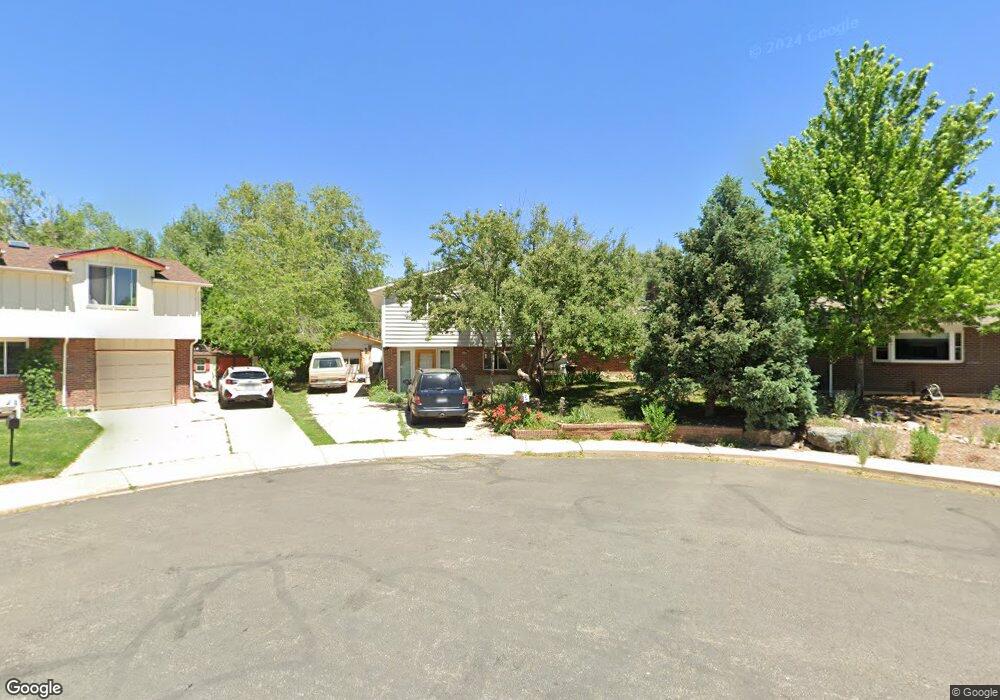
1019 Vivian Cir Boulder, CO 80303
Southeast Boulder NeighborhoodEstimated Value: $843,203 - $997,000
4
Beds
3
Baths
1,943
Sq Ft
$459/Sq Ft
Est. Value
About This Home
This home is located at 1019 Vivian Cir, Boulder, CO 80303 and is currently estimated at $892,051, approximately $459 per square foot. 1019 Vivian Cir is a home located in Boulder County with nearby schools including Eisenhower Elementary School, Manhattan Middle School of the Arts & Academics, and Fairview High School.
Ownership History
Date
Name
Owned For
Owner Type
Purchase Details
Closed on
Aug 2, 2001
Sold by
Temple Paulina S
Bought by
Reifsnyder Dwight L and Reifsnyder Cheryl M
Current Estimated Value
Home Financials for this Owner
Home Financials are based on the most recent Mortgage that was taken out on this home.
Original Mortgage
$150,000
Interest Rate
7.05%
Purchase Details
Closed on
Nov 5, 1973
Bought by
Reifsnyder Dwight L and Reifsnyder Cheryl M
Create a Home Valuation Report for This Property
The Home Valuation Report is an in-depth analysis detailing your home's value as well as a comparison with similar homes in the area
Home Values in the Area
Average Home Value in this Area
Purchase History
| Date | Buyer | Sale Price | Title Company |
|---|---|---|---|
| Reifsnyder Dwight L | -- | -- | |
| Reifsnyder Dwight L | $350,000 | -- | |
| Reifsnyder Dwight L | $33,500 | -- |
Source: Public Records
Mortgage History
| Date | Status | Borrower | Loan Amount |
|---|---|---|---|
| Previous Owner | Reifsnyder Dwight L | $150,000 |
Source: Public Records
Tax History
| Year | Tax Paid | Tax Assessment Tax Assessment Total Assessment is a certain percentage of the fair market value that is determined by local assessors to be the total taxable value of land and additions on the property. | Land | Improvement |
|---|---|---|---|---|
| 2025 | $5,196 | $52,781 | $37,681 | $15,100 |
| 2024 | $5,196 | $52,781 | $37,681 | $15,100 |
| 2023 | $5,106 | $59,128 | $44,776 | $18,036 |
| 2022 | $4,443 | $47,844 | $32,387 | $15,457 |
| 2021 | $4,237 | $49,221 | $33,319 | $15,902 |
| 2020 | $3,932 | $45,167 | $29,315 | $15,852 |
| 2019 | $3,871 | $45,167 | $29,315 | $15,852 |
| 2018 | $3,709 | $42,775 | $27,144 | $15,631 |
| 2017 | $3,593 | $47,290 | $30,009 | $17,281 |
| 2016 | $3,281 | $37,898 | $19,582 | $18,316 |
| 2015 | $3,107 | $33,368 | $19,263 | $14,105 |
| 2014 | $2,806 | $33,368 | $19,263 | $14,105 |
Source: Public Records
Map
Nearby Homes
- 4222 Monroe Dr Unit C
- 1180 Monroe Dr Unit B
- 5016 Forsythe Place
- 5044 Gallatin Place
- 3970 Colorado Ave Unit G
- 4500 Baseline Rd Unit 3303
- 4500 Baseline Rd Unit 4-4402
- 4415 Laguna Place Unit 201
- 810 37th St
- 695 Manhattan Dr Unit 109
- 695 Manhattan Dr Unit 219
- 5411 White Place
- 625 Manhattan Place Unit 308
- 501 Manhattan Dr Unit 101
- 600 Manhattan Dr
- 655 Cree Cir
- 3161 Madison Ave Unit 313
- 3601 Arapahoe Ave Unit 408
- 3601 Arapahoe Ave Unit 205
- 3009 Madison Ave Unit L216
- 1021 Vivian Cir
- 1017 Vivian Cir
- 1023 Vivian Cir
- 1015 Vivian Cir
- 1025 Waite Dr
- 1011 Vivian Cir
- 1009 Vivian Cir
- 4710 Hancock Dr
- 4720 Hancock Dr
- 1031 Waite Dr
- 4730 Hancock Dr
- 4700 Hancock Dr
- 1010 Waite Dr
- 4740 Hancock Dr
- 1007 Waite Dr
- 1020 Waite Dr
- 1045 Waite Dr
- 1030 Waite Dr
- 4750 Hancock Dr
- 1115 Hancock Dr