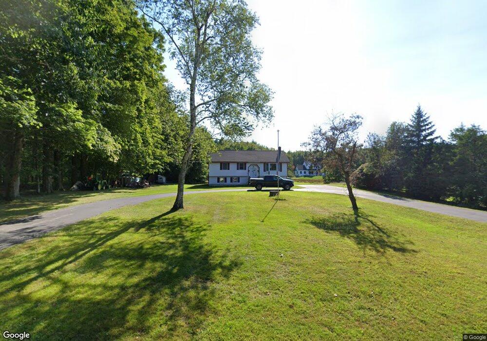
102 Mckenney Rd Saco, ME 04072
North Saco NeighborhoodEstimated Value: $396,000 - $461,000
3
Beds
1
Bath
1,074
Sq Ft
$393/Sq Ft
Est. Value
About This Home
This home is located at 102 Mckenney Rd, Saco, ME 04072 and is currently estimated at $421,597, approximately $392 per square foot. 102 Mckenney Rd is a home located in York County with nearby schools including C K Burns School and Saco Middle School.
Ownership History
Date
Name
Owned For
Owner Type
Purchase Details
Closed on
Mar 5, 2021
Sold by
Lampugnale Antonina
Bought by
Roberts Timothy and Roberts Bobbie
Current Estimated Value
Purchase Details
Closed on
Nov 30, 2018
Sold by
Deering Gladys E Est
Bought by
Camire Jonathan M
Home Financials for this Owner
Home Financials are based on the most recent Mortgage that was taken out on this home.
Original Mortgage
$206,196
Interest Rate
4.8%
Mortgage Type
FHA
Create a Home Valuation Report for This Property
The Home Valuation Report is an in-depth analysis detailing your home's value as well as a comparison with similar homes in the area
Home Values in the Area
Average Home Value in this Area
Purchase History
| Date | Buyer | Sale Price | Title Company |
|---|---|---|---|
| Roberts Timothy | -- | None Available | |
| Camire Jonathan M | -- | -- |
Source: Public Records
Mortgage History
| Date | Status | Borrower | Loan Amount |
|---|---|---|---|
| Previous Owner | Camire Jonathan M | $206,196 |
Source: Public Records
Tax History
| Year | Tax Paid | Tax Assessment Tax Assessment Total Assessment is a certain percentage of the fair market value that is determined by local assessors to be the total taxable value of land and additions on the property. | Land | Improvement |
|---|---|---|---|---|
| 2024 | $4,481 | $318,900 | $148,100 | $170,800 |
| 2023 | $4,704 | $318,900 | $148,100 | $170,800 |
| 2022 | $4,251 | $231,900 | $112,800 | $119,100 |
| 2021 | $4,097 | $217,000 | $101,500 | $115,500 |
| 2020 | $3,834 | $194,900 | $89,300 | $105,600 |
| 2019 | $3,777 | $194,900 | $89,300 | $105,600 |
| 2018 | $3,156 | $208,900 | $107,900 | $101,000 |
| 2017 | $3,457 | $204,400 | $100,900 | $103,500 |
| 2016 | $3,564 | $183,500 | $85,900 | $97,600 |
| 2015 | $3,481 | $181,100 | $84,600 | $96,500 |
| 2014 | $3,372 | $181,100 | $84,600 | $96,500 |
| 2013 | $3,365 | $181,100 | $84,600 | $96,500 |
Source: Public Records
Map
Nearby Homes
- 181 Watson Mill Rd
- 153 Mckenney Rd
- 3 Trapper John Rd
- 130 Heath Rd
- Lot 1 & 2 Memory Ln
- 00 Miso Way
- 196 Old Orchard Rd
- 70 Beech Plains Rd
- 0 Beech Plains Rd
- 0 Simpson Rd
- 4 Lebanon Rd
- 158 Lord Rd
- 48 Tickle Way
- 3 Dunn Estates Dr
- 69 Old Orchard Rd
- 8 Peaceful Ln
- 91 C Broadturn Rd
- 5 Moose Creek Ln
- 17 Johnson Farm Rd
- 9 Johnson Farm Rd
Your Personal Tour Guide
Ask me questions while you tour the home.