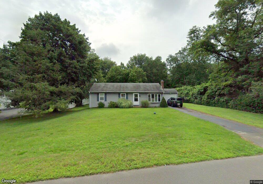
102 Mungertown Rd Madison, CT 06443
Estimated Value: $428,000 - $443,000
3
Beds
1
Bath
1,008
Sq Ft
$434/Sq Ft
Est. Value
About This Home
This home is located at 102 Mungertown Rd, Madison, CT 06443 and is currently estimated at $437,663, approximately $434 per square foot. 102 Mungertown Rd is a home located in New Haven County with nearby schools including Walter C. Polson Upper Middle School, Daniel Hand High School, and Our Lady of Mercy Preparatory Academy.
Ownership History
Date
Name
Owned For
Owner Type
Purchase Details
Closed on
Sep 29, 2009
Sold by
Mcguirk Peter E and Mcguirk Adna L
Bought by
Burkhardt William D
Current Estimated Value
Home Financials for this Owner
Home Financials are based on the most recent Mortgage that was taken out on this home.
Original Mortgage
$212,657
Interest Rate
5.31%
Mortgage Type
Purchase Money Mortgage
Purchase Details
Closed on
Jun 24, 1994
Sold by
Johnson Warren W
Bought by
Mcguirk Peter E and Mcguirk Anna L
Home Financials for this Owner
Home Financials are based on the most recent Mortgage that was taken out on this home.
Original Mortgage
$76,000
Interest Rate
8.74%
Mortgage Type
Purchase Money Mortgage
Create a Home Valuation Report for This Property
The Home Valuation Report is an in-depth analysis detailing your home's value as well as a comparison with similar homes in the area
Home Values in the Area
Average Home Value in this Area
Purchase History
| Date | Buyer | Sale Price | Title Company |
|---|---|---|---|
| Burkhardt William D | $225,000 | -- | |
| Mcguirk Peter E | $95,000 | -- |
Source: Public Records
Mortgage History
| Date | Status | Borrower | Loan Amount |
|---|---|---|---|
| Open | Mcguirk Peter E | $207,969 | |
| Closed | Mcguirk Peter E | $212,657 | |
| Previous Owner | Mcguirk Peter E | $79,500 | |
| Previous Owner | Mcguirk Peter E | $76,000 |
Source: Public Records
Tax History
| Year | Tax Paid | Tax Assessment Tax Assessment Total Assessment is a certain percentage of the fair market value that is determined by local assessors to be the total taxable value of land and additions on the property. | Land | Improvement |
|---|---|---|---|---|
| 2025 | $5,459 | $243,400 | $113,900 | $129,500 |
| 2024 | $5,592 | $254,200 | $113,900 | $140,300 |
| 2023 | $5,047 | $168,400 | $87,600 | $80,800 |
| 2022 | $4,953 | $168,400 | $87,600 | $80,800 |
| 2021 | $6,118 | $168,400 | $87,600 | $80,800 |
| 2020 | $6,120 | $168,400 | $87,600 | $80,800 |
| 2019 | $4,774 | $168,400 | $87,600 | $80,800 |
| 2018 | $4,733 | $168,800 | $90,300 | $78,500 |
| 2017 | $6,644 | $168,800 | $90,300 | $78,500 |
| 2016 | $4,472 | $168,800 | $90,300 | $78,500 |
| 2015 | $4,348 | $168,800 | $90,300 | $78,500 |
| 2014 | $4,757 | $189,000 | $119,200 | $69,800 |
Source: Public Records
Map
Nearby Homes
- 22 Nathans Ln
- 178 Mungertown Rd
- 19 Green Acres Dr
- 31 Stony Lane Lot 3 Rd
- 31 Stony Lane Lot 2 Rd
- 31 Stony Lane Lot 1 Rd
- 70 Wildwood Ave
- 42 Neck Rd
- 58 Neck Rd
- 67 Boston Post Rd Unit 8
- 173 Wildwood Ave
- 395 Boston Post Rd
- 18 Riverside Terrace
- 75 Fairview Dr
- 41 Harbor Ave
- 23 Sheep Pasture Rd
- 46A Beach Ave
- 37 Lantern Hill Rd
- 115 Harbor Ave
- 4 Boston Post Rd
- 106 Mungertown Rd
- 98 Mungertown Rd
- 94 Mungertown Rd
- 255 Fort Path Rd
- 112 Mungertown Rd
- 253 Fort Path Rd
- 12 Pardee Place
- 259 Fort Path Rd
- 90 Mungertown Rd
- 91 Mungertown Rd
- 14 Pardee Place
- 87 Mungertown Rd
- 86 Mungertown Rd
- 19 Pardee Place
- 61 Pardee Place
- 83 Mungertown Rd
- 243 Fort Path Rd
- 82 Mungertown Rd
- 239 Fort Path Rd
- 18 Pardee Place
Your Personal Tour Guide
Ask me questions while you tour the home.