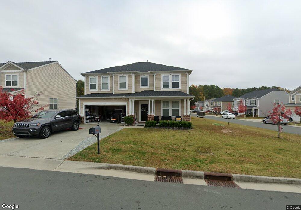
102 Red Bird Dr Durham, NC 27704
Eastern Durham NeighborhoodEstimated Value: $391,991 - $428,000
3
Beds
3
Baths
2,366
Sq Ft
$170/Sq Ft
Est. Value
About This Home
This home is located at 102 Red Bird Dr, Durham, NC 27704 and is currently estimated at $403,248, approximately $170 per square foot. 102 Red Bird Dr is a home located in Durham County with nearby schools including Glenn Elementary, John W Neal Middle School, and Southern School of Energy & Sustainability.
Ownership History
Date
Name
Owned For
Owner Type
Purchase Details
Closed on
Jun 30, 2010
Sold by
Beazer Homes Corp
Bought by
Beal Koketta
Current Estimated Value
Home Financials for this Owner
Home Financials are based on the most recent Mortgage that was taken out on this home.
Original Mortgage
$7,500
Interest Rate
4.79%
Mortgage Type
Unknown
Create a Home Valuation Report for This Property
The Home Valuation Report is an in-depth analysis detailing your home's value as well as a comparison with similar homes in the area
Home Values in the Area
Average Home Value in this Area
Purchase History
| Date | Buyer | Sale Price | Title Company |
|---|---|---|---|
| Beal Koketta | $178,000 | None Available |
Source: Public Records
Mortgage History
| Date | Status | Borrower | Loan Amount |
|---|---|---|---|
| Closed | Beal Koketta | $7,500 | |
| Open | Beal Koketta | $166,200 |
Source: Public Records
Tax History Compared to Growth
Tax History
| Year | Tax Paid | Tax Assessment Tax Assessment Total Assessment is a certain percentage of the fair market value that is determined by local assessors to be the total taxable value of land and additions on the property. | Land | Improvement |
|---|---|---|---|---|
| 2025 | $3,227 | $426,236 | $75,625 | $350,611 |
| 2024 | $3,227 | $231,354 | $36,240 | $195,114 |
| 2023 | $3,031 | $231,354 | $36,240 | $195,114 |
| 2022 | $2,961 | $231,354 | $36,240 | $195,114 |
| 2021 | $2,947 | $231,354 | $36,240 | $195,114 |
| 2020 | $2,878 | $231,354 | $36,240 | $195,114 |
| 2019 | $2,878 | $231,354 | $36,240 | $195,114 |
| 2018 | $2,707 | $199,553 | $36,240 | $163,313 |
| 2017 | $2,687 | $199,553 | $36,240 | $163,313 |
| 2016 | $2,596 | $199,553 | $36,240 | $163,313 |
| 2015 | $2,704 | $195,366 | $39,523 | $155,843 |
| 2014 | $2,704 | $195,366 | $39,523 | $155,843 |
Source: Public Records
Map
Nearby Homes
- 1201 Opal Ln
- 1201 Opal Ln Unit 77
- 1212 Opal Ln
- 1213 Opal Ln Unit 80
- 1213 Opal Ln
- 1209 Opal Ln Unit 79
- 1209 Opal Ln
- 3721 Brightwood Ln
- 124 Rosebud Ln
- 1217 Golden Eagle Dr
- 112 Eastern Teal Dr
- 608 Clearfield Dr
- 721 Pebblestone Dr
- 509 Pebblestone Dr
- 512 Magna Dr
- 1104 Pebblestone Dr
- 510 Cove Hollow Dr
- 1828 Fletchers Chapel Rd
- 4300-4304 Cheek Rd
- 2204 Fletchers Ridge Dr
- 104 Red Bird Dr
- 1110 Whispering Oak Ln
- 1106 Whispering Oak Ln
- 106 Red Bird Dr
- 1109 Whispering Oak Ln
- 101 Red Bird Dr
- 1111 Whispering Oak Ln
- 1107 Whispering Oak Ln
- 103 Red Bird Dr
- 1104 Whispering Oak Ln
- 1201 Whispering Oak Ln
- 108 Red Bird Dr
- 1105 Whispering Oak Ln
- 105 Red Bird Dr
- 1203 Whispering Oak Ln
- 1103 Whispering Oak Ln
- 1206 Whispering Oak Ln
- 107 Red Bird Dr
- 1111 Red Crest Ln
- 1109 Red Crest Ln