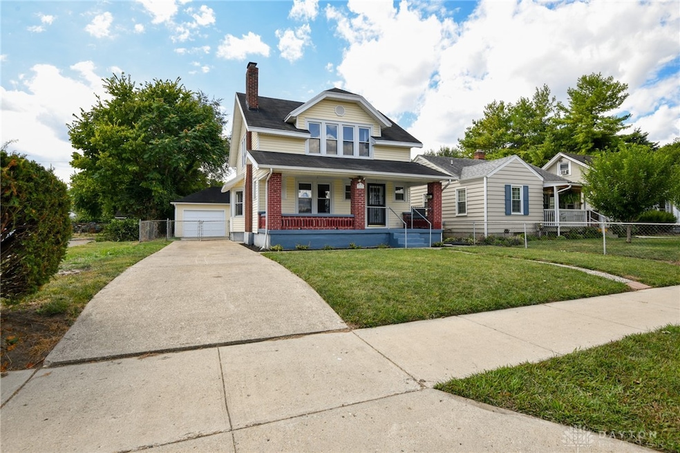
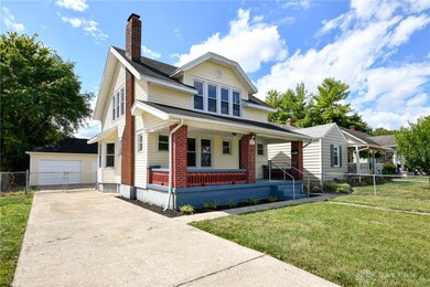
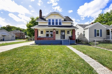
102 Warren Ave Franklin, OH 45005
Estimated payment $1,085/month
Highlights
- No HOA
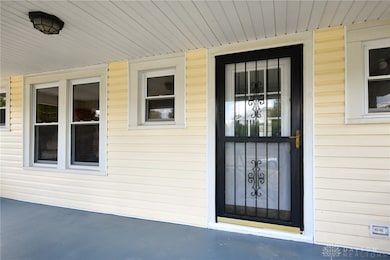
- Porch
- Walk-In Closet
- 2 Car Detached Garage
- Double Pane Windows
- Patio
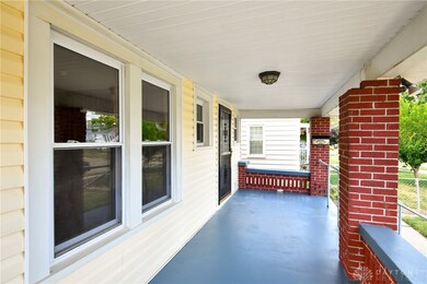
About This Home
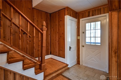
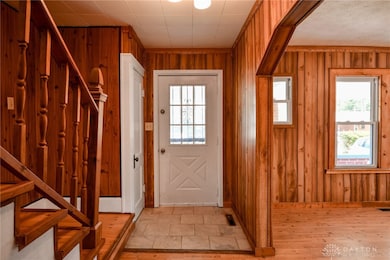
Nicely updated 2 story with 2-3 beds (1 bedroom would make a wonderful nursery and/or office. The bathroom has been totally updated. The many updates include flooring, kitchen, windows, lighting fixtures, plumbing fixtures and more. Home has been freshly painted and ready for the new owner(s). The inviting oversized covered front porch gives you a warm welcome. The covered back porch is great for those evening barbecues. Nice flat yard is fully fenced and the detached oversized 2 car garage is great for storage along with space for a nice workshop, mechanical area and more. The full unfinished basement boasts the laundry area and has a carved out work out room/ office, etc. This lovely home brings a lot of warmth, especially the living room with the built in bookcases from the 40's. Priced to sell--why rent when you can own.
Listing Agent
BHHS Professional Realty Brokerage Phone: (937) 436-9494 License #0000324418 Listed on: 09/08/2025

Home Details
Home Type
- Single Family
Est. Annual Taxes
- $2,882
Year Built
- 1940
Lot Details
- 6,075 Sq Ft Lot
- Fenced
Parking
- 2 Car Detached Garage
- Parking Storage or Cabinetry
Home Design
- Aluminum Siding
- Vinyl Siding
Interior Spaces
- 2-Story Property
- Ceiling Fan
- Decorative Fireplace
- Double Pane Windows
- Unfinished Basement
- Basement Fills Entire Space Under The House
- Fire and Smoke Detector
Kitchen
- Range
- Dishwasher
- Laminate Countertops
Bedrooms and Bathrooms
- 3 Bedrooms
- Walk-In Closet
- 1 Full Bathroom
Outdoor Features
- Patio
- Porch
Utilities
- Central Air
- Heating System Uses Natural Gas
- 220 Volts in Garage
- Gas Water Heater
Community Details
- No Home Owners Association
- Plainview Manor Subdivision, 2 Story Floorplan
Listing and Financial Details
- Assessor Parcel Number 04322520060
Map
Home Values in the Area
Average Home Value in this Area
Tax History
| Year | Tax Paid | Tax Assessment Tax Assessment Total Assessment is a certain percentage of the fair market value that is determined by local assessors to be the total taxable value of land and additions on the property. | Land | Improvement |
|---|---|---|---|---|
| 2024 | $2,882 | $44,270 | $9,010 | $35,260 |
| 2023 | $1,958 | $33,960 | $5,110 | $28,850 |
| 2022 | $1,923 | $33,961 | $5,110 | $28,851 |
| 2021 | $1,923 | $33,961 | $5,110 | $28,851 |
| 2020 | $1,667 | $26,950 | $4,053 | $22,897 |
| 2019 | $1,532 | $26,950 | $4,053 | $22,897 |
| 2018 | $1,337 | $26,950 | $4,053 | $22,897 |
| 2017 | $1,580 | $25,487 | $3,892 | $21,595 |
| 2016 | $1,607 | $25,487 | $3,892 | $21,595 |
| 2015 | $1,607 | $25,487 | $3,892 | $21,595 |
| 2014 | $1,449 | $25,490 | $3,890 | $21,600 |
| 2013 | $1,244 | $29,480 | $4,500 | $24,980 |
Property History
| Date | Event | Price | List to Sale | Price per Sq Ft |
|---|---|---|---|---|
| 09/08/2025 09/08/25 | For Sale | $159,987 | -- | -- |
Purchase History
| Date | Type | Sale Price | Title Company |
|---|---|---|---|
| Deed | $58,500 | -- | |
| Deed | $38,400 | -- | |
| Deed | $40,000 | -- | |
| Deed | $35,200 | -- | |
| Deed | $32,000 | -- |
Source: Dayton REALTORS®
MLS Number: 943154
APN: 04-32-252-006
Disclaimer: Certain information contained herein is derived from information provided by parties other than Homes.com. All information provided is deemed reliable, but is not guaranteed to be accurate and should be independently verified.
![]() The information is being provided by Dayton Area Board of Realtors MLS. Information deemed reliable but not guaranteed. Information is provided for the consumer's personal, non-commercial use, and may not be used for any purpose other than the identification of potential properties for purchase. Copyright 2025 Dayton Area Board of Realtors MLS. All Rights Reserved.
The information is being provided by Dayton Area Board of Realtors MLS. Information deemed reliable but not guaranteed. Information is provided for the consumer's personal, non-commercial use, and may not be used for any purpose other than the identification of potential properties for purchase. Copyright 2025 Dayton Area Board of Realtors MLS. All Rights Reserved.
- 121 Boys Ave
- 315 Bridge St
- 0 Victoria Dr Unit 942075
- 0 Victoria Dr Unit 1852824
- 141 Arlington Ave
- 324 Cris Ct
- 50 N Main St
- 128 Stadia Dr
- 56 Skokiaan Dr
- 418 Home Ave
- 7 Highland St
- 413 Spring Ave
- 551 E 2nd St
- 521 Spring Ave
- 605 Spring Ave
- 410 Park Ave
- 104 Mound Builder Place
- 509 Forest Ave
- 511 Forest Ave
- 111 Moore Dr
- 101 N Main St Unit 3
- 601 Moses Dr Unit 1
- 2 Emerald Way
- 510 Arlington Dr
- 8967 Cam Dr
- 950 Dubois Rd
- 5019 Waterford Ln
- 5019 Waterford Dr
- 140 Redbud Dr
- 7184 Franklin Madison Rd
- 475 Gilpin Dr
- 5017 Waterford Ln
- 9 Cozy Ln
- 20 Chris Ln Unit 57
- 5 Cozy Dr
- 8571 Dayton Cincinnati Pike
- 10501 Landing Way
- 2991 Austin Springs Blvd
- 2895 Taos Dr
- 1804 Belvo Rd