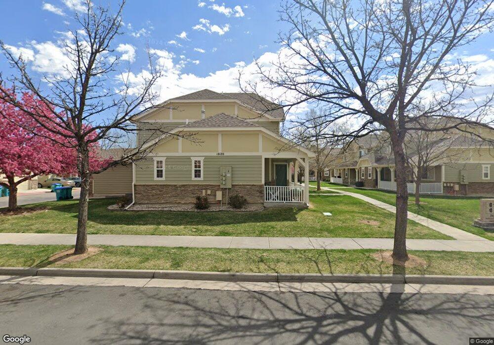
1020 Andrews Peak Dr Unit C109 Fort Collins, CO 80521
P.O.E.T. NeighborhoodEstimated Value: $424,466 - $464,000
3
Beds
3
Baths
1,448
Sq Ft
$306/Sq Ft
Est. Value
About This Home
This home is located at 1020 Andrews Peak Dr Unit C109, Fort Collins, CO 80521 and is currently estimated at $443,117, approximately $306 per square foot. 1020 Andrews Peak Dr Unit C109 is a home located in Larimer County with nearby schools including Bauder Elementary School, Blevins Middle School, and Rocky Mountain High School.
Ownership History
Date
Name
Owned For
Owner Type
Purchase Details
Closed on
Nov 6, 2012
Sold by
Maxwell Christopher D and Maxwell Richard P
Bought by
Maxwell Christopher D
Current Estimated Value
Home Financials for this Owner
Home Financials are based on the most recent Mortgage that was taken out on this home.
Original Mortgage
$149,250
Outstanding Balance
$103,670
Interest Rate
3.5%
Mortgage Type
Adjustable Rate Mortgage/ARM
Estimated Equity
$339,447
Purchase Details
Closed on
May 20, 2005
Sold by
Bls Development Llc
Bought by
Maxwell Christopher D and Svaldi Aldo P
Home Financials for this Owner
Home Financials are based on the most recent Mortgage that was taken out on this home.
Original Mortgage
$19,100
Interest Rate
5.92%
Mortgage Type
Credit Line Revolving
Create a Home Valuation Report for This Property
The Home Valuation Report is an in-depth analysis detailing your home's value as well as a comparison with similar homes in the area
Home Values in the Area
Average Home Value in this Area
Purchase History
| Date | Buyer | Sale Price | Title Company |
|---|---|---|---|
| Maxwell Christopher D | -- | None Available | |
| Maxwell Christopher D | $191,000 | -- |
Source: Public Records
Mortgage History
| Date | Status | Borrower | Loan Amount |
|---|---|---|---|
| Open | Maxwell Christopher D | $149,250 | |
| Closed | Maxwell Christopher D | $19,100 | |
| Closed | Maxwell Christopher D | $152,800 |
Source: Public Records
Tax History Compared to Growth
Tax History
| Year | Tax Paid | Tax Assessment Tax Assessment Total Assessment is a certain percentage of the fair market value that is determined by local assessors to be the total taxable value of land and additions on the property. | Land | Improvement |
|---|---|---|---|---|
| 2025 | $2,552 | $30,284 | $3,162 | $27,122 |
| 2024 | $2,428 | $30,284 | $3,162 | $27,122 |
| 2022 | $2,299 | $24,345 | $3,280 | $21,065 |
| 2021 | $2,323 | $25,047 | $3,375 | $21,672 |
| 2020 | $2,201 | $23,524 | $3,375 | $20,149 |
| 2019 | $2,211 | $23,524 | $3,375 | $20,149 |
| 2018 | $2,033 | $22,305 | $3,398 | $18,907 |
| 2017 | $2,026 | $22,305 | $3,398 | $18,907 |
| 2016 | $1,751 | $19,176 | $3,757 | $15,419 |
| 2015 | $1,738 | $19,180 | $3,760 | $15,420 |
| 2014 | $1,445 | $15,840 | $3,760 | $12,080 |
Source: Public Records
Map
Nearby Homes
- 1014 Andrews Peak Dr Unit D112
- 1002 Andrews Peak Dr Unit 103
- 1061 Tierra Ln Unit A
- 2609 Bartlett Dr
- 1007 Tierra Ln Unit A2
- 3002 W Elizabeth St Unit 8E
- 3002 W Elizabeth St
- 3002 W Elizabeth St Unit 22F
- 3002 W Elizabeth St Unit G
- 3002 W Elizabeth St Unit 16G
- 920 S Overland Trail
- 812 Rocky Rd
- 2631 Flintridge Place
- 1037 Cypress Dr
- 2436 Poplar Dr
- 813 Timber Ln
- 2513 Flintridge Place
- 720 S Overland Trail
- 3000 W Lake St
- 2513 Bradbury Ct
- 1020 Andrews Peak Dr Unit D113
- 1020 Andrews Peak Dr Unit D112
- 1020 Andrews Peak Dr Unit D111
- 1020 Andrews Peak Dr Unit C110
- 1020 Andrews Peak Dr Unit C108
- 1020 Andrews Peak Dr Unit B107
- 1020 Andrews Peak Dr Unit B106
- 1020 Andrews Peak Dr Unit B105
- 1020 Andrews Peak Dr Unit B104
- 1020 Andrews Peak Dr Unit A103
- 1020 Andrews Peak Dr Unit A102
- 1020 Andrews Peak Dr Unit A101
- 1020 Andrews Peak Dr
- 1020 Andrews Peak Dr Unit B
- 1014 Andrews Peak Dr Unit D111
- 1014 Andrews Peak Dr Unit C110
- 1014 Andrews Peak Dr Unit C109
- 1014 Andrews Peak Dr Unit C108
- 1014 Andrews Peak Dr Unit E114
- 1014 Andrews Peak Dr Unit E113