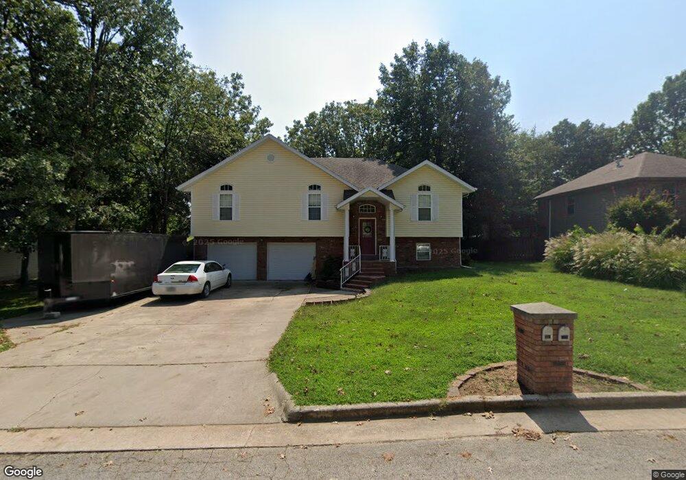
1020 Daniels St Aurora, MO 65605
Estimated Value: $283,107 - $336,000
4
Beds
3
Baths
2,307
Sq Ft
$130/Sq Ft
Est. Value
About This Home
This home is located at 1020 Daniels St, Aurora, MO 65605 and is currently estimated at $300,527, approximately $130 per square foot. 1020 Daniels St is a home located in Lawrence County with nearby schools including Pate Early Childhood Center, Robinson Elementary School, and Robinson Intermediate School.
Ownership History
Date
Name
Owned For
Owner Type
Purchase Details
Closed on
Sep 30, 2024
Sold by
Hedrick Russell and Hedrick Anna V
Bought by
Hedrick Russell K and Hedrick Anna V
Current Estimated Value
Home Financials for this Owner
Home Financials are based on the most recent Mortgage that was taken out on this home.
Original Mortgage
$153,750
Outstanding Balance
$152,152
Interest Rate
6.88%
Mortgage Type
New Conventional
Estimated Equity
$148,375
Purchase Details
Closed on
Dec 2, 2009
Sold by
Edmondson Kirby and Edmondson Kim
Bought by
Hedrick Russell
Create a Home Valuation Report for This Property
The Home Valuation Report is an in-depth analysis detailing your home's value as well as a comparison with similar homes in the area
Home Values in the Area
Average Home Value in this Area
Purchase History
| Date | Buyer | Sale Price | Title Company |
|---|---|---|---|
| Hedrick Russell K | -- | Waco Title | |
| Hedrick Russell | $155,000 | -- | |
| Hedrick Russell | $155,000 | None Available |
Source: Public Records
Mortgage History
| Date | Status | Borrower | Loan Amount |
|---|---|---|---|
| Open | Hedrick Russell K | $153,750 |
Source: Public Records
Tax History Compared to Growth
Tax History
| Year | Tax Paid | Tax Assessment Tax Assessment Total Assessment is a certain percentage of the fair market value that is determined by local assessors to be the total taxable value of land and additions on the property. | Land | Improvement |
|---|---|---|---|---|
| 2025 | $1,591 | $31,790 | $3,780 | $28,010 |
| 2024 | $1,464 | $29,030 | $3,780 | $25,250 |
| 2023 | $1,456 | $29,030 | $3,780 | $25,250 |
| 2022 | $1,364 | $27,210 | $3,780 | $23,430 |
| 2021 | $1,366 | $27,210 | $3,780 | $23,430 |
| 2020 | $1,354 | $26,720 | $3,290 | $23,430 |
| 2019 | $1,331 | $26,720 | $3,290 | $23,430 |
| 2018 | $1,329 | $26,720 | $3,290 | $23,430 |
| 2017 | $1,322 | $26,720 | $3,290 | $23,430 |
| 2016 | -- | $24,420 | $3,290 | $21,130 |
| 2015 | -- | $24,420 | $3,290 | $21,130 |
| 2014 | -- | $24,420 | $3,290 | $21,130 |
Source: Public Records
Map
Nearby Homes
- 1019 Daniels St
- 1100 Chicory Ln
- 1705 S Tyler Ave
- 1301 S Tyler Ave
- 1220 Tyler St
- 1813 Edgewood Dr
- 906 W Pearl St
- 667 W Elm St
- 1006 Baretta Ct
- 1101 Highland Dr
- 923 Rosemary Ave
- 17366 Lawrence 2220
- 1307 S Washington Ave
- 611 S Harrison Ave
- 722 S Pheasant Run Dr
- 314 Jasper St
- 221 W South St
- 504 S Lincoln Ave
- 308 W Church St
- 213 Jasper St
- 1018 Daniels St
- 1022 Daniels St
- 1027 Chicory Ln
- 1016 Daniels St
- 1024 Daniels St
- 1017 Daniels St
- 1023 Daniels St
- 1025 Daniels St
- 1014 Daniels St
- 1028 Daniels St
- 1028 Daniels St Unit 1312892
- 1512 Taylor St Unit 1313973
- 1512 Taylor St
- 1027 Daniels St
- 1022 Nickolas St
- 1018 Nickolas St
- 1020 Nickolas St
- 1510 Taylor St
- 1510 Taylor St Unit 60002247
- 1026 Nickolas St