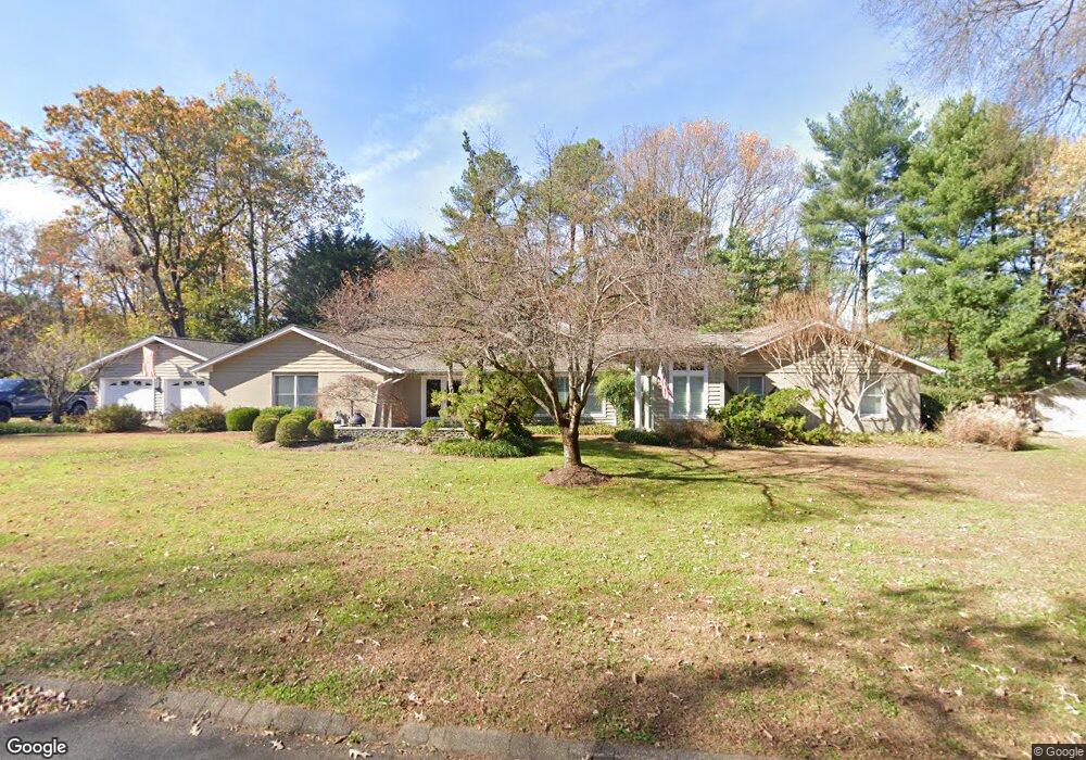
1022 Ulmstead Cir Arnold, MD 21012
Estimated Value: $718,166 - $1,006,000
Studio
2
Baths
2,623
Sq Ft
$342/Sq Ft
Est. Value
About This Home
This home is located at 1022 Ulmstead Cir, Arnold, MD 21012 and is currently estimated at $897,542, approximately $342 per square foot. 1022 Ulmstead Cir is a home located in Anne Arundel County with nearby schools including Broadneck Elementary School, Magothy River Middle School, and Broadneck High School.
Ownership History
Date
Name
Owned For
Owner Type
Purchase Details
Closed on
Aug 29, 2022
Sold by
Nolte Jeffrey
Bought by
Jeffrey Nolte Revocable Trust and Wendy Woodard Nolte Revocable Trust
Current Estimated Value
Purchase Details
Closed on
Jul 8, 1993
Sold by
Kohnken William H
Bought by
Nolte Jeffrey E and Nolte Wendy W
Home Financials for this Owner
Home Financials are based on the most recent Mortgage that was taken out on this home.
Original Mortgage
$203,150
Interest Rate
7.23%
Purchase Details
Closed on
Oct 19, 1989
Sold by
Usry Dallas B
Bought by
Kohnken William H
Home Financials for this Owner
Home Financials are based on the most recent Mortgage that was taken out on this home.
Original Mortgage
$187,600
Interest Rate
9.95%
Create a Home Valuation Report for This Property
The Home Valuation Report is an in-depth analysis detailing your home's value as well as a comparison with similar homes in the area
Home Values in the Area
Average Home Value in this Area
Purchase History
| Date | Buyer | Sale Price | Title Company |
|---|---|---|---|
| Jeffrey Nolte Revocable Trust | -- | -- | |
| Nolte Jeffrey E | $231,600 | -- | |
| Kohnken William H | $220,000 | -- |
Source: Public Records
Mortgage History
| Date | Status | Borrower | Loan Amount |
|---|---|---|---|
| Previous Owner | Nolte Jeffrey E | $203,150 | |
| Previous Owner | Kohnken William H | $187,600 |
Source: Public Records
Tax History
| Year | Tax Paid | Tax Assessment Tax Assessment Total Assessment is a certain percentage of the fair market value that is determined by local assessors to be the total taxable value of land and additions on the property. | Land | Improvement |
|---|---|---|---|---|
| 2025 | $5,101 | $615,233 | -- | -- |
| 2024 | $5,101 | $584,200 | $317,700 | $266,500 |
| 2023 | $4,979 | $580,300 | $0 | $0 |
| 2022 | $4,674 | $576,400 | $0 | $0 |
| 2020 | $4,491 | $572,500 | $317,700 | $254,800 |
| 2019 | $4,427 | $572,500 | $317,700 | $254,800 |
| 2018 | $6,156 | $607,100 | $379,700 | $227,400 |
| 2017 | $4,225 | $601,267 | $0 | $0 |
| 2016 | -- | $595,433 | $0 | $0 |
| 2015 | -- | $589,600 | $0 | $0 |
| 2014 | -- | $574,033 | $0 | $0 |
Source: Public Records
Map
Nearby Homes
- 559 Melissa Ct
- 1159 Greenhill Rd
- 539 Greenblades Ct
- 876 Shore Acres Rd
- 889 Lynch Dr
- 404 Alameda Pkwy
- 643 Oakland Hills Dr Unit U2A
- 276 Overleaf Dr
- 1124 Brassie Ct
- 303 Ternwing Dr
- 1110 Niblick Ct
- 413 Colonial Ridge Ln
- 920 Burnett Ave
- 1254 Masters Dr
- 975 Phillips Dr
- 1221 Seminole Dr
- 1410 Greendale Ct Unit 2-1410
- 618 Newbridge Ct Unit 3-618
- 371 Freshfield Ln
- 1078 Brightleaf Ct
- 1021 Ulmstead Cir
- 1028 Ulmstead Cir
- 1006 Placid Ct
- 1019 Placid Ct
- 1027 Ulmstead Cir
- 605 Breton Place
- 1022 Placid Ct
- 1021 Placid Ct
- 1034 Ulmstead Cir
- 1000 Placid Ct
- 611 Breton Place
- 1024 Placid Ct
- 606 Saber Ln
- 1023 Placid Ct
- 1020 Garywood Ln
- 617 Breton Place
- 1153 Stiarna Ct
- 1039 Ulmstead Cir
- 999 Placid Ct
- 994 Placid Ct
Your Personal Tour Guide
Ask me questions while you tour the home.