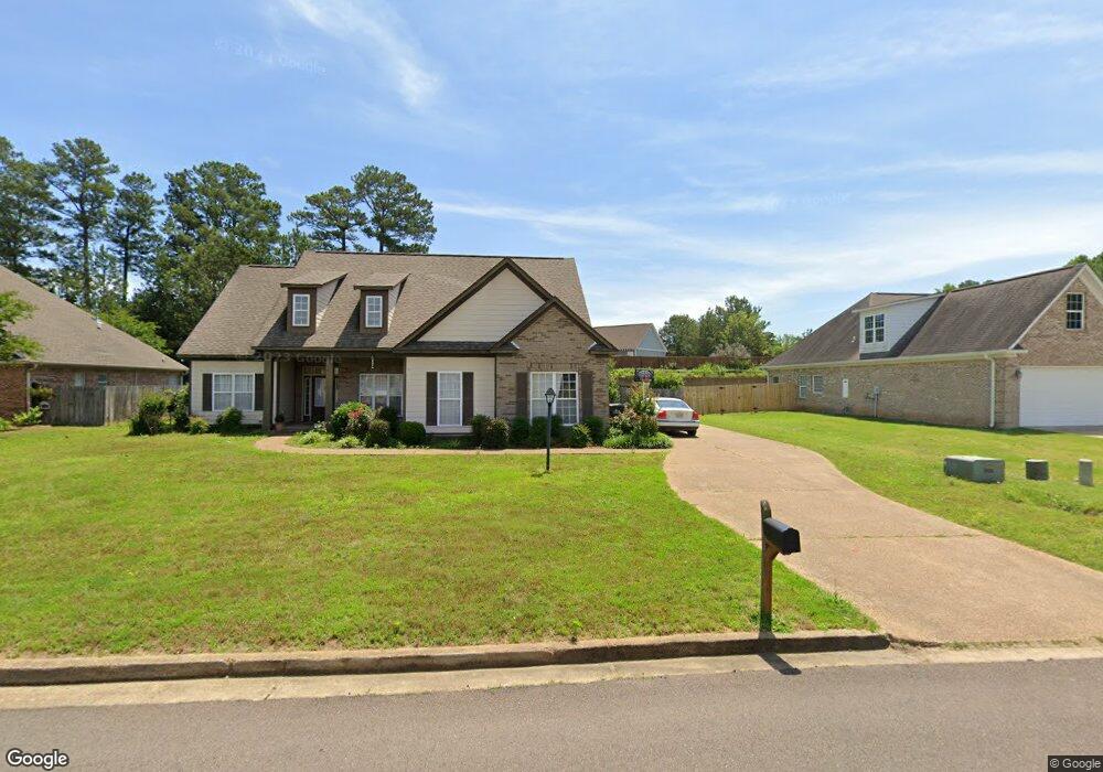
1025 Scarlet Dr Oxford, MS 38655
Estimated Value: $348,707 - $372,000
3
Beds
2
Baths
1,548
Sq Ft
$229/Sq Ft
Est. Value
About This Home
This home is located at 1025 Scarlet Dr, Oxford, MS 38655 and is currently estimated at $355,177, approximately $229 per square foot. 1025 Scarlet Dr is a home located in Lafayette County with nearby schools including Lafayette Elementary School, Lafayette Upper Elementary School, and Lafayette Middle School.
Ownership History
Date
Name
Owned For
Owner Type
Purchase Details
Closed on
Feb 15, 2012
Sold by
Westbrook Const Co Of Oxford Llc
Bought by
Mccary William and Mccary Bonnie
Current Estimated Value
Home Financials for this Owner
Home Financials are based on the most recent Mortgage that was taken out on this home.
Original Mortgage
$140,320
Outstanding Balance
$96,134
Interest Rate
3.89%
Mortgage Type
New Conventional
Estimated Equity
$259,043
Create a Home Valuation Report for This Property
The Home Valuation Report is an in-depth analysis detailing your home's value as well as a comparison with similar homes in the area
Home Values in the Area
Average Home Value in this Area
Purchase History
| Date | Buyer | Sale Price | Title Company |
|---|---|---|---|
| Mccary William | -- | None Available |
Source: Public Records
Mortgage History
| Date | Status | Borrower | Loan Amount |
|---|---|---|---|
| Open | Mccary William | $140,320 |
Source: Public Records
Tax History Compared to Growth
Tax History
| Year | Tax Paid | Tax Assessment Tax Assessment Total Assessment is a certain percentage of the fair market value that is determined by local assessors to be the total taxable value of land and additions on the property. | Land | Improvement |
|---|---|---|---|---|
| 2024 | $2,918 | $26,850 | $0 | $0 |
| 2023 | $2,918 | $26,732 | $0 | $0 |
| 2022 | $2,852 | $26,732 | $0 | $0 |
| 2021 | $2,896 | $26,732 | $0 | $0 |
| 2020 | $2,809 | $26,474 | $0 | $0 |
| 2019 | $2,809 | $26,474 | $0 | $0 |
| 2018 | $2,816 | $26,474 | $0 | $0 |
| 2017 | $2,816 | $26,474 | $0 | $0 |
| 2016 | $2,667 | $25,373 | $0 | $0 |
| 2015 | -- | $25,373 | $0 | $0 |
| 2014 | -- | $25,373 | $0 | $0 |
Source: Public Records
Map
Nearby Homes
- 717 Savannah Dr
- 1701 Rhett's Dr
- 1817 Atlanta Ave
- 710 Happy Ln
- 607 Happy Ln
- 108 Cedar Hill Dr
- 100 Heights Dr
- 133 Heights Dr
- 11 County Road 1057
- 128 Cedar Hill Dr
- 3809 #6 Old Sardis Rd
- 3809 #5 Old Sardis Rd
- 3809 #9 Old Sardis Rd
- 3809 #11 Old Sardis Rd
- 3809 #4 Old Sardis Rd
- 3809 #14 Old Sardis Rd
- 3809 #12 Old Sardis Rd
- 3809 #7 Old Sardis Rd
- 3809 #8 Old Sardis Rd
- 3809 #13 Old Sardis Rd
- 1027 Scarlett Dr
- 1027 Scarlet Dr
- 1023 Scarlett Dr
- 1026 Scarlet Dr
- 1024 Scarlett Dr
- 1319 Ashleys Dr
- 1029 Scarlett Dr
- 1318 Ashleys Dr
- 1317 Ashleys Dr
- 1022 Scarlett Dr
- 1316 Ashleys Dr
- 1020 Scarlet Dr
- 1217 Westbrook Dr
- 1227 Westbrook Dr
- 1019 Scarlet Dr
- 1315 Ashleys Dr
- 148 Westbrook Dr
- Lot 149 Westbrook Dr
- LOT 154 Westbrook Dr
- LOT 157 Westbrook Dr