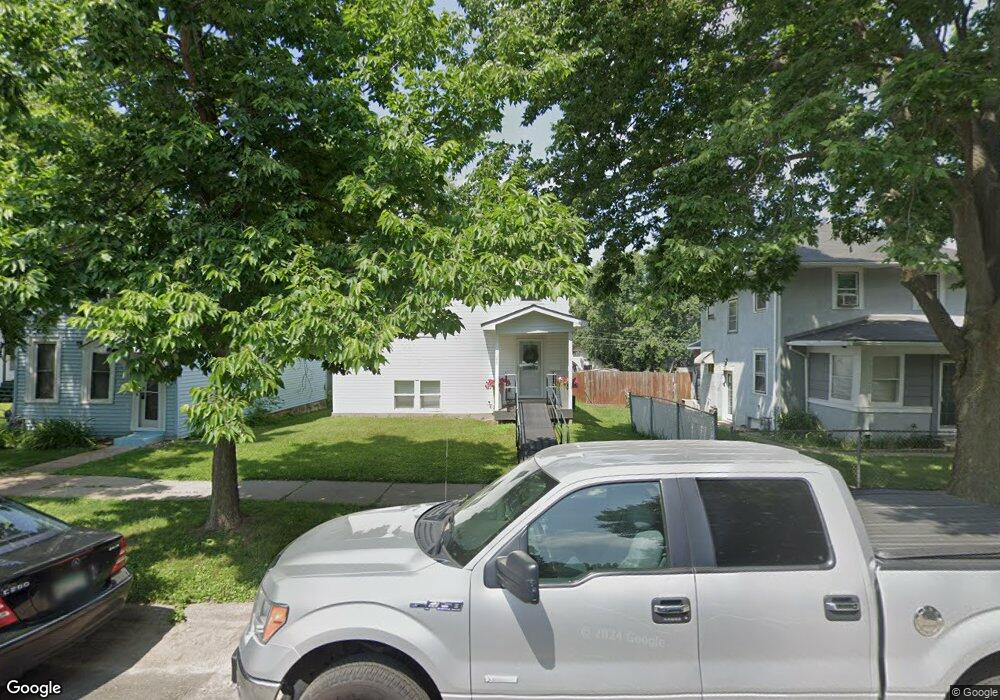
1027 1027 McLean-avenue- St. Paul, MN 55106
Dayton's Bluff NeighborhoodEstimated Value: $305,000 - $319,759
2
Beds
1
Bath
1,092
Sq Ft
$285/Sq Ft
Est. Value
About This Home
This home is located at 1027 1027 McLean-avenue-, St. Paul, MN 55106 and is currently estimated at $310,940, approximately $284 per square foot. 1027 1027 McLean-avenue- is a home located in Ramsey County with nearby schools including Dayton's Bluff Achievement Plus Elementary School, Battle Creek Middle School, and Harding Senior High School.
Ownership History
Date
Name
Owned For
Owner Type
Purchase Details
Closed on
Aug 8, 2023
Sold by
Dorweiler Blaine A
Bought by
Yang Marly and Yang Pao
Current Estimated Value
Purchase Details
Closed on
Apr 30, 2021
Sold by
Schell David E
Bought by
Yang Marly E
Home Financials for this Owner
Home Financials are based on the most recent Mortgage that was taken out on this home.
Original Mortgage
$255,550
Interest Rate
3%
Mortgage Type
New Conventional
Purchase Details
Closed on
Mar 9, 2015
Sold by
County Of Ramsey
Bought by
Schell David E
Home Financials for this Owner
Home Financials are based on the most recent Mortgage that was taken out on this home.
Original Mortgage
$9,000
Interest Rate
3.56%
Mortgage Type
Seller Take Back
Purchase Details
Closed on
Jan 17, 1997
Sold by
Marsh Robert James
Bought by
Hanson Richard L
Create a Home Valuation Report for This Property
The Home Valuation Report is an in-depth analysis detailing your home's value as well as a comparison with similar homes in the area
Home Values in the Area
Average Home Value in this Area
Purchase History
| Date | Buyer | Sale Price | Title Company |
|---|---|---|---|
| Yang Marly | $85,000 | None Listed On Document | |
| Yang Marly E | $269,000 | Land Title Inc | |
| Schell David E | $10,000 | None Available | |
| Hanson Richard L | $16,590 | -- | |
| Yang Marly Marly | $269,000 | -- |
Source: Public Records
Mortgage History
| Date | Status | Borrower | Loan Amount |
|---|---|---|---|
| Previous Owner | Yang Marly E | $255,550 | |
| Previous Owner | Schell David E | $9,000 | |
| Closed | Yang Marly Marly | $255,550 |
Source: Public Records
Tax History Compared to Growth
Tax History
| Year | Tax Paid | Tax Assessment Tax Assessment Total Assessment is a certain percentage of the fair market value that is determined by local assessors to be the total taxable value of land and additions on the property. | Land | Improvement |
|---|---|---|---|---|
| 2025 | $4,446 | $303,800 | $25,300 | $278,500 |
| 2023 | $4,446 | $286,600 | $16,200 | $270,400 |
| 2022 | $544 | $285,900 | $16,200 | $269,700 |
| 2021 | $422 | $44,200 | $16,200 | $28,000 |
| 2020 | $456 | $16,200 | $16,200 | $0 |
| 2019 | $566 | $16,200 | $16,200 | $0 |
| 2018 | $370 | $16,200 | $16,200 | $0 |
| 2017 | $530 | $16,200 | $16,200 | $0 |
| 2016 | $220 | $0 | $0 | $0 |
| 2015 | -- | $10,000 | $10,000 | $0 |
| 2014 | -- | $0 | $0 | $0 |
Source: Public Records
Map
Nearby Homes
- 1005 Mclean Ave
- 1102 Pacific St
- 995 Wakefield Ave
- 1020 Wilson Ave
- 1076 Wilson Ave
- 1097 Euclid St
- 212 Maple St
- 980 3rd St E
- 1056 3rd St E
- 1026 Fremont Ave
- 854 Euclid St
- 725 Wilson Ave
- 721 Wilson Ave
- 401 Johnson Pkwy
- 530 Forest St
- 726 Euclid St
- 150 Mounds Blvd
- 535 Forest St
- 695 Euclid St
- 1257 Wilson Ave
- 1027 Mclean Ave
- 1033 Mclean Ave
- 1025 Mclean Ave
- 1035 Mclean Ave
- 1019 Mclean Ave
- 1039 Mclean Ave
- 1015 Mclean Ave
- 1030 Pacific St
- 1034 Pacific St
- 1024 Pacific St
- 1043 Mclean Ave
- 1020 Mclean Ave
- 1020 1020 McLean-avenue-
- 1028 Mclean Ave
- 1034 Mclean Ave
- 1034 1034 McLean-avenue-
- 1038 Pacific St
- 1024 Mclean Ave
- 1024 1024 McLean-avenue-
- 1038 Mclean Ave