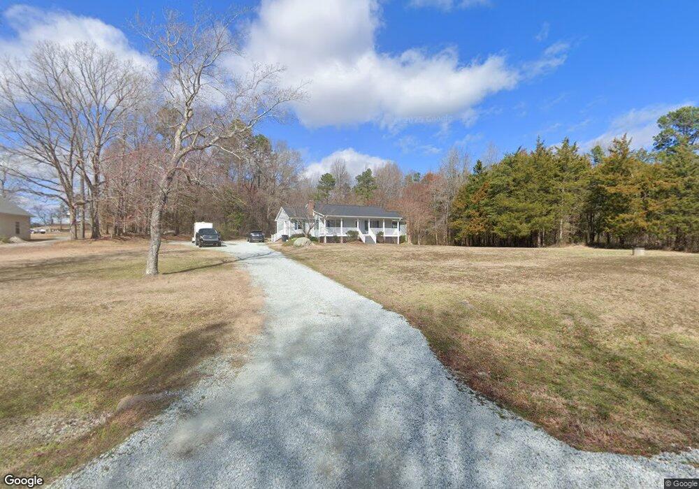
103 Miranda Ln Roxboro, NC 27574
Estimated Value: $267,000 - $287,000
3
Beds
2
Baths
1,568
Sq Ft
$178/Sq Ft
Est. Value
About This Home
This home is located at 103 Miranda Ln, Roxboro, NC 27574 and is currently estimated at $278,428, approximately $177 per square foot. 103 Miranda Ln is a home located in Person County with nearby schools including Person High School and Sneed Academy.
Ownership History
Date
Name
Owned For
Owner Type
Purchase Details
Closed on
Nov 28, 2011
Sold by
States Employees Credit Union
Bought by
Groce Brent W and Groce Rachel P
Current Estimated Value
Home Financials for this Owner
Home Financials are based on the most recent Mortgage that was taken out on this home.
Original Mortgage
$122,000
Outstanding Balance
$84,095
Interest Rate
4.17%
Mortgage Type
New Conventional
Estimated Equity
$194,333
Purchase Details
Closed on
Aug 13, 2010
Sold by
Denny Richard A and Denny Kelley H
Bought by
State Employees Cu
Purchase Details
Closed on
Jul 23, 2007
Sold by
Adams Jay Dee and Adams Dana Pounder
Bought by
Denny Richard A and Denny Kelley H
Home Financials for this Owner
Home Financials are based on the most recent Mortgage that was taken out on this home.
Original Mortgage
$135,000
Interest Rate
6.52%
Mortgage Type
New Conventional
Create a Home Valuation Report for This Property
The Home Valuation Report is an in-depth analysis detailing your home's value as well as a comparison with similar homes in the area
Purchase History
| Date | Buyer | Sale Price | Title Company |
|---|---|---|---|
| Groce Brent W | $122,500 | -- | |
| State Employees Cu | $152,500 | -- | |
| Denny Richard A | $135,000 | -- |
Source: Public Records
Mortgage History
| Date | Status | Borrower | Loan Amount |
|---|---|---|---|
| Open | Groce Brent W | $122,000 | |
| Previous Owner | Denny Richard A | $135,000 |
Source: Public Records
Tax History
| Year | Tax Paid | Tax Assessment Tax Assessment Total Assessment is a certain percentage of the fair market value that is determined by local assessors to be the total taxable value of land and additions on the property. | Land | Improvement |
|---|---|---|---|---|
| 2025 | $1,654 | $245,656 | $0 | $0 |
| 2024 | $1,305 | $167,835 | $0 | $0 |
| 2023 | $1,305 | $167,835 | $0 | $0 |
| 2022 | $1,300 | $167,835 | $0 | $0 |
| 2021 | $1,263 | $167,835 | $0 | $0 |
| 2020 | $1,006 | $133,473 | $0 | $0 |
| 2019 | $1,019 | $133,473 | $0 | $0 |
| 2018 | $956 | $133,473 | $0 | $0 |
| 2017 | $942 | $133,473 | $0 | $0 |
| 2016 | $942 | $133,473 | $0 | $0 |
| 2015 | $942 | $133,473 | $0 | $0 |
| 2014 | $942 | $133,473 | $0 | $0 |
Source: Public Records
Map
Nearby Homes
- 9 Buttonwood Ln
- 500 Jones Lester Rd
- 111 Fox Crossing Dr
- 40 John D Winstead Rd
- 98 Lochridge Dr
- Lot 5 Woodberry Dr
- Lot 8 Woodberry Dr
- Lot 3 Woodberry Dr
- Lot 6 Woodberry Dr
- 382 Wimbledon Dr
- Lot 15 Quail Hollow Dr
- Lot 19 Ferncrest Ct
- 0 Summer Oak Dr Unit 10040007
- 2 Semora Rd
- Lot 26 Peninsula Dr
- Lot 25 Peninsula Dr
- 303 Hidden Hills Rd
- 70 Younger Rd
- 1.5 Acres Burlington Rd
- 181 Stonegate Dr
Your Personal Tour Guide
Ask me questions while you tour the home.