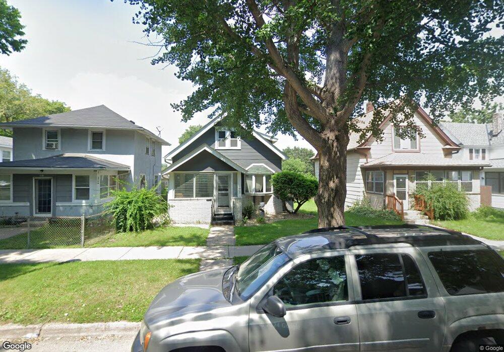
1035 Mclean Ave Saint Paul, MN 55106
Dayton's Bluff NeighborhoodEstimated Value: $212,000 - $243,548
3
Beds
1
Bath
1,723
Sq Ft
$134/Sq Ft
Est. Value
About This Home
This home is located at 1035 Mclean Ave, Saint Paul, MN 55106 and is currently estimated at $231,637, approximately $134 per square foot. 1035 Mclean Ave is a home located in Ramsey County with nearby schools including Dayton's Bluff Achievement Plus Elementary School, Battle Creek Middle School, and Harding Senior High School.
Ownership History
Date
Name
Owned For
Owner Type
Purchase Details
Closed on
Apr 19, 2021
Sold by
Peters Benjamin J and Peters Rebecca F
Bought by
Monroe Brandon
Current Estimated Value
Home Financials for this Owner
Home Financials are based on the most recent Mortgage that was taken out on this home.
Original Mortgage
$178,110
Outstanding Balance
$160,940
Interest Rate
3.05%
Mortgage Type
New Conventional
Estimated Equity
$70,697
Purchase Details
Closed on
Apr 6, 2017
Sold by
Hedlund Dawn L and Zwinger John G
Bought by
Peters Benjamin J and Peters Rebecca F
Purchase Details
Closed on
Feb 9, 2017
Sold by
Zwinger Shirley A and Hedlund Dawn L
Bought by
Hedlund Dawn L
Create a Home Valuation Report for This Property
The Home Valuation Report is an in-depth analysis detailing your home's value as well as a comparison with similar homes in the area
Home Values in the Area
Average Home Value in this Area
Purchase History
| Date | Buyer | Sale Price | Title Company |
|---|---|---|---|
| Monroe Brandon | $197,900 | Regis Title | |
| Peters Benjamin J | $95,000 | Partners Title Llc | |
| Hedlund Dawn L | -- | None Available | |
| Monroe Brandon Brandon | $197,900 | -- |
Source: Public Records
Mortgage History
| Date | Status | Borrower | Loan Amount |
|---|---|---|---|
| Open | Monroe Brandon | $178,110 | |
| Closed | Monroe Brandon Brandon | $192,900 |
Source: Public Records
Tax History Compared to Growth
Tax History
| Year | Tax Paid | Tax Assessment Tax Assessment Total Assessment is a certain percentage of the fair market value that is determined by local assessors to be the total taxable value of land and additions on the property. | Land | Improvement |
|---|---|---|---|---|
| 2025 | $3,034 | $216,400 | $25,300 | $191,100 |
| 2023 | $3,034 | $207,000 | $16,200 | $190,800 |
| 2022 | $2,198 | $215,800 | $16,200 | $199,600 |
| 2021 | $1,690 | $152,800 | $16,200 | $136,600 |
| 2020 | $1,696 | $126,900 | $16,200 | $110,700 |
| 2019 | $1,470 | $120,800 | $16,200 | $104,600 |
| 2018 | $1,420 | $106,700 | $16,200 | $90,500 |
| 2017 | $1,402 | $105,700 | $16,200 | $89,500 |
| 2016 | $1,204 | $0 | $0 | $0 |
| 2015 | $1,018 | $96,100 | $14,100 | $82,000 |
| 2014 | $1,072 | $0 | $0 | $0 |
Source: Public Records
Map
Nearby Homes
- 1005 Mclean Ave
- 1102 Pacific St
- 995 Wakefield Ave
- 1020 Wilson Ave
- 1076 Wilson Ave
- 1097 Euclid St
- 212 Maple St
- 1056 3rd St E
- 980 3rd St E
- 401 Johnson Pkwy
- 725 Wilson Ave
- 1026 Fremont Ave
- 854 Euclid St
- 721 Wilson Ave
- 150 Mounds Blvd
- 726 Euclid St
- 530 Forest St
- 535 Forest St
- 1257 Wilson Ave
- 271 English St
- 1039 Mclean Ave
- 1033 Mclean Ave
- 1043 Mclean Ave
- 1027 Mclean Ave
- 1027 1027 McLean-avenue-
- 1047 Mclean Ave
- 1047 1047 McLean-avenue-
- 1025 Mclean Ave
- 1038 Pacific St
- 1051 1051 McLean-avenue-
- 1034 Pacific St
- 1051 Mclean Ave
- 1046 Pacific St
- 1046 1046 Pacific-Street-
- 1030 Pacific St
- 1019 Mclean Ave
- 1038 Mclean Ave
- 1034 Mclean Ave
- 1042 Mclean Ave
- 1034 1034 McLean-avenue-