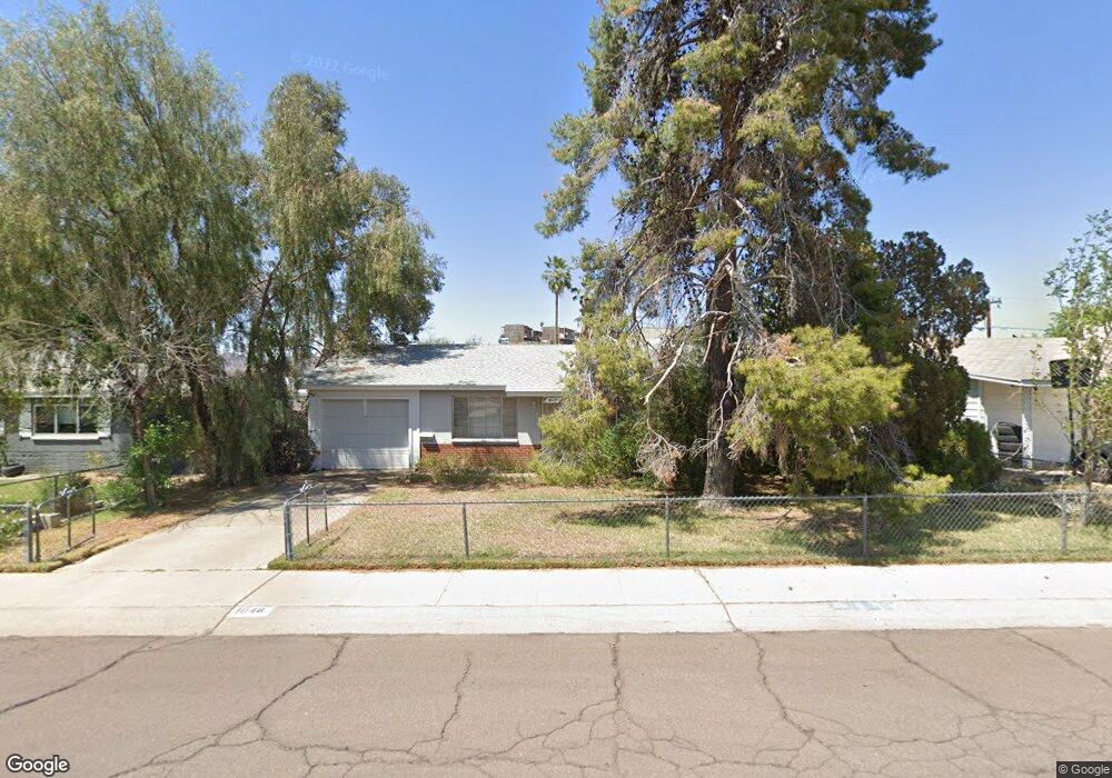
1046 E Griswold Rd Phoenix, AZ 85020
North Central NeighborhoodEstimated Value: $333,252 - $478,000
Studio
2
Baths
1,448
Sq Ft
$283/Sq Ft
Est. Value
About This Home
This home is located at 1046 E Griswold Rd, Phoenix, AZ 85020 and is currently estimated at $410,063, approximately $283 per square foot. 1046 E Griswold Rd is a home located in Maricopa County with nearby schools including Desert View Elementary School, Royal Palm Middle School, and Sunnyslope High School.
Ownership History
Date
Name
Owned For
Owner Type
Purchase Details
Closed on
Oct 18, 1995
Sold by
Fahay Mary Elizabeth and Fayah Mary E
Bought by
Landeros David and Dittrich Matthew
Current Estimated Value
Home Financials for this Owner
Home Financials are based on the most recent Mortgage that was taken out on this home.
Original Mortgage
$71,935
Outstanding Balance
$504
Interest Rate
7.58%
Mortgage Type
FHA
Estimated Equity
$409,559
Create a Home Valuation Report for This Property
The Home Valuation Report is an in-depth analysis detailing your home's value as well as a comparison with similar homes in the area
Home Values in the Area
Average Home Value in this Area
Purchase History
| Date | Buyer | Sale Price | Title Company |
|---|---|---|---|
| Landeros David | $72,000 | First American Title |
Source: Public Records
Mortgage History
| Date | Status | Borrower | Loan Amount |
|---|---|---|---|
| Open | Landeros David | $71,935 |
Source: Public Records
Tax History
| Year | Tax Paid | Tax Assessment Tax Assessment Total Assessment is a certain percentage of the fair market value that is determined by local assessors to be the total taxable value of land and additions on the property. | Land | Improvement |
|---|---|---|---|---|
| 2025 | $1,292 | $11,589 | -- | -- |
| 2024 | $1,218 | $11,037 | -- | -- |
| 2023 | $1,218 | $31,780 | $6,350 | $25,430 |
| 2022 | $1,175 | $23,300 | $4,660 | $18,640 |
| 2021 | $1,204 | $21,230 | $4,240 | $16,990 |
| 2020 | $1,172 | $19,420 | $3,880 | $15,540 |
| 2019 | $1,151 | $16,880 | $3,370 | $13,510 |
| 2018 | $1,118 | $15,760 | $3,150 | $12,610 |
| 2017 | $1,115 | $12,080 | $2,410 | $9,670 |
| 2016 | $1,095 | $10,420 | $2,080 | $8,340 |
| 2015 | $1,016 | $9,760 | $1,950 | $7,810 |
Source: Public Records
Map
Nearby Homes
- 8120 N 10th Place
- 8112 N 10th Place
- 8050 N 11th Place
- 8049 N 10th St
- 8216 N 9th St
- 1214 E Las Palmaritas Dr
- 1130 E Butler Dr Unit A1
- 8149 N 13th Place
- 829 E Echo Ln
- 1214 E Butler Dr
- 8436 N 13th Place
- 717 E Royal Palm Rd
- 8220 N 14th St Unit 1
- 1114 E Orchid Ln
- 1246 E Winter Dr
- 1402 E Las Palmaritas Dr
- 8514 N 8th St
- 750 E Northern Ave Unit 1041
- 750 E Northern Ave Unit 2093
- 750 E Northern Ave Unit 1075
- 1102 E Griswold Rd
- 1040 E Griswold Rd
- 1041 E El Camino Dr
- 1101 E El Camino Dr
- 1108 E Griswold Rd
- 1036 E Griswold Rd
- 1037 E El Camino Dr
- 1107 E El Camino Dr
- 8147 N 11th St
- 1033 E El Camino Dr
- 1113 E El Camino Dr
- 1114 E Griswold Rd
- 1030 E Griswold Rd
- 8148 N 11th St
- 1117 E El Camino Dr
- 1102 E El Camino Dr
- 8141 N 11th St Unit 11
- 8141 N 11th St
- 1118 E Griswold Rd
- 1026 E Griswold Rd
Your Personal Tour Guide
Ask me questions while you tour the home.