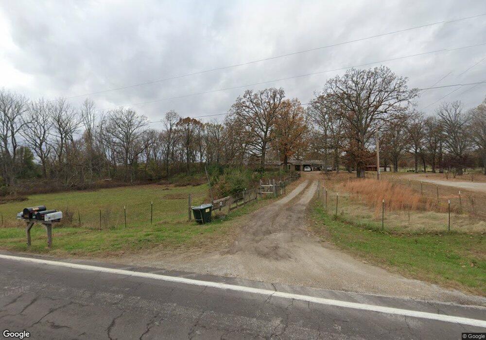
10465 State Route 17 West Plains, MO 65775
Estimated Value: $239,920 - $283,000
--
Bed
--
Bath
1,456
Sq Ft
$179/Sq Ft
Est. Value
About This Home
This home is located at 10465 State Route 17, West Plains, MO 65775 and is currently estimated at $261,230, approximately $179 per square foot. 10465 State Route 17 is a home with nearby schools including Glenwood Elementary School.
Ownership History
Date
Name
Owned For
Owner Type
Purchase Details
Closed on
Aug 31, 2020
Sold by
Slavings Jordan L and Slavings Diana M
Bought by
Briggs Taylor J
Current Estimated Value
Home Financials for this Owner
Home Financials are based on the most recent Mortgage that was taken out on this home.
Original Mortgage
$153,535
Outstanding Balance
$136,502
Interest Rate
3%
Mortgage Type
New Conventional
Estimated Equity
$124,728
Purchase Details
Closed on
May 4, 2018
Sold by
Maffei Jeremi G
Bought by
Slavings Jordan L and Slavings Diana M
Home Financials for this Owner
Home Financials are based on the most recent Mortgage that was taken out on this home.
Original Mortgage
$143,030
Interest Rate
4.45%
Mortgage Type
New Conventional
Purchase Details
Closed on
May 26, 2011
Sold by
Wood Bruce L and Wood Cheryl
Bought by
Maffei Jeremi G
Home Financials for this Owner
Home Financials are based on the most recent Mortgage that was taken out on this home.
Original Mortgage
$106,500
Interest Rate
4.95%
Mortgage Type
New Conventional
Create a Home Valuation Report for This Property
The Home Valuation Report is an in-depth analysis detailing your home's value as well as a comparison with similar homes in the area
Home Values in the Area
Average Home Value in this Area
Purchase History
| Date | Buyer | Sale Price | Title Company |
|---|---|---|---|
| Briggs Taylor J | -- | Wiles Abstract & Title Co | |
| Slavings Jordan L | -- | Wiles Abstract Co | |
| Maffei Jeremi G | -- | Btc |
Source: Public Records
Mortgage History
| Date | Status | Borrower | Loan Amount |
|---|---|---|---|
| Open | Briggs Taylor J | $153,535 | |
| Previous Owner | Slavings Jordan L | $143,030 | |
| Previous Owner | Maffei Jeremi G | $106,500 |
Source: Public Records
Tax History Compared to Growth
Tax History
| Year | Tax Paid | Tax Assessment Tax Assessment Total Assessment is a certain percentage of the fair market value that is determined by local assessors to be the total taxable value of land and additions on the property. | Land | Improvement |
|---|---|---|---|---|
| 2025 | $710 | $19,660 | $3,580 | $16,080 |
| 2024 | $648 | $17,560 | -- | -- |
| 2023 | $648 | $17,560 | $0 | $0 |
| 2022 | $615 | $16,700 | $0 | $0 |
| 2021 | $581 | $16,700 | $0 | $0 |
| 2020 | $581 | $15,300 | $0 | $0 |
| 2019 | $609 | $15,300 | $0 | $0 |
| 2018 | $586 | $14,740 | $0 | $0 |
| 2017 | $575 | $14,740 | $0 | $0 |
| 2015 | -- | $14,740 | $0 | $0 |
| 2014 | -- | $14,730 | $0 | $0 |
| 2013 | -- | $14,730 | $0 | $0 |
Source: Public Records
Map
Nearby Homes
- 000 State Route 17 S
- 0 Lanton Rd
- 000 Arrowhead Acres
- 000 County Road 8800
- 10567 County Road 8130
- 10733 County Road 8070
- 5038 County Road 8940
- 5019 Private Road 8948
- 000 Private Road 8825
- 9744 County Road 8270
- 4808 County Road 8940
- 9871 Private Road 8291
- 9888 County Road 8490
- 10068 County Road 8490
- 0 State Route Jj
- 9845 County Road 8530
- 000 County Road 8190
- 9681 Private Road 6685
- 000 the Timbers
- 5506 County Road 9100
- 10465 Missouri 17
- 10441 State Route 17
- 10441 State Route 17
- 10461 State Route 17
- 10495 State Route 17
- 10470 Missouri 17
- 10405 State Route 17
- 10428 State Route 17
- 10586 Missouri 17
- 10599 Missouri 17
- 10410 State Route 17
- 10506 State Route 17
- 10549 State Route 17
- 10351 State Route 17
- 10344 State Route 17
- 6022 Private Road 8882
- 10464 State Route 17
- 10323 Missouri 17
- 10323 State Route 17
- 10326 State Route 17