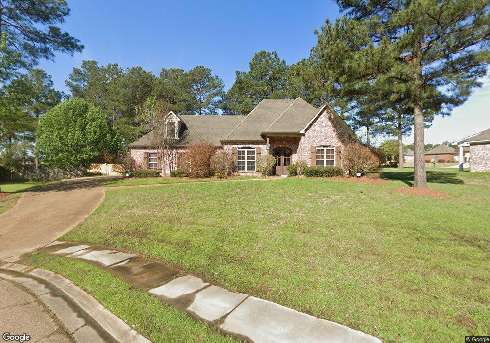
105 Mulberry Way Unit 11 Madison, MS 39110
Estimated Value: $361,396 - $399,000
--
Bed
--
Bath
2,609
Sq Ft
$148/Sq Ft
Est. Value
About This Home
This home is located at 105 Mulberry Way Unit 11, Madison, MS 39110 and is currently estimated at $386,099, approximately $147 per square foot. 105 Mulberry Way Unit 11 is a home located in Madison County with nearby schools including Mannsdale Elementary School, Germantown Middle School, and Germantown High School.
Ownership History
Date
Name
Owned For
Owner Type
Purchase Details
Closed on
Sep 8, 2017
Sold by
Satcher Carolyn C and Satcher John N
Bought by
Nation Summerlyn Mae
Current Estimated Value
Home Financials for this Owner
Home Financials are based on the most recent Mortgage that was taken out on this home.
Original Mortgage
$285,950
Outstanding Balance
$238,789
Interest Rate
3.9%
Mortgage Type
New Conventional
Estimated Equity
$147,310
Purchase Details
Closed on
Jan 17, 2017
Bought by
Satcher John N and Satcher Carolyn C
Home Financials for this Owner
Home Financials are based on the most recent Mortgage that was taken out on this home.
Original Mortgage
$439,000
Interest Rate
4.12%
Purchase Details
Closed on
Nov 15, 2005
Sold by
Lewallen Construction Inc
Bought by
Satcher Carolyn C and Satcher Ii John N
Create a Home Valuation Report for This Property
The Home Valuation Report is an in-depth analysis detailing your home's value as well as a comparison with similar homes in the area
Home Values in the Area
Average Home Value in this Area
Purchase History
| Date | Buyer | Sale Price | Title Company |
|---|---|---|---|
| Nation Summerlyn Mae | -- | None Available | |
| Satcher John N | -- | -- | |
| Satcher Carolyn C | -- | None Available |
Source: Public Records
Mortgage History
| Date | Status | Borrower | Loan Amount |
|---|---|---|---|
| Open | Nation Summerlyn Mae | $285,950 | |
| Previous Owner | Satcher John N | $439,000 | |
| Previous Owner | Satcher John N | -- |
Source: Public Records
Tax History Compared to Growth
Tax History
| Year | Tax Paid | Tax Assessment Tax Assessment Total Assessment is a certain percentage of the fair market value that is determined by local assessors to be the total taxable value of land and additions on the property. | Land | Improvement |
|---|---|---|---|---|
| 2024 | $2,168 | $24,038 | $0 | $0 |
| 2023 | $2,168 | $24,038 | $0 | $0 |
| 2022 | $2,168 | $24,038 | $0 | $0 |
| 2021 | $2,027 | $23,108 | $0 | $0 |
| 2020 | $2,026 | $23,098 | $0 | $0 |
| 2019 | $2,026 | $23,098 | $0 | $0 |
| 2018 | $2,026 | $23,098 | $0 | $0 |
| 2017 | $1,988 | $22,726 | $0 | $0 |
| 2016 | $1,988 | $22,726 | $0 | $0 |
| 2015 | $1,897 | $22,726 | $0 | $0 |
| 2014 | $1,897 | $22,726 | $0 | $0 |
Source: Public Records
Map
Nearby Homes
- 124 Ashbrooke Blvd
- 110 Buckeye Dr
- 103 Elm Ct
- 100 Memory Ln
- 108 Timber Dr
- 103 Maple Grove
- 125 Memory Ln
- 157 Cotton Wood Dr
- 156 Cotton Wood Dr
- 101 Blackberry Patch
- 258 Falls Crossing
- 102 Blackberry Patch
- 104 Azalea Cove
- 522 Carpenter Cove
- 228 Rockbridge Dr
- 172 Cornerstone Dr
- 205 Cornerstone Dr
- 120 Saddlebrook Cove
- 117 Links Cove
- 487 Crossvine Place
- 105 Mulberry Way
- 101 Mulberry Way
- 107 Mulberry Way
- 120 Ashbrooke Blvd
- 0 Mulberry Way Unit B12 1147101
- 0 Mulberry Way Unit B 15
- 122 Ashbrooke Blvd
- 122 Ashbrooke Blvd Unit E12
- 106 Mulberry Way
- 108 Mulberry Way
- 104 Mulberry Way
- 102 Mulberry Way
- 119 Ashbrooke Blvd
- 201 Memory Ln
- 203 Memory Ln
- 116 Ashbrooke Blvd
- 117 Ashbrooke Blvd
- 199 Memory Ln
- 121 Ashbrooke Blvd
- 205 Memory Ln