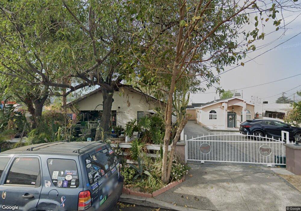
10517 Leolang Ave Sunland, CA 91040
Sunland NeighborhoodEstimated Value: $647,387 - $725,000
2
Beds
1
Bath
718
Sq Ft
$976/Sq Ft
Est. Value
About This Home
This home is located at 10517 Leolang Ave, Sunland, CA 91040 and is currently estimated at $701,097, approximately $976 per square foot. 10517 Leolang Ave is a home located in Los Angeles County with nearby schools including Mt. Gleason Middle School, Verdugo Hills Senior High School, and Plainview Academic Charter Academy.
Ownership History
Date
Name
Owned For
Owner Type
Purchase Details
Closed on
Jul 14, 2023
Sold by
Nunn Gregory C and Nunn Flordeliza L
Bought by
Nunn Family Trust and Nunn
Current Estimated Value
Purchase Details
Closed on
Apr 18, 2018
Sold by
Nunn Gregory C and Nunn Survivors Trust
Bought by
Nunn Gregory C
Purchase Details
Closed on
May 12, 2010
Sold by
Nunn Socorro L and Nunn Marshall E
Bought by
Nunn Socorro L and Nunn Survivors Trust
Purchase Details
Closed on
May 26, 2001
Sold by
Pendleton Mary L
Bought by
Marshall E & Socorro L Nunn Living Trust
Purchase Details
Closed on
May 20, 1996
Sold by
Nunn Marshall M
Bought by
Pendleton Mary L
Create a Home Valuation Report for This Property
The Home Valuation Report is an in-depth analysis detailing your home's value as well as a comparison with similar homes in the area
Home Values in the Area
Average Home Value in this Area
Purchase History
| Date | Buyer | Sale Price | Title Company |
|---|---|---|---|
| Nunn Family Trust | -- | None Listed On Document | |
| Nunn Gregory C | -- | None Listed On Document | |
| Nunn Gregory C | -- | None Available | |
| Nunn Socorro L | -- | None Available | |
| Marshall E & Socorro L Nunn Living Trust | -- | -- | |
| Pendleton Mary L | $52,000 | Old Republic Title Company |
Source: Public Records
Tax History Compared to Growth
Tax History
| Year | Tax Paid | Tax Assessment Tax Assessment Total Assessment is a certain percentage of the fair market value that is determined by local assessors to be the total taxable value of land and additions on the property. | Land | Improvement |
|---|---|---|---|---|
| 2025 | $3,497 | $283,289 | $220,741 | $62,548 |
| 2024 | $3,497 | $277,735 | $216,413 | $61,322 |
| 2023 | $3,430 | $272,290 | $212,170 | $60,120 |
| 2022 | $3,271 | $266,952 | $208,010 | $58,942 |
| 2021 | $3,230 | $261,719 | $203,932 | $57,787 |
| 2019 | $3,134 | $253,958 | $197,884 | $56,074 |
| 2018 | $3,101 | $248,979 | $194,004 | $54,975 |
| 2016 | $2,961 | $239,313 | $186,471 | $52,842 |
| 2015 | $2,918 | $235,720 | $183,671 | $52,049 |
| 2014 | $2,936 | $231,104 | $180,074 | $51,030 |
Source: Public Records
Map
Nearby Homes
- 7860 Fenwick St
- 7851 Fenwick St
- 10623 Woodward Ave
- 10529 Mount Gleason Ave
- 10414 Whitegate Ave
- 10404 Jardine Ave
- 10300 Whitegate Ave
- 10530 Mcvine Ave
- 10430 Mcvine Ave
- 10415 Mcvine Ave Unit 2
- 7961 Day St
- 7848 Forsythe St
- 8230 Hillrose St
- 7755 Forsythe St
- 7861 Cora St
- 10338 Scoville Ave
- 10621 Helendale Ave
- 10831 Odell Ave
- 8352 Wyngate St
- 10549 Mcclemont Ave
- 10521 Leolang Ave
- 10525 Leolang Ave
- 7937 Foothill Blvd
- 10529 Leolang Ave
- 10516 Woodward Ave
- 7937 Foothill Blvd
- 10520 Woodward Ave
- 10514 Leolang Ave
- 10533 Leolang Ave
- 10520 Leolang Ave
- 10524 Woodward Ave
- 10526 Woodward Ave
- 10526 Leolang Ave
- 10537 Leolang Ave
- 10532 Woodward Ave
- 10532 Leolang Ave
- 0 Woodward Unit BB13245183
- 0 Woodward Unit BB14187643
- 0 Woodward Unit BB17010167
- 0 Woodward Unit 11-563033