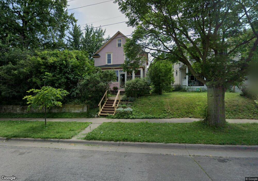
1054 Burns Ave Saint Paul, MN 55106
Dayton's Bluff NeighborhoodEstimated Value: $272,000 - $284,000
3
Beds
2
Baths
1,200
Sq Ft
$232/Sq Ft
Est. Value
About This Home
This home is located at 1054 Burns Ave, Saint Paul, MN 55106 and is currently estimated at $278,487, approximately $232 per square foot. 1054 Burns Ave is a home located in Ramsey County with nearby schools including Dayton's Bluff Achievement Plus Elementary School, Battle Creek Middle School, and Harding Senior High School.
Ownership History
Date
Name
Owned For
Owner Type
Purchase Details
Closed on
Oct 3, 2016
Sold by
Langer Langer M and Langer James J
Bought by
Leuthard Rachel Alyse
Current Estimated Value
Home Financials for this Owner
Home Financials are based on the most recent Mortgage that was taken out on this home.
Original Mortgage
$163,930
Outstanding Balance
$131,421
Interest Rate
3.46%
Mortgage Type
New Conventional
Estimated Equity
$147,066
Purchase Details
Closed on
Jul 9, 2001
Sold by
Peterson Melanie A and Peterson Thomas C
Bought by
Peterson Peg Brennan
Create a Home Valuation Report for This Property
The Home Valuation Report is an in-depth analysis detailing your home's value as well as a comparison with similar homes in the area
Home Values in the Area
Average Home Value in this Area
Purchase History
| Date | Buyer | Sale Price | Title Company |
|---|---|---|---|
| Leuthard Rachel Alyse | $174,121 | Edina Realty Title Inc | |
| Peterson Peg Brennan | $140,000 | -- |
Source: Public Records
Mortgage History
| Date | Status | Borrower | Loan Amount |
|---|---|---|---|
| Open | Leuthard Rachel Alyse | $163,930 |
Source: Public Records
Tax History Compared to Growth
Tax History
| Year | Tax Paid | Tax Assessment Tax Assessment Total Assessment is a certain percentage of the fair market value that is determined by local assessors to be the total taxable value of land and additions on the property. | Land | Improvement |
|---|---|---|---|---|
| 2025 | $3,718 | $272,000 | $31,400 | $240,600 |
| 2023 | $3,718 | $249,000 | $20,100 | $228,900 |
| 2022 | $3,304 | $247,600 | $20,100 | $227,500 |
| 2021 | $2,876 | $206,800 | $20,100 | $186,700 |
| 2020 | $3,232 | $187,400 | $20,100 | $167,300 |
| 2019 | $2,542 | $190,100 | $20,100 | $170,000 |
| 2018 | $2,460 | $155,000 | $20,100 | $134,900 |
| 2017 | $2,036 | $154,400 | $20,100 | $134,300 |
| 2016 | $2,256 | $0 | $0 | $0 |
| 2015 | $2,230 | $94,000 | $18,500 | $75,500 |
| 2014 | $2,178 | $0 | $0 | $0 |
Source: Public Records
Map
Nearby Homes
- 1005 Mclean Ave
- 1102 Pacific St
- 995 Wakefield Ave
- 1076 Wilson Ave
- 1020 Wilson Ave
- 1097 Euclid St
- 401 Johnson Pkwy
- 212 Maple St
- 271 English St
- 150 Mounds Blvd
- 1056 3rd St E
- 980 3rd St E
- 725 Wilson Ave
- 721 Wilson Ave
- 1257 Wilson Ave
- 854 Euclid St
- 1026 Fremont Ave
- 726 Euclid St
- 1269 Wilson Ave
- 244 Point Douglas Rd N