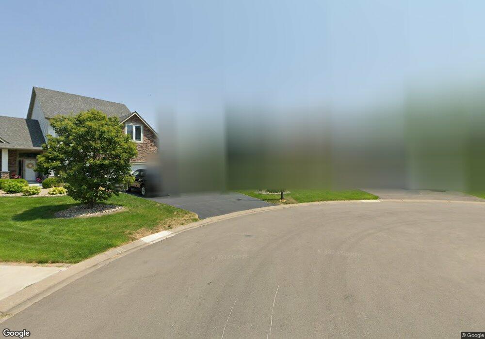
1060 Patterson Cir Shakopee, MN 55379
Estimated Value: $673,000 - $727,000
5
Beds
4
Baths
2,926
Sq Ft
$242/Sq Ft
Est. Value
About This Home
This home is located at 1060 Patterson Cir, Shakopee, MN 55379 and is currently estimated at $708,232, approximately $242 per square foot. 1060 Patterson Cir is a home located in Scott County with nearby schools including Jackson Elementary School, East Middle School, and Shakopee Senior High School.
Ownership History
Date
Name
Owned For
Owner Type
Purchase Details
Closed on
Oct 1, 2004
Sold by
C&M Home Builders Inc
Bought by
Mckeown Dana R and Mckeown Julie J
Current Estimated Value
Purchase Details
Closed on
Dec 2, 2003
Sold by
Topaz Llc
Bought by
C & M Home Builders Inc
Create a Home Valuation Report for This Property
The Home Valuation Report is an in-depth analysis detailing your home's value as well as a comparison with similar homes in the area
Home Values in the Area
Average Home Value in this Area
Purchase History
| Date | Buyer | Sale Price | Title Company |
|---|---|---|---|
| Mckeown Dana R | $599,750 | -- | |
| C & M Home Builders Inc | $128,900 | -- |
Source: Public Records
Tax History Compared to Growth
Tax History
| Year | Tax Paid | Tax Assessment Tax Assessment Total Assessment is a certain percentage of the fair market value that is determined by local assessors to be the total taxable value of land and additions on the property. | Land | Improvement |
|---|---|---|---|---|
| 2025 | $7,658 | $685,600 | $190,300 | $495,300 |
| 2024 | $8,114 | $688,400 | $190,300 | $498,100 |
| 2023 | $8,276 | $715,100 | $186,600 | $528,500 |
| 2022 | $8,238 | $715,200 | $186,600 | $528,600 |
| 2021 | $7,348 | $622,900 | $152,100 | $470,800 |
| 2020 | $7,180 | $604,800 | $136,500 | $468,300 |
| 2019 | $7,068 | $530,900 | $114,500 | $416,400 |
| 2018 | $8,734 | $0 | $0 | $0 |
| 2016 | $8,152 | $0 | $0 | $0 |
| 2014 | -- | $0 | $0 | $0 |
Source: Public Records
Map
Nearby Homes
- 668 Cobblestone Way
- 1022 Providence Dr
- 849 Providence Dr
- 826 Princeton Ave
- 1590 Countryside Dr Unit 5108
- 1562 Liberty Cir Unit 2403
- 1573 Creekside Ln
- 2052 Wilhelm Ct
- 1284 Meadow Ln S
- 1820 Mockingbird Ave
- 1844 Mockingbird Ave Unit 1102
- 291 Appleblossom Ln
- 793 Lupine Ct
- 2XX Stonebrooke Curve
- 3XX Stonebrooke Curve
- 1XX Stonebrooke Curve
- 508 Hackney Ave
- 13599 Stonebrooke Curve
- 335 Bluestem Ave
- 2015 Lusitano St
- 1085 Patterson Cir
- 1950 Raspberry Ln
- 1040 Patterson Cir
- 1958 Raspberry Ln
- 1942 Raspberry Ln
- 1065 Patterson Cir
- 1142 Patterson Dr
- 1020 Patterson Cir
- 1168 Patterson Dr
- 1116 Patterson Dr
- 1934 Raspberry Ln
- 1045 Patterson Cir
- 1090 Patterson Dr
- 1957 Raspberry Ln
- 1949 Raspberry Ln
- 1965 Raspberry Ln
- 1025 Patterson Cir
- 1064 Patterson Dr
- 1966 Raspberry Ln
- 1941 Raspberry Ln