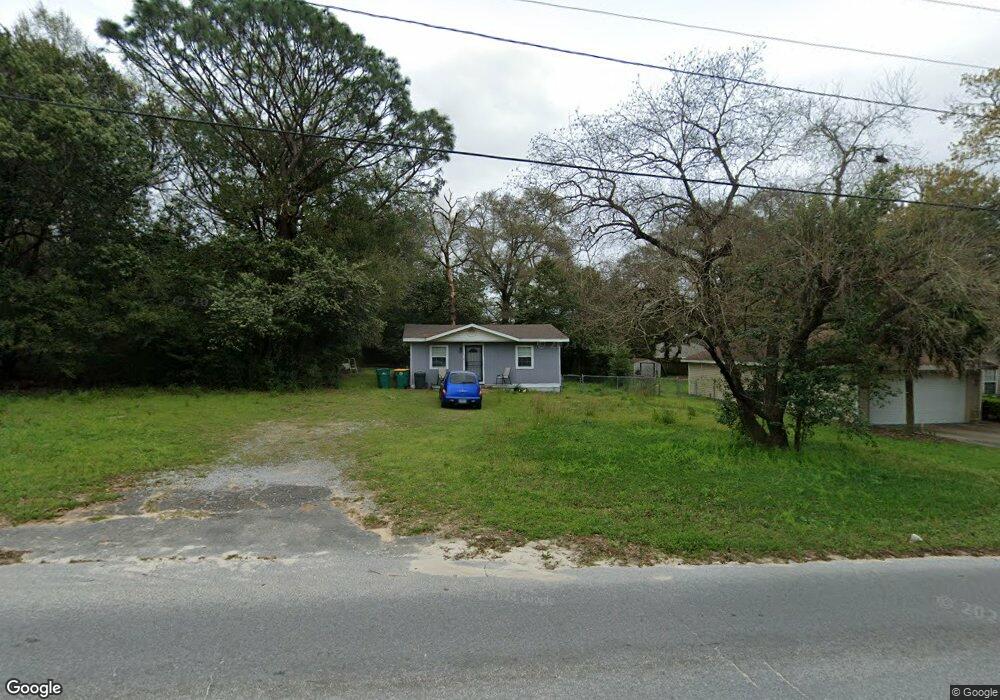
1063 Farmer St Crestview, FL 32539
Estimated Value: $221,000 - $229,000
3
Beds
2
Baths
1,305
Sq Ft
$173/Sq Ft
Est. Value
About This Home
This home is located at 1063 Farmer St, Crestview, FL 32539 and is currently estimated at $226,107, approximately $173 per square foot. 1063 Farmer St is a home located in Okaloosa County with nearby schools including Walker Elementary School, Davidson Middle School, and Crestview High School.
Ownership History
Date
Name
Owned For
Owner Type
Purchase Details
Closed on
Jan 31, 2007
Sold by
Milligan John A
Bought by
Megahee Gail A and Megahee Timothy S
Current Estimated Value
Home Financials for this Owner
Home Financials are based on the most recent Mortgage that was taken out on this home.
Original Mortgage
$132,660
Outstanding Balance
$88,261
Interest Rate
8.25%
Mortgage Type
Stand Alone First
Estimated Equity
$137,846
Purchase Details
Closed on
Sep 20, 2005
Sold by
Westfall Patrick W and Westfall Barbara
Bought by
Milligan John A
Create a Home Valuation Report for This Property
The Home Valuation Report is an in-depth analysis detailing your home's value as well as a comparison with similar homes in the area
Home Values in the Area
Average Home Value in this Area
Purchase History
| Date | Buyer | Sale Price | Title Company |
|---|---|---|---|
| Megahee Gail A | $147,400 | Accu Title Agency Inc | |
| Milligan John A | $32,500 | Accu Title Agency Inc |
Source: Public Records
Mortgage History
| Date | Status | Borrower | Loan Amount |
|---|---|---|---|
| Open | Megahee Gail A | $132,660 |
Source: Public Records
Tax History Compared to Growth
Tax History
| Year | Tax Paid | Tax Assessment Tax Assessment Total Assessment is a certain percentage of the fair market value that is determined by local assessors to be the total taxable value of land and additions on the property. | Land | Improvement |
|---|---|---|---|---|
| 2024 | $1,649 | $158,257 | $19,208 | $139,049 |
| 2023 | $1,649 | $171,804 | $17,951 | $153,853 |
| 2022 | $1,552 | $161,538 | $16,777 | $144,761 |
| 2021 | $1,308 | $119,495 | $15,969 | $103,526 |
| 2020 | $1,215 | $110,044 | $15,656 | $94,388 |
| 2019 | $1,121 | $98,599 | $15,656 | $82,943 |
| 2018 | $1,079 | $93,096 | $0 | $0 |
| 2017 | $1,036 | $87,099 | $0 | $0 |
| 2016 | $1,017 | $86,021 | $0 | $0 |
| 2015 | $994 | $80,979 | $0 | $0 |
| 2014 | $1,010 | $81,550 | $0 | $0 |
Source: Public Records
Map
Nearby Homes
- 2893 Pansy Ave
- 2895 Pansy Ave
- 00 NE Second Ave
- 702 Valley Rd
- 289 Dahlquist Dr
- 966 Valley Rd
- 291 Dahlquist Dr
- 960 Valley Rd
- 2930 Mccarty Ave
- 2920 Patch Ave
- 104 Lear Ct
- 528 Hyde Park Dr
- 212 Eleases Crossing
- 499 Eisenhower Dr
- 495 Eisenhower Dr
- 329 Strawbridge Dr
- 205 Eleases Crossing
- TBD Richbourg Ln
- 1202 Sunshine Dr
- 438 Brackin St
- 1063 Farmer St
- 1055 Farmer St
- 5524 Poinsetta St
- 5522 Poinsetta St
- 5526 Poinsetta St
- 5526 Poinsetia St
- 0 Poinsetia St
- 1069 Farmer St
- 5520 Poinsetta St
- 5532 Poinsetta St
- 1058 Farmer St
- 1049 Farmer St
- 5518 Poinsetta St
- LOT 10 Poinsettia St
- 5538 Poinsetta St
- 5516 Poinsetta St
- 1077 Farmer St
- 2890 Azalea Ave
- 5535 Poinsetta St
- 2893 Azalea Ave