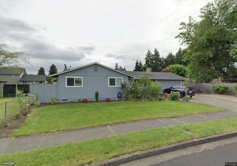
1067 Surrey Ln Eugene, OR 97402
Bethel NeighborhoodEstimated Value: $386,000 - $439,000
4
Beds
2
Baths
1,452
Sq Ft
$280/Sq Ft
Est. Value
About This Home
This home is located at 1067 Surrey Ln, Eugene, OR 97402 and is currently estimated at $407,258, approximately $280 per square foot. 1067 Surrey Ln is a home located in Lane County with nearby schools including Danebo Elementary School, Shasta Middle School, and Willamette High School.
Ownership History
Date
Name
Owned For
Owner Type
Purchase Details
Closed on
Jul 2, 2014
Sold by
Bell Melva J
Bought by
Mathers Daniel
Current Estimated Value
Home Financials for this Owner
Home Financials are based on the most recent Mortgage that was taken out on this home.
Original Mortgage
$170,050
Outstanding Balance
$128,425
Interest Rate
4.09%
Mortgage Type
New Conventional
Estimated Equity
$278,833
Create a Home Valuation Report for This Property
The Home Valuation Report is an in-depth analysis detailing your home's value as well as a comparison with similar homes in the area
Home Values in the Area
Average Home Value in this Area
Purchase History
| Date | Buyer | Sale Price | Title Company |
|---|---|---|---|
| Mathers Daniel | $179,000 | Cascade Title Company |
Source: Public Records
Mortgage History
| Date | Status | Borrower | Loan Amount |
|---|---|---|---|
| Open | Mathers Daniel | $170,050 |
Source: Public Records
Tax History
| Year | Tax Paid | Tax Assessment Tax Assessment Total Assessment is a certain percentage of the fair market value that is determined by local assessors to be the total taxable value of land and additions on the property. | Land | Improvement |
|---|---|---|---|---|
| 2025 | $3,280 | $188,572 | -- | -- |
| 2024 | $3,197 | $183,080 | -- | -- |
| 2023 | $3,197 | $177,748 | $0 | $0 |
| 2022 | $2,976 | $172,571 | $0 | $0 |
| 2021 | $2,914 | $167,545 | $0 | $0 |
| 2020 | $2,829 | $162,666 | $0 | $0 |
| 2019 | $2,690 | $157,929 | $0 | $0 |
| 2018 | $2,614 | $148,864 | $0 | $0 |
| 2017 | $2,499 | $148,864 | $0 | $0 |
| 2016 | $2,435 | $144,528 | $0 | $0 |
| 2015 | $2,387 | $140,318 | $0 | $0 |
| 2014 | $2,351 | $136,231 | $0 | $0 |
Source: Public Records
Map
Nearby Homes
- 4749 Royal Ave
- 870 Laurelhurst Dr
- 1145 Ludgate Dr
- 4941 Stagecoach Rd
- 4548 Cambon St
- 1159 Throne Dr
- 4554 Woodsboro St
- 1562 Philip St
- 1153 Elizabeth St
- 1199 N Terry St
- 1199 N Terry St Unit 248
- 1199 N Terry St Unit 259
- 1199 N Terry St Unit 139
- 1199 N Terry St Unit 258
- 1199 N Terry St Unit SP113
- 1199 N Terry St Unit 309
- 1199 N Terry St Unit SP282
- 1199 N Terry St Unit 128
- 1199 N Terry St Unit 366
- 1199 N Terry St Unit 404
- 1022 Gas Lamp St
- 1085 Surrey Ln
- 1034 Gas Lamp St
- 1049 Surrey Ln
- 1016 Gas Lamp St
- 1037 Surrey Ln
- 1044 Gas Lamp St
- 1008 Gas Lamp St
- 1074 Surrey Ln
- 1054 Surrey Ln
- 1094 Surrey Ln
- 1030 Surrey Ln
- 1019 Gas Lamp St
- 1027 Gas Lamp St
- 1129 Surrey Ln
- 1047 Gas Lamp St
- 1077 Lamplite Ln
- 1116 Surrey Ln
- 1001 Surrey Ln
- 1012 Surrey Ln
Your Personal Tour Guide
Ask me questions while you tour the home.