L
Seller's Agent in 2024
LINK Email Cache
LINK
Not listed in LINK. New Subdivision
Last Agent to Sell the Property
LINK Email Cache
LINK Listed on: 10/25/2024
Property Type
Land
Est. Annual Taxes
$975
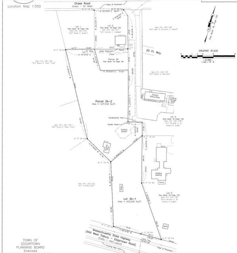
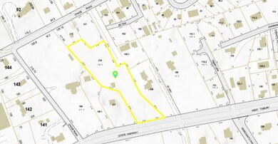
Lot Details
0
| Date | Event | Price | Change | Sq Ft Price |
|---|---|---|---|---|
| 10/25/2024 10/25/24 | Sold | $1,700,000 | -- | -- |
| Year | Tax Paid | Tax Assessment Tax Assessment Total Assessment is a certain percentage of the fair market value that is determined by local assessors to be the total taxable value of land and additions on the property. | Land | Improvement |
|---|---|---|---|---|
| 2025 | $975 | $368,100 | $363,900 | $4,200 |
| 2024 | $950 | $372,400 | $368,200 | $4,200 |
| 2023 | $856 | $339,800 | $335,600 | $4,200 |
| 2022 | $998 | $329,300 | $326,800 | $2,500 |
| 2021 | $1,089 | $331,900 | $329,400 | $2,500 |
| 2020 | $1,011 | $301,900 | $299,400 | $2,500 |
| 2019 | $1,160 | $299,700 | $297,200 | $2,500 |
| 2018 | $1,160 | $299,700 | $297,200 | $2,500 |
| 2017 | $1,067 | $300,500 | $297,200 | $3,300 |
| 2016 | $1,088 | $300,500 | $297,200 | $3,300 |
| 2015 | $1,043 | $300,500 | $297,200 | $3,300 |
L
Seller's Agent in 2024
LINK Email Cache
LINK
Source: LINK (Vineyard)
MLS Number: 42670
APN: EDGA-000020C-000218