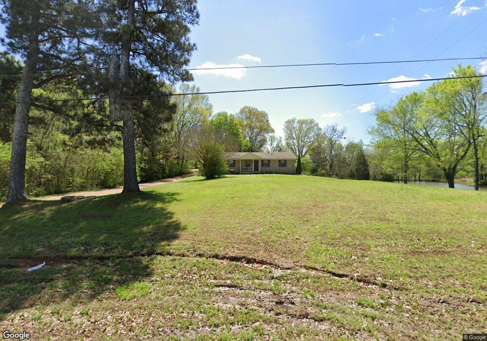
10715 College Rd Olive Branch, MS 38654
Lewisburg NeighborhoodEstimated Value: $197,000 - $264,000
3
Beds
2
Baths
1,675
Sq Ft
$134/Sq Ft
Est. Value
About This Home
This home is located at 10715 College Rd, Olive Branch, MS 38654 and is currently estimated at $224,076, approximately $133 per square foot. 10715 College Rd is a home located in DeSoto County with nearby schools including Lewisburg Primary School, Lewisburg Elementary School, and Lewisburg Middle School.
Ownership History
Date
Name
Owned For
Owner Type
Purchase Details
Closed on
May 10, 2019
Sold by
Miller Amanda
Bought by
Miller James Pierre
Current Estimated Value
Home Financials for this Owner
Home Financials are based on the most recent Mortgage that was taken out on this home.
Original Mortgage
$84,000
Outstanding Balance
$73,551
Interest Rate
4%
Mortgage Type
New Conventional
Estimated Equity
$150,525
Purchase Details
Closed on
Apr 11, 2019
Sold by
North Mississippi Real Estate Mgmt Llc
Bought by
Miller Amanda
Home Financials for this Owner
Home Financials are based on the most recent Mortgage that was taken out on this home.
Original Mortgage
$84,000
Outstanding Balance
$73,551
Interest Rate
4%
Mortgage Type
New Conventional
Estimated Equity
$150,525
Create a Home Valuation Report for This Property
The Home Valuation Report is an in-depth analysis detailing your home's value as well as a comparison with similar homes in the area
Home Values in the Area
Average Home Value in this Area
Purchase History
| Date | Buyer | Sale Price | Title Company |
|---|---|---|---|
| Miller James Pierre | -- | Guardian Title Llc | |
| Miller Amanda | -- | Guardian Title Llc |
Source: Public Records
Mortgage History
| Date | Status | Borrower | Loan Amount |
|---|---|---|---|
| Open | Miller James Pierre | $84,000 | |
| Closed | Miller Amanda | $62,900 |
Source: Public Records
Tax History Compared to Growth
Tax History
| Year | Tax Paid | Tax Assessment Tax Assessment Total Assessment is a certain percentage of the fair market value that is determined by local assessors to be the total taxable value of land and additions on the property. | Land | Improvement |
|---|---|---|---|---|
| 2024 | $794 | $7,942 | $1,500 | $6,442 |
| 2023 | $794 | $7,942 | $0 | $0 |
| 2022 | $794 | $7,942 | $1,500 | $6,442 |
| 2021 | $794 | $7,942 | $1,500 | $6,442 |
| 2020 | $748 | $7,477 | $1,500 | $5,977 |
| 2019 | $748 | $7,477 | $1,500 | $5,977 |
| 2017 | $724 | $12,878 | $7,189 | $5,689 |
| 2016 | $724 | $4,793 | $1,000 | $3,793 |
| 2015 | $483 | $8,586 | $4,793 | $3,793 |
| 2014 | $291 | $4,793 | $0 | $0 |
| 2013 | $306 | $4,793 | $0 | $0 |
Source: Public Records
Map
Nearby Homes
- 4073 Colton Dr
- 4213 Sidlehill Dr
- 2 Bethel Rd
- 1 Bethel Rd
- 3406 Bethel Rd
- 10515 Long Bridge Rd S
- 0 Polk Ln Unit 4125320
- 0 Hacks Cross Rd Unit 10199776
- 3328 Straw Bridge Rd
- 2998 Cypress Lake Dr
- 10237 Cypress Plantation Dr S
- 8626 Lamar Rd
- 9490 Mississippi 178
- 4630 Alexander Rd
- 11258 Vicki's Ln
- 10243 March Meadows Way
- 10890 Mississippi 178
- 10262 March Meadows Way
- 10199 March Meadows Way
- 11317 Vicki's Ln
- 10723 College Rd
- 10723 College Rd
- 4014 Amherst Dr
- 4015 Amherst Dr
- 4013 Colton Dr
- 10719 College Rd
- 10649 College Rd
- 4028 Amherst Dr
- 4029 Devon Dr
- 4029 Amherst Dr
- 4025 Colton Dr
- 4037 Colton Dr
- 4042 Amherst Dr
- 4056 Amherst Dr
- 10691 Cornell Dr
- 10656 College Rd
- 4016 Colton Dr
- 10629 College Rd
- 10677 Cornell Dr
- 4028 Colton Dr