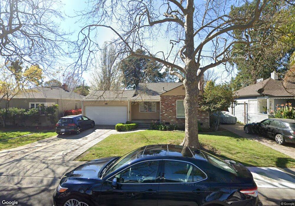
1074 Perkins Way Sacramento, CA 95818
Upper Land Park NeighborhoodEstimated Value: $553,000 - $985,658
2
Beds
2
Baths
1,942
Sq Ft
$377/Sq Ft
Est. Value
About This Home
This home is located at 1074 Perkins Way, Sacramento, CA 95818 and is currently estimated at $732,915, approximately $377 per square foot. 1074 Perkins Way is a home located in Sacramento County with nearby schools including Crocker/Riverside Elementary School, California Middle, and C. K. McClatchy High.
Ownership History
Date
Name
Owned For
Owner Type
Purchase Details
Closed on
May 1, 2009
Sold by
Cazares Rosalinda Jorrin and Cazares Rosalinda
Bought by
Page Paul S and Page Claudia Buck
Current Estimated Value
Purchase Details
Closed on
Jun 6, 2001
Sold by
Cazares John
Bought by
Cazares Rosalinda
Purchase Details
Closed on
Jun 8, 1999
Sold by
Goss Vance A
Bought by
Goss Vance A and Goss Jennifer E
Purchase Details
Closed on
Feb 12, 1997
Sold by
Goss William A
Bought by
Goss William A and Goss Karen A
Purchase Details
Closed on
Aug 26, 1992
Sold by
Scott Laurel M
Bought by
Scott Laurel M
Create a Home Valuation Report for This Property
The Home Valuation Report is an in-depth analysis detailing your home's value as well as a comparison with similar homes in the area
Home Values in the Area
Average Home Value in this Area
Purchase History
| Date | Buyer | Sale Price | Title Company |
|---|---|---|---|
| Page Paul S | $350,000 | Stewart Title Of Sacramento | |
| Cazares Rosalinda | -- | Fidelity National Title Co | |
| Goss Vance A | -- | -- | |
| Goss Vance A | -- | -- | |
| Goss William A | -- | -- | |
| Goss William A | -- | -- | |
| Scott Laurel M | -- | -- |
Source: Public Records
Tax History Compared to Growth
Tax History
| Year | Tax Paid | Tax Assessment Tax Assessment Total Assessment is a certain percentage of the fair market value that is determined by local assessors to be the total taxable value of land and additions on the property. | Land | Improvement |
|---|---|---|---|---|
| 2025 | $5,481 | $450,704 | $186,719 | $263,985 |
| 2024 | $5,481 | $441,867 | $183,058 | $258,809 |
| 2023 | $5,353 | $433,204 | $179,469 | $253,735 |
| 2022 | $5,262 | $424,710 | $175,950 | $248,760 |
| 2021 | $5,017 | $416,383 | $172,500 | $243,883 |
| 2020 | $5,056 | $412,115 | $170,732 | $241,383 |
| 2019 | $4,950 | $404,035 | $167,385 | $236,650 |
| 2018 | $4,822 | $396,113 | $164,103 | $232,010 |
| 2017 | $4,756 | $388,347 | $160,886 | $227,461 |
| 2016 | $4,650 | $380,733 | $157,732 | $223,001 |
| 2015 | $4,583 | $375,015 | $155,363 | $219,652 |
| 2014 | $4,462 | $367,670 | $152,320 | $215,350 |
Source: Public Records
Map
Nearby Homes
- 3098 Riverside Blvd
- 849 8th Ave
- 710 7th Ave
- 625 Robertson Way
- 1032 10th Ave
- 613 Swanston Dr
- 749 3rd Ave Unit 3
- 808 Fremont Way
- 1432 Teneighth Way
- 941 McClatchy Way
- 2766 San Luis Ct
- 2756 San Luis Ct
- 2726 Moonflower St
- 2750 Moonflower St
- 601 Dudley Way
- 1259 Milano Dr Unit 2
- 1615 Vallejo Way
- 1701 9th Ave
- 2825 Elderberry St
- 1268 Milano Dr Unit 6
- 1070 Perkins Way
- 1078 Perkins Way
- 1066 Perkins Way
- 1082 Perkins Way
- 1077 6th Ave
- 1073 6th Ave
- 1083 6th Ave
- 1062 Perkins Way
- 1086 Perkins Way
- 1065 6th Ave
- 3074 Riverside Blvd
- 1075 Perkins Way
- 1071 Perkins Way
- 1049 6th Ave
- 1087 6th Ave
- 1089 6th Ave
- 1058 Perkins Way
- 1081 Perkins Way
- 1067 Perkins Way
- 951 6th Ave