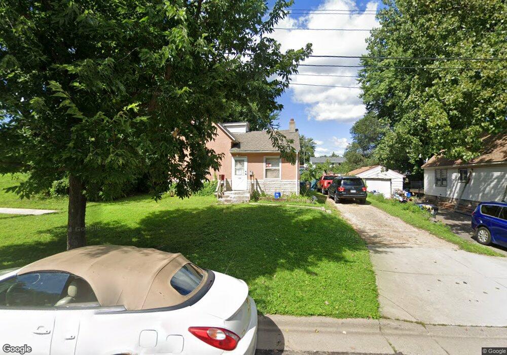
1075 MacKubin St Saint Paul, MN 55117
North End NeighborhoodEstimated Value: $143,000 - $209,000
3
Beds
2
Baths
1,166
Sq Ft
$159/Sq Ft
Est. Value
About This Home
This home is located at 1075 MacKubin St, Saint Paul, MN 55117 and is currently estimated at $185,368, approximately $158 per square foot. 1075 MacKubin St is a home located in Ramsey County with nearby schools including Como Park Elementary School, Murray Middle School, and Como Park Senior High School.
Ownership History
Date
Name
Owned For
Owner Type
Purchase Details
Closed on
May 9, 2003
Sold by
Jensen Roberta K
Bought by
Maloney Jesse E and Maloney Annie E
Current Estimated Value
Purchase Details
Closed on
Jun 23, 1999
Sold by
Driscoll Gerald and Driscoll Sherry
Bought by
Jensen Roberta K
Purchase Details
Closed on
Jun 14, 1996
Sold by
Delisle Joseph C
Bought by
Driscoll Gerald D
Create a Home Valuation Report for This Property
The Home Valuation Report is an in-depth analysis detailing your home's value as well as a comparison with similar homes in the area
Home Values in the Area
Average Home Value in this Area
Purchase History
| Date | Buyer | Sale Price | Title Company |
|---|---|---|---|
| Maloney Jesse E | $119,900 | -- | |
| Jensen Roberta K | $77,000 | -- | |
| Driscoll Gerald D | $60,700 | -- |
Source: Public Records
Mortgage History
| Date | Status | Borrower | Loan Amount |
|---|---|---|---|
| Closed | Driscoll Gerald D | -- |
Source: Public Records
Tax History Compared to Growth
Tax History
| Year | Tax Paid | Tax Assessment Tax Assessment Total Assessment is a certain percentage of the fair market value that is determined by local assessors to be the total taxable value of land and additions on the property. | Land | Improvement |
|---|---|---|---|---|
| 2025 | $2,714 | $166,300 | $25,000 | $141,300 |
| 2023 | $2,714 | $146,200 | $20,000 | $126,200 |
| 2022 | $2,198 | $141,900 | $20,000 | $121,900 |
| 2021 | $1,934 | $108,000 | $20,000 | $88,000 |
| 2020 | $2,058 | $109,800 | $10,600 | $99,200 |
| 2019 | $1,786 | $102,600 | $10,600 | $92,000 |
| 2018 | $1,136 | $92,400 | $10,600 | $81,800 |
| 2017 | $842 | $64,500 | $10,600 | $53,900 |
| 2016 | $906 | $0 | $0 | $0 |
| 2015 | $938 | $51,800 | $10,600 | $41,200 |
| 2014 | $1,164 | $0 | $0 | $0 |
Source: Public Records
Map
Nearby Homes
- 1104 MacKubin St
- 475 Lawson Ave W
- 1049 Kent St
- 496 Maryland Ave W
- 1019 Cumberland St
- 1048 Dale St N
- 569 Hatch Ave
- 1060 Virginia St
- tbd MacKubin St
- 352 Como Ave
- 1151 Farrington St
- 952 Western Ave N
- 1300 Schletti St
- 552 Burgess St
- 1071 Matilda St
- 359 Stinson St W
- 307 Maryland Ave W
- 469 Como Ave
- 1248 Farrington St
- 1005 Galtier St
- 1075 1075 MacKubin St
- 1089 MacKubin St
- 1095 MacKubin St
- 1099 MacKubin St
- 514 Jessamine Ave W
- 1080 MacKubin St
- 1090 MacKubin St
- 1090 1090 MacKubin St
- 1096 MacKubin St
- 518 Jessamine Ave W
- 1084 Jessamine Ct
- 1088 Jessamine Ct
- 1094 Jessamine Ct
- 1098 Jessamine Ct
- 1079 1079 Norton-Street-
- 1079 Norton St
- 1071 Norton St
- 1089 Norton St
- 1075 Norton St
- 1108 MacKubin St