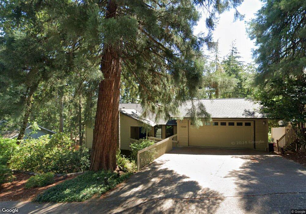
1089 Brookside Dr Eugene, OR 97405
Crest Drive NeighborhoodEstimated Value: $570,000 - $584,000
About This Home
This home is located at 1089 Brookside Dr, Eugene, OR 97405 and is currently estimated at $579,218, approximately $545 per square foot. 1089 Brookside Dr is a home located in Lane County with nearby schools including Edgewood Community Elementary School, Spencer Butte Middle School, and South Eugene High School.
Ownership History
We collect this data history from publicly available records. To have your information removed, we recommend requesting removal directly through your county’s website.
Purchase Details
Home Financials for this Owner
Home Financials are based on the most recent Mortgage that was taken out on this home.Purchase Details
Home Financials for this Owner
Home Financials are based on the most recent Mortgage that was taken out on this home.Home Values in the Area
Average Home Value in this Area
Purchase History
We collect this data history from publicly available records. To have your information removed, we recommend requesting removal directly through your county’s website.
| Date | Buyer | Sale Price | Title Company |
|---|---|---|---|
| $192,900 | Western Pioneer Title Co | ||
| -- | Evergreen Land Title Co |
Mortgage History
We collect this data history from publicly available records. To have your information removed, we recommend requesting removal directly through your county’s website.
| Date | Status | Borrower | Loan Amount |
|---|---|---|---|
| Open | $196,758 | ||
| Previous Owner | $123,200 |
Tax History
We collect this data history from publicly available records. To have your information removed, we recommend requesting removal directly through your county’s website.
| Year | Tax Paid | Tax Assessment Tax Assessment Total Assessment is a certain percentage of the fair market value that is determined by local assessors to be the total taxable value of land and additions on the property. | Land | Improvement |
|---|---|---|---|---|
| 2025 | $5,434 | $278,885 | -- | -- |
| 2024 | $5,366 | $270,763 | -- | -- |
| 2023 | $5,366 | $262,877 | -- | -- |
| 2022 | $5,027 | $255,221 | $0 | $0 |
| 2021 | $4,722 | $247,788 | $0 | $0 |
| 2020 | $4,738 | $240,571 | $0 | $0 |
| 2019 | $4,576 | $233,565 | $0 | $0 |
| 2018 | $4,308 | $220,158 | $0 | $0 |
| 2017 | $4,115 | $220,158 | $0 | $0 |
| 2016 | $4,013 | $213,746 | $0 | $0 |
| 2015 | $3,897 | $207,520 | $0 | $0 |
| 2014 | $3,819 | $201,476 | $0 | $0 |
Map
- 0 Pine View Ct Unit 758820410
- 784 Brookside Dr
- 217 Rockridge Loop
- 0 Rockridge Loop Unit 339703397
- 0 Rockridge Loop Unit 1513157 Lp
- 0 Rockridge Loop Unit 13
- 157 Westbrook Way
- 602 Montara Way
- 4007 Brae Burn Dr
- 278 Rockridge Ct
- 160 Westbrook Way
- 101 Westbrook Way
- 667 Kamapheema Place
- 151 Rockridge Loop
- 67 Westbrook Way
- 3982 Monroe St
- 417 Stonewood Dr
- 151 Treehill Loop Unit 151
- 149 Treehill Loop Unit 149
- 806 Sundance St
- 1109 Brookside Dr
- 4380 Inwood Ln
- 4360 Inwood Ln
- 1143 Brookside Dr
- 1047 Brookside Dr
- 1090 Brookside Dr
- 1054 Brookside Dr
- 4420 Inwood Ln
- 4340 Inwood Ln
- 1116 Brookside Dr
- 4345 Inwood Ln
- 4460 Inwood Ln
- 1025 Brookside Dr
- 4320 Inwood Ln
- 4385 Inwood Ln
- 4315 Inwood Ln
- 4415 Inwood Ln
- 1128 Brookside Dr
- 1020 Brookside Dr
- 422 Brae Burn Dr
Ask me questions while you tour the home.