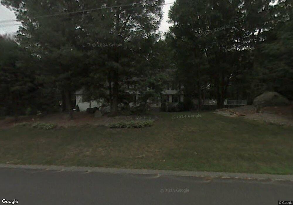
109 Westfall Rd Pelham, NH 03076
Estimated Value: $780,000 - $807,000
4
Beds
4
Baths
2,678
Sq Ft
$296/Sq Ft
Est. Value
About This Home
This home is located at 109 Westfall Rd, Pelham, NH 03076 and is currently estimated at $791,544, approximately $295 per square foot. 109 Westfall Rd is a home with nearby schools including Pelham Elementary School, Pelham Memorial School, and Pelham High School.
Ownership History
Date
Name
Owned For
Owner Type
Purchase Details
Closed on
Jul 15, 2024
Sold by
Macdonald Edward C and Macdonald Kelly D
Bought by
Macdonald
Current Estimated Value
Purchase Details
Closed on
Jun 5, 1987
Bought by
Macdonald Edward C and Macdonald Kelly D
Create a Home Valuation Report for This Property
The Home Valuation Report is an in-depth analysis detailing your home's value as well as a comparison with similar homes in the area
Home Values in the Area
Average Home Value in this Area
Purchase History
| Date | Buyer | Sale Price | Title Company |
|---|---|---|---|
| Macdonald | -- | None Available | |
| Macdonald | -- | None Available | |
| Macdonald Edward C | -- | -- |
Source: Public Records
Mortgage History
| Date | Status | Borrower | Loan Amount |
|---|---|---|---|
| Previous Owner | Macdonald Edward C | $288,000 | |
| Previous Owner | Macdonald Edward C | $22,000 | |
| Previous Owner | Macdonald Edward C | $76,000 |
Source: Public Records
Tax History
| Year | Tax Paid | Tax Assessment Tax Assessment Total Assessment is a certain percentage of the fair market value that is determined by local assessors to be the total taxable value of land and additions on the property. | Land | Improvement |
|---|---|---|---|---|
| 2024 | $11,158 | $608,400 | $179,700 | $428,700 |
| 2023 | $11,067 | $608,400 | $179,700 | $428,700 |
| 2022 | $10,598 | $608,400 | $179,700 | $428,700 |
| 2021 | $9,710 | $608,400 | $179,700 | $428,700 |
| 2020 | $8,409 | $416,300 | $143,800 | $272,500 |
| 2019 | $8,076 | $416,300 | $143,800 | $272,500 |
| 2018 | $8,159 | $380,200 | $143,800 | $236,400 |
| 2017 | $8,155 | $380,200 | $143,800 | $236,400 |
| 2016 | $7,965 | $380,200 | $143,800 | $236,400 |
| 2015 | $7,827 | $336,500 | $137,100 | $199,400 |
| 2014 | $7,696 | $336,500 | $137,100 | $199,400 |
| 2013 | $7,696 | $336,500 | $137,100 | $199,400 |
Source: Public Records
Map
Nearby Homes
- 40 Westfall Rd
- 6 David Dr
- 6 Wilshire Ln Unit 6
- 4 Wilshire Ln Unit 4
- 4 Wilshire Ln
- 9 Cornstalk Ln
- 2 Aspen Dr
- 2 Aspen Dr Unit Lot 146-17
- 10 Oakland Ridge Rd Unit 11
- 43 & 53 5th St
- 26 Sagewood Dr Unit 26
- 4 Haystack Cir
- 104 Long Pond Rd
- 17 Spare St
- 60 Robert St
- 94 Tanager Cir Unit 94
- 1905 Lakeview Ave
- 29 Mill St Unit B
- 6 Hemlock Dr
- 53 Vinal St
- 13A Misty Ln
- 73 Westfall Rd
- 67 Westfall Rd
- 110 Westfall Rd
- 123 Westfall Rd
- 116 Westfall Rd
- 128 Westfall Rd
- 23 Wyndridge Cir
- 59 Westfall Rd
- 17 Wyndridge Cir
- 70 Westfall Rd
- 30 Misty Ln
- 4 Wyndridge Cir
- 62 Westfall Rd
- 29 Wyndridge Cir
- 90 Westfall Rd
- 80 Westfall Rd
- 22 Misty Ln
- 84 Westfall Rd
- 37 Wyndridge Cir
Your Personal Tour Guide
Ask me questions while you tour the home.