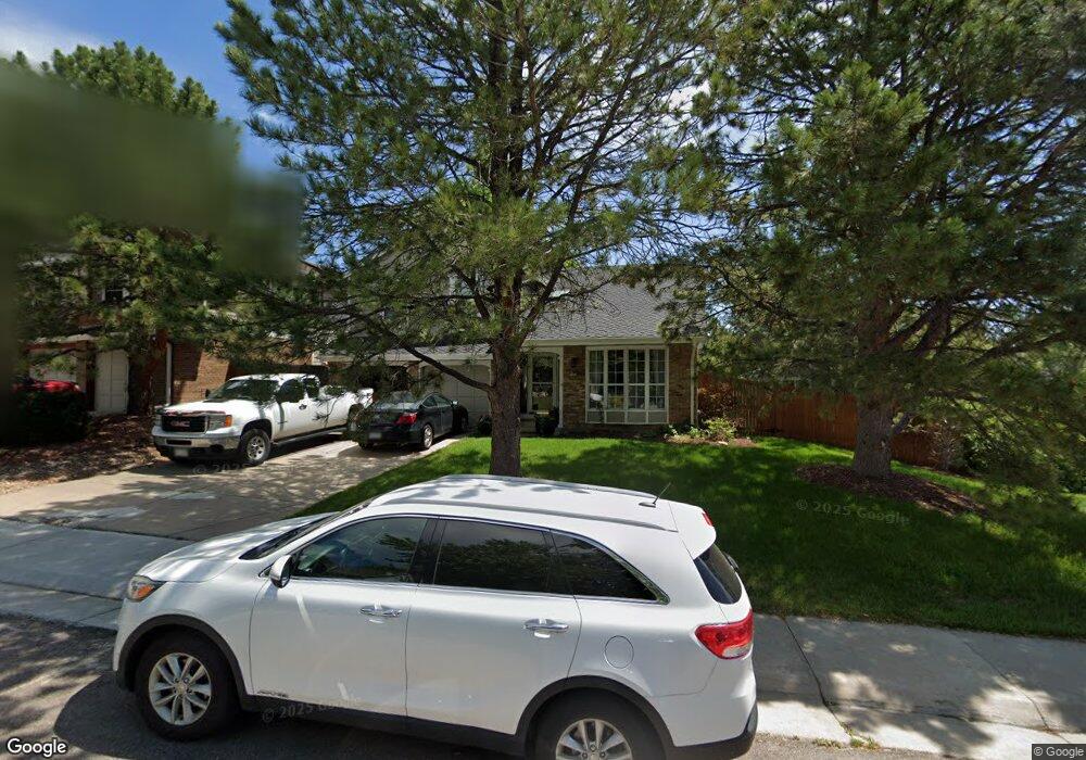
10901 Main Range Trail Littleton, CO 80127
Ken Caryl Ranch NeighborhoodEstimated Value: $721,201 - $817,000
4
Beds
3
Baths
3,653
Sq Ft
$208/Sq Ft
Est. Value
About This Home
This home is located at 10901 Main Range Trail, Littleton, CO 80127 and is currently estimated at $758,800, approximately $207 per square foot. 10901 Main Range Trail is a home located in Jefferson County with nearby schools including Shaffer Elementary School, Falcon Bluffs Middle School, and Chatfield High School.
Ownership History
Date
Name
Owned For
Owner Type
Purchase Details
Closed on
Jun 20, 2014
Sold by
Aughenbaugh James R and Aughenbaugh Linda
Bought by
Lehrke Douglas R and Lehrke Shelly A
Current Estimated Value
Home Financials for this Owner
Home Financials are based on the most recent Mortgage that was taken out on this home.
Original Mortgage
$325,752
Outstanding Balance
$243,512
Interest Rate
3.75%
Mortgage Type
FHA
Estimated Equity
$515,288
Purchase Details
Closed on
Feb 13, 2002
Sold by
Boorom Richard J and Boorom Carol A
Bought by
Aughenbaugh James R and Aughenbaugh Linda
Home Financials for this Owner
Home Financials are based on the most recent Mortgage that was taken out on this home.
Original Mortgage
$250,000
Interest Rate
7.12%
Purchase Details
Closed on
Oct 20, 1999
Sold by
Murphy Richard M
Bought by
Boorom Richard J and Boorom Carol A
Home Financials for this Owner
Home Financials are based on the most recent Mortgage that was taken out on this home.
Original Mortgage
$201,600
Interest Rate
7.9%
Create a Home Valuation Report for This Property
The Home Valuation Report is an in-depth analysis detailing your home's value as well as a comparison with similar homes in the area
Home Values in the Area
Average Home Value in this Area
Purchase History
| Date | Buyer | Sale Price | Title Company |
|---|---|---|---|
| Lehrke Douglas R | $337,000 | None Available | |
| Aughenbaugh James R | $295,000 | Land Title | |
| Boorom Richard J | $252,000 | -- |
Source: Public Records
Mortgage History
| Date | Status | Borrower | Loan Amount |
|---|---|---|---|
| Open | Lehrke Douglas R | $325,752 | |
| Previous Owner | Aughenbaugh James R | $250,000 | |
| Previous Owner | Boorom Richard J | $201,600 |
Source: Public Records
Tax History Compared to Growth
Tax History
| Year | Tax Paid | Tax Assessment Tax Assessment Total Assessment is a certain percentage of the fair market value that is determined by local assessors to be the total taxable value of land and additions on the property. | Land | Improvement |
|---|---|---|---|---|
| 2024 | $4,267 | $39,856 | $10,393 | $29,463 |
| 2023 | $4,267 | $39,856 | $10,393 | $29,463 |
| 2022 | $3,731 | $34,081 | $8,428 | $25,653 |
| 2021 | $3,788 | $35,062 | $8,671 | $26,391 |
| 2020 | $3,362 | $31,216 | $6,943 | $24,273 |
| 2019 | $3,322 | $31,216 | $6,943 | $24,273 |
| 2018 | $2,934 | $26,628 | $6,791 | $19,837 |
| 2017 | $2,728 | $26,628 | $6,791 | $19,837 |
| 2016 | $2,935 | $27,103 | $8,429 | $18,674 |
| 2015 | $2,596 | $27,103 | $8,429 | $18,674 |
| 2014 | $2,596 | $22,589 | $6,685 | $15,904 |
Source: Public Records
Map
Nearby Homes
- 7825 Sand Mountain
- 10791 Trailrider Pass
- 7747 Gunsight Pass
- 10494 W Turtle Mountain
- 10866 W Half Moon Pass
- 10567 W Chautauga Mountain
- 10550 W Raspberry Mountain
- 11104 W San Juan Range Rd
- 10606 Park Mountain W
- 11617 Elk Head Range Rd
- 10355 Red Mountain E
- 10351 Red Mountain E
- 11703 Elk Head Range Rd
- 7413 S Quail Cir Unit 1417
- 11804 Elk Head Range Rd
- 7418 S Quail Cir Unit 1315
- Willow Plan at Ken-Caryl Ranch - Deer Creek
- Ponderosa Plan at Ken-Caryl Ranch - Deer Creek
- 11781 Elk Head Range Rd
- 11341 W Alder Dr
- 10911 Main Range Trail
- 10921 Main Range Trail
- 10902 Main Range Trail
- 7816 Cathedral Peak
- 10931 Main Range Trail
- 10912 Main Range Trail
- 10922 Main Range Trail
- 7817 Cathedral Peak
- 10741 W Dakan Mountain
- 7826 Cathedral Peak
- 10932 Main Range Trail
- 10941 Main Range Trail
- 10706 W Devils Head
- 10942 Main Range Trail
- 7827 Cathedral Peak
- 10951 Main Range Trail
- 7780 Crystal Peak
- 7770 Crystal Peak
- 7760 Crystal Peak
- 7836 Cathedral Peak