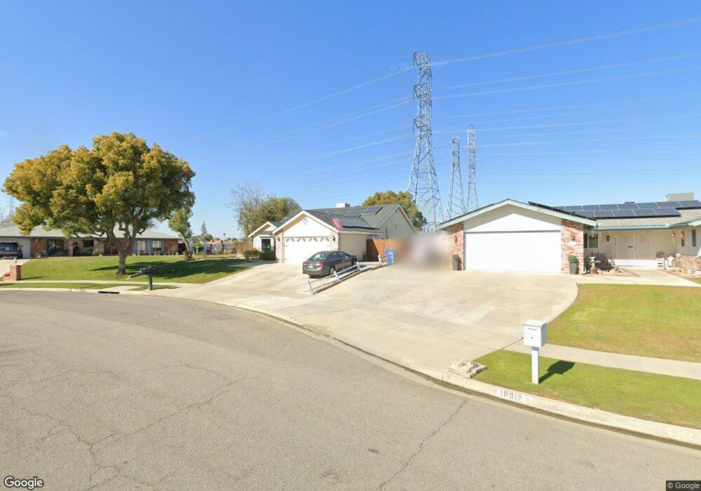
10918 Dee Dee Ave Bakersfield, CA 93312
Polo Grounds NeighborhoodEstimated Value: $430,000 - $506,801
3
Beds
2
Baths
1,725
Sq Ft
$273/Sq Ft
Est. Value
About This Home
This home is located at 10918 Dee Dee Ave, Bakersfield, CA 93312 and is currently estimated at $470,200, approximately $272 per square foot. 10918 Dee Dee Ave is a home located in Kern County with nearby schools including Rosedale-North Elementary School, Freedom Middle School, and Centennial High School.
Ownership History
Date
Name
Owned For
Owner Type
Purchase Details
Closed on
Jun 3, 2023
Sold by
Michaels Lorenzo and Michaels Shari
Bought by
Saleh Jazem R
Current Estimated Value
Home Financials for this Owner
Home Financials are based on the most recent Mortgage that was taken out on this home.
Original Mortgage
$360,000
Outstanding Balance
$350,374
Interest Rate
6.39%
Mortgage Type
New Conventional
Estimated Equity
$119,826
Purchase Details
Closed on
Sep 18, 2013
Sold by
Lyons Robert F and Lyons Tamera J
Bought by
Michaels Lorenzo and Michaels Shari
Home Financials for this Owner
Home Financials are based on the most recent Mortgage that was taken out on this home.
Original Mortgage
$209,142
Interest Rate
4.12%
Mortgage Type
FHA
Purchase Details
Closed on
Jun 4, 2004
Sold by
Lyons Robert F and Lyons Tami J
Bought by
Lyons Robert F and Lyons Tamera J
Create a Home Valuation Report for This Property
The Home Valuation Report is an in-depth analysis detailing your home's value as well as a comparison with similar homes in the area
Home Values in the Area
Average Home Value in this Area
Purchase History
| Date | Buyer | Sale Price | Title Company |
|---|---|---|---|
| Saleh Jazem R | $450,000 | All California Title | |
| Michaels Lorenzo | $260,000 | Placer Title Company | |
| Lyons Robert F | -- | -- |
Source: Public Records
Mortgage History
| Date | Status | Borrower | Loan Amount |
|---|---|---|---|
| Open | Saleh Jazem R | $360,000 | |
| Previous Owner | Michaels Lorenzo | $209,142 |
Source: Public Records
Tax History
| Year | Tax Paid | Tax Assessment Tax Assessment Total Assessment is a certain percentage of the fair market value that is determined by local assessors to be the total taxable value of land and additions on the property. | Land | Improvement |
|---|---|---|---|---|
| 2025 | $5,757 | $468,180 | $156,060 | $312,120 |
| 2024 | $4,078 | $459,000 | $153,000 | $306,000 |
| 2023 | $4,078 | $306,337 | $70,690 | $235,647 |
| 2022 | $3,982 | $300,331 | $69,304 | $231,027 |
| 2021 | $3,861 | $294,444 | $67,946 | $226,498 |
| 2020 | $3,792 | $291,426 | $67,250 | $224,176 |
| 2019 | $3,736 | $291,426 | $67,250 | $224,176 |
| 2018 | $3,617 | $280,112 | $64,640 | $215,472 |
| 2017 | $4,996 | $274,621 | $63,373 | $211,248 |
| 2016 | $3,329 | $269,237 | $62,131 | $207,106 |
| 2015 | $3,289 | $265,194 | $61,198 | $203,996 |
| 2014 | $3,217 | $260,000 | $60,000 | $200,000 |
Source: Public Records
Map
Nearby Homes
- 10801 Baron Ave
- 3301 Beyers St
- 11001 Aimee Way
- 10617 Baron Ave
- 10512 Dee Ave
- 11216 Aimee Way
- 3435 Moss St
- 10701 Meacham Rd
- 1900 Jewetta Ave
- 0 Fruitvale Snow Rd Unit 202602724
- 3212 Chuckwagon St
- 11409 Lariat Ct
- 3100 Woodstown St
- 11308 Sagebrush Ave
- 3122 Campfire Dr Unit 2
- 10219 Planebrook Ave
- 3105 Silver Spur Way
- 3110 Campfire Dr
- 3604 Mehgan Ave
- 10200 Wayland Ct
- 10918 Dee Ave
- 10912 Dee Dee Ave
- 10906 Dee Dee Ave
- 10906 Dee Ave
- 10924 Dee Dee Ave
- 10913 Dee Dee Ave
- 10900 Dee Ave
- 10900 Dee Dee Ave
- 10907 Dee Ave
- 2809 Nicole Way
- 10907 Dee Dee Ave
- 2817 Nicole Way
- 10901 Dee Ave
- 10818 Dee Dee Ave
- 10818 Dee Ave
- 10901 Dee Dee Ave
- 10913 Baron Ave
- 2801 Nicole Way
- 11001 Baron Ave
Your Personal Tour Guide
Ask me questions while you tour the home.