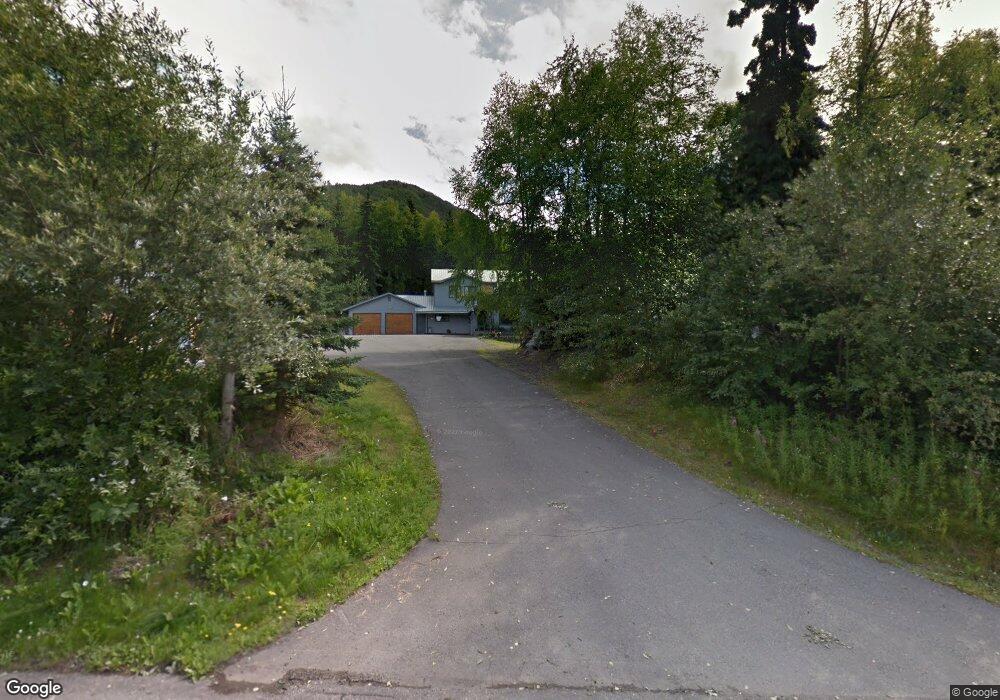
10921 High Bluff Dr Eagle River, AK 99577
Eagle River Valley NeighborhoodEstimated Value: $251,000 - $661,653
4
Beds
5
Baths
3,698
Sq Ft
$134/Sq Ft
Est. Value
About This Home
This home is located at 10921 High Bluff Dr, Eagle River, AK 99577 and is currently estimated at $494,413, approximately $133 per square foot. 10921 High Bluff Dr is a home located in Anchorage Municipality with nearby schools including Ravenwood Elementary School, Gruening Middle School, and Chugiak High School.
Ownership History
Date
Name
Owned For
Owner Type
Purchase Details
Closed on
Nov 4, 2010
Sold by
Voth Clarissa
Bought by
Voth Clarissa
Current Estimated Value
Purchase Details
Closed on
Feb 14, 2003
Sold by
Voth Richard L
Bought by
Voth Richard L and Voth Clarissa
Home Financials for this Owner
Home Financials are based on the most recent Mortgage that was taken out on this home.
Original Mortgage
$115,000
Interest Rate
5.89%
Purchase Details
Closed on
Nov 2, 1993
Sold by
Voth Richard L
Bought by
Voth Richard L
Home Financials for this Owner
Home Financials are based on the most recent Mortgage that was taken out on this home.
Original Mortgage
$63,100
Interest Rate
6.97%
Mortgage Type
New Conventional
Create a Home Valuation Report for This Property
The Home Valuation Report is an in-depth analysis detailing your home's value as well as a comparison with similar homes in the area
Home Values in the Area
Average Home Value in this Area
Purchase History
| Date | Buyer | Sale Price | Title Company |
|---|---|---|---|
| Voth Clarissa | -- | None Available | |
| Voth Richard L | -- | First American Title Of Alas | |
| Voth Richard L | -- | -- | |
| Voth Richard L | -- | -- | |
| Voth Richard L | -- | -- |
Source: Public Records
Mortgage History
| Date | Status | Borrower | Loan Amount |
|---|---|---|---|
| Previous Owner | Voth Richard L | $115,000 | |
| Previous Owner | Voth Richard L | $63,100 |
Source: Public Records
Tax History
| Year | Tax Paid | Tax Assessment Tax Assessment Total Assessment is a certain percentage of the fair market value that is determined by local assessors to be the total taxable value of land and additions on the property. | Land | Improvement |
|---|---|---|---|---|
| 2025 | $8,905 | $552,900 | $139,200 | $413,700 |
| 2024 | $8,905 | $557,600 | $139,200 | $418,400 |
| 2023 | $8,513 | $517,500 | $139,200 | $378,300 |
| 2022 | $5,203 | $513,600 | $142,800 | $370,800 |
| 2021 | $8,512 | $481,200 | $142,800 | $338,400 |
| 2020 | $4,293 | $478,800 | $142,800 | $336,000 |
| 2019 | $4,452 | $477,200 | $142,800 | $334,400 |
| 2018 | $4,381 | $472,600 | $142,800 | $329,800 |
| 2017 | $4,718 | $468,200 | $137,600 | $330,600 |
| 2016 | $3,762 | $475,300 | $137,600 | $337,700 |
| 2015 | $3,762 | $472,800 | $133,600 | $339,200 |
| 2014 | $3,762 | $455,300 | $117,100 | $338,200 |
Source: Public Records
Map
Nearby Homes
- 18709 Whirlaway Rd
- 19413 First St
- 18919 Upper Skyline Dr
- 18643 N Lowrie Loop
- 9500 Puffin Cir
- 9545 Grey Owl Way
- L7 Grey Owl Way
- 17645 Meadow Creek Dr
- 10579 Chain of Rock St
- 18821 S Kanaga Loop
- LOT 4 Upper Lowland Ave
- 9243 Biorka Cir
- 20786 Melody Ln
- 20537 Ptarmigan Blvd
- 17527 Baronoff Ave
- 18931 Danny Dr
- 10220 Silvertip Cir
- 17415 Palos Verdes Dr
- 17727 Nitoanya Cir
- 8935 Birch Park Cir
- 10921 Highbluff Dr
- 10949 Highbluff Dr
- 10949 High Bluff Dr
- 19325 War Admiral Rd
- 10920 Corrie Way
- 10900 Corrie Way
- 10930 Corrie Way
- 10820 High Bluff Dr
- 10920 High Bluff Dr
- 10820 Corrie Way
- 10979 High Bluff Dr
- 10974 High Bluff Dr
- 10974 Highbluff Dr
- 19332 War Admiral Rd
- 10925 Corrie Way
- 10736 High Bluff Dr
- 0 Mile 7 Hiland Rd - D B Gray Homestead Southfork Unit 19-3570
- 19325 Highbluff Dr
- 19400 War Admiral Rd
- 10948 Suneagle Cir
Your Personal Tour Guide
Ask me questions while you tour the home.