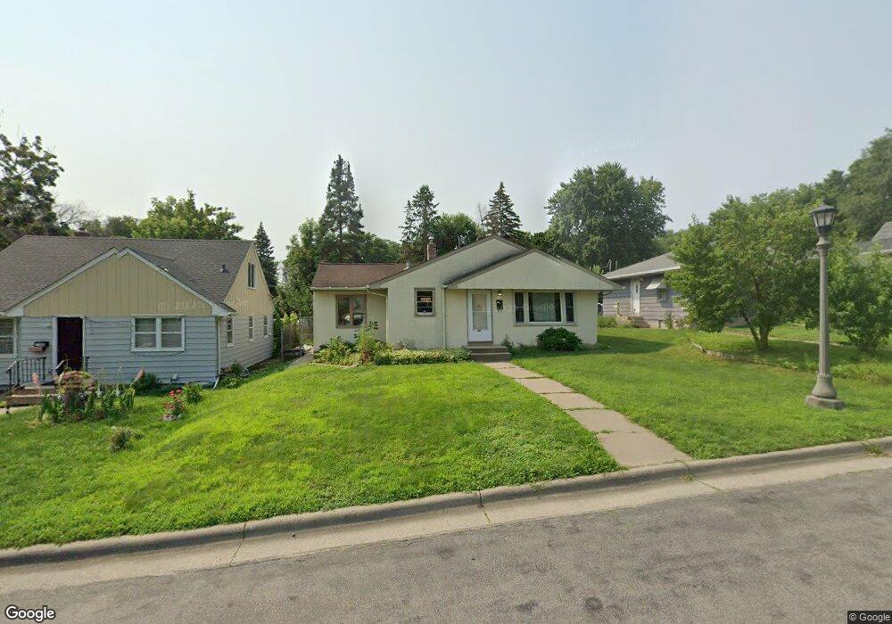
1096 Euclid St Saint Paul, MN 55106
Dayton's Bluff NeighborhoodEstimated Value: $201,000 - $288,000
3
Beds
2
Baths
644
Sq Ft
$369/Sq Ft
Est. Value
About This Home
This home is located at 1096 Euclid St, Saint Paul, MN 55106 and is currently estimated at $237,699, approximately $369 per square foot. 1096 Euclid St is a home located in Ramsey County with nearby schools including Dayton's Bluff Achievement Plus Elementary School, Battle Creek Middle School, and Harding Senior High School.
Ownership History
Date
Name
Owned For
Owner Type
Purchase Details
Closed on
May 16, 2022
Sold by
Eod Enterprises Llc
Bought by
Olson Marlis and Olson Barry D
Current Estimated Value
Purchase Details
Closed on
Jul 10, 1998
Sold by
Kurtz Patricia A
Bought by
Tinge Amy C and Bailey Kimberly A
Create a Home Valuation Report for This Property
The Home Valuation Report is an in-depth analysis detailing your home's value as well as a comparison with similar homes in the area
Home Values in the Area
Average Home Value in this Area
Purchase History
| Date | Buyer | Sale Price | Title Company |
|---|---|---|---|
| Olson Marlis | $15,000 | Titlesmart | |
| Tinge Amy C | $95,000 | -- |
Source: Public Records
Tax History Compared to Growth
Tax History
| Year | Tax Paid | Tax Assessment Tax Assessment Total Assessment is a certain percentage of the fair market value that is determined by local assessors to be the total taxable value of land and additions on the property. | Land | Improvement |
|---|---|---|---|---|
| 2025 | $3,010 | $203,700 | $29,300 | $174,400 |
| 2023 | $3,010 | $198,400 | $18,800 | $179,600 |
| 2022 | $3,042 | $233,800 | $18,800 | $215,000 |
| 2021 | $2,834 | $201,700 | $18,800 | $182,900 |
| 2020 | $2,942 | $179,000 | $18,800 | $160,200 |
| 2019 | $2,908 | $176,800 | $18,800 | $158,000 |
| 2018 | $2,448 | $176,800 | $18,800 | $158,000 |
| 2017 | $1,940 | $157,400 | $18,800 | $138,600 |
| 2016 | $2,016 | $0 | $0 | $0 |
| 2015 | $1,978 | $122,400 | $16,400 | $106,000 |
| 2014 | $1,422 | $0 | $0 | $0 |
Source: Public Records
Map
Nearby Homes
- 1090 Euclid St
- 1090 1090 Euclid-Street-
- 1100 Euclid St
- 1086 Euclid St
- 1108 Euclid St
- 1084 1084 Euclid-Street-
- 1084 Euclid St
- 1095 Wilson Ave
- 1091 Wilson Ave
- 1105 Wilson Ave
- 1082 Euclid St
- 1083 Wilson Ave
- 1093 Euclid St
- 1093 1093 Euclid-Street-
- 1078 Euclid St
- 1116 Euclid St
- 1103 Euclid St
- 1109 Wilson Ave
- 1109 1109 Wilson-Avenue-
- 1085 Euclid St