A
Seller's Agent in 2024
Alexis Holden
Tea Lane Associates
Estimated Value: $4,379,657 - $6,306,000
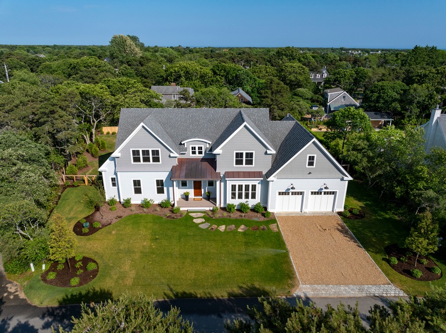
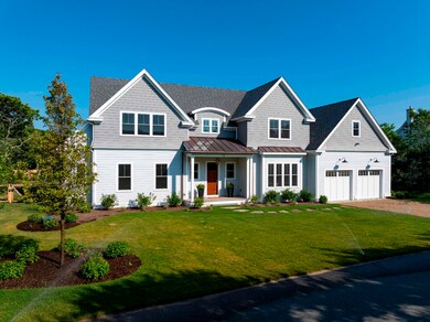
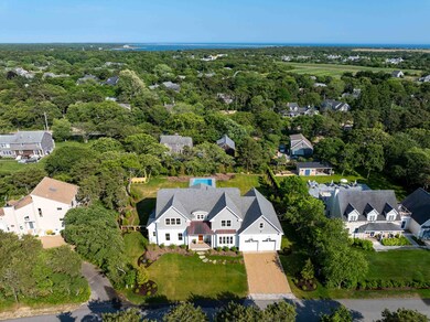
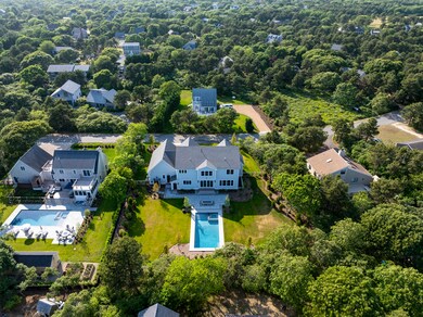
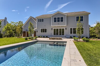
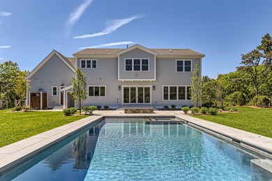
Newly built 6100 square foot custom home located in Katama, just a short walk to Edgartown and a quick bike ride to South Beach.
A new owner will appreciate the thought and attention to detail that has been incorporated into this home which was designed and built by experienced building company, Speedwagon Partners.
Featuring a combination of contemporary design and expertly crafted details like bespoke cabinetry, porcelain and quartz surfaces and white oak flooring, the home instantly feels very luxurious and elegant.
There are a total of four bedrooms and four full baths plus two half baths and two laundry rooms. The living spaces are open to each other yet also defined, with an abundance of natural light thanks to oversized windows and high ceilings. The living room fireplace, Wolf and Thermadore kitchen appliances and a 10 foot quartz island are just some of the features that make this property stand out.
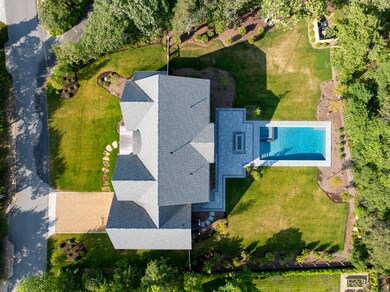
A finished lower level completes the spacious home and the property is well landscaped focusing on an 8 foot deep gunite pool and hot tub with tasteful stonework, gas fire pit and decking.
Last Agent to Sell the Property
Alexis Holden
Tea Lane Associates Listed on: 02/02/2024
Last Buyer's Agent
Alyssa Halisky
Wallace & Co. Sotheby's
| Date | Buyer | Sale Price | Title Company |
|---|---|---|---|
| Abhaile Llc | $4,100,000 | None Available | |
| Abhaile Llc | $4,100,000 | None Available | |
| Abhaile Llc | $4,100,000 | None Available | |
| Glen Sargent Llc | $1,225,000 | None Available | |
| Glen Sargent Llc | $1,225,000 | None Available | |
| Glen Sargent Llc | $1,225,000 | None Available | |
| Coelho Brushy Rt | -- | -- | |
| Coelho Brushy Rt | -- | -- | |
| Coelho Brushy Rt | -- | -- | |
| Coelho Edward Philip | $100,000 | -- | |
| Coelho Edward Philip | $100,000 | -- | |
| Coelho David B | -- | -- | |
| Coelho David B | -- | -- |
| Date | Status | Borrower | Loan Amount |
|---|---|---|---|
| Open | Abhaile Llc | $3,075,000 | |
| Closed | Abhaile Llc | $3,075,000 |
| Date | Event | Price | List to Sale | Price per Sq Ft | Prior Sale |
|---|---|---|---|---|---|
| 10/15/2024 10/15/24 | Sold | $4,100,000 | -25.4% | $672 / Sq Ft | |
| 09/09/2024 09/09/24 | Pending | -- | -- | -- | |
| 02/02/2024 02/02/24 | For Sale | $5,495,000 | +348.6% | $901 / Sq Ft | |
| 12/01/2022 12/01/22 | Sold | $1,225,000 | -- | $256 / Sq Ft | View Prior Sale |
| Year | Tax Paid | Tax Assessment Tax Assessment Total Assessment is a certain percentage of the fair market value that is determined by local assessors to be the total taxable value of land and additions on the property. | Land | Improvement |
|---|---|---|---|---|
| 2025 | $12,761 | $4,815,600 | $888,500 | $3,927,100 |
| 2024 | $2,266 | $888,500 | $888,500 | $0 |
| 2023 | $1,867 | $740,700 | $740,700 | $0 |
| 2022 | $2,107 | $695,300 | $695,300 | $0 |
| 2021 | $1,983 | $604,700 | $604,700 | $0 |
| 2020 | $2,026 | $604,700 | $604,700 | $0 |
| 2019 | $1,755 | $453,500 | $453,500 | $0 |
| 2018 | $1,628 | $508,500 | $508,500 | $0 |
| 2017 | $1,561 | $439,800 | $439,800 | $0 |
| 2016 | $1,443 | $398,600 | $398,600 | $0 |
| 2015 | $1,383 | $398,600 | $398,600 | $0 |
A
Seller's Agent in 2024
Alexis Holden
Tea Lane Associates
A
Buyer's Agent in 2024
Alyssa Halisky
Wallace & Co. Sotheby's
L
Seller's Agent in 2022
LINK Email Cache
LINK
Source: LINK (Vineyard)
MLS Number: 41492
APN: EDGA-000036-000210-000001
Ask me questions while you tour the home.