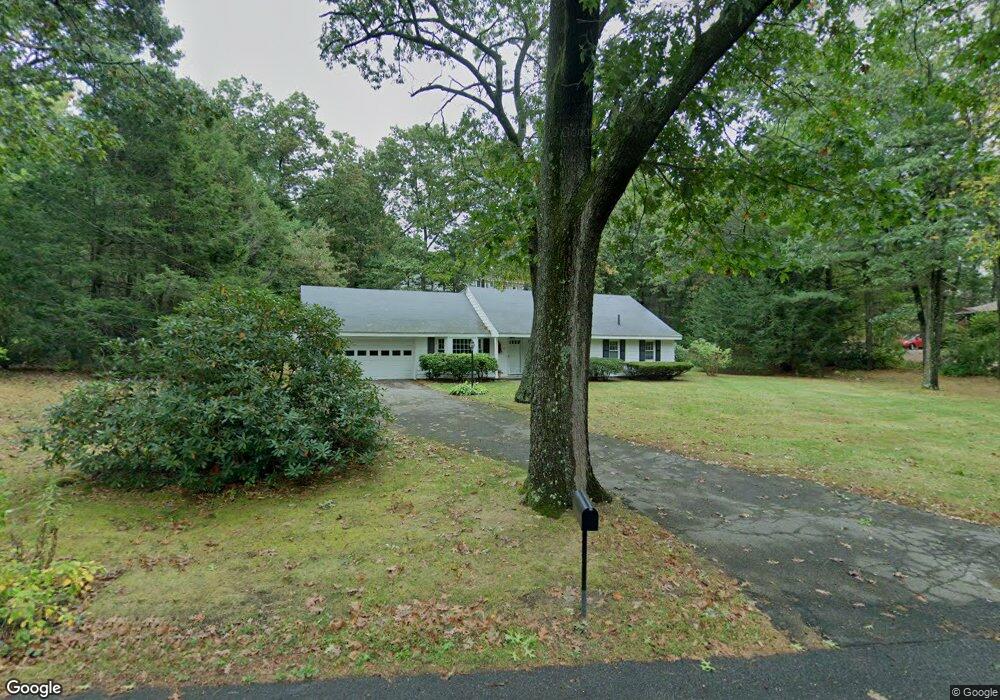
11 Gleason St Andover, MA 01810
West Andover NeighborhoodEstimated Value: $762,000 - $931,000
3
Beds
2
Baths
2,093
Sq Ft
$395/Sq Ft
Est. Value
About This Home
This home is located at 11 Gleason St, Andover, MA 01810 and is currently estimated at $827,047, approximately $395 per square foot. 11 Gleason St is a home located in Essex County with nearby schools including West Elementary School, Wood Hill Middle School, and Willow River Secondary School.
Ownership History
Date
Name
Owned For
Owner Type
Purchase Details
Closed on
Mar 22, 2023
Sold by
11 Gleason Rt and Pierro
Bought by
Patricia A Pierro Ret and Pierro
Current Estimated Value
Purchase Details
Closed on
Feb 19, 2020
Sold by
Pierro Patricia A
Bought by
11 Gleason Rt and Pierro
Purchase Details
Closed on
Apr 28, 1994
Sold by
Chilson R S
Bought by
Pierro Patricia A
Home Financials for this Owner
Home Financials are based on the most recent Mortgage that was taken out on this home.
Original Mortgage
$100,000
Interest Rate
7.7%
Mortgage Type
Purchase Money Mortgage
Create a Home Valuation Report for This Property
The Home Valuation Report is an in-depth analysis detailing your home's value as well as a comparison with similar homes in the area
Home Values in the Area
Average Home Value in this Area
Purchase History
| Date | Buyer | Sale Price | Title Company |
|---|---|---|---|
| Patricia A Pierro Ret | -- | None Available | |
| Patricia A Pierro Ret | -- | None Available | |
| 11 Gleason Rt | -- | None Available | |
| 11 Gleason Rt | -- | None Available | |
| Pierro Patricia A | $178,000 | -- | |
| Pierro Patricia A | $178,000 | -- |
Source: Public Records
Mortgage History
| Date | Status | Borrower | Loan Amount |
|---|---|---|---|
| Previous Owner | Pierro Patricia A | $50,000 | |
| Previous Owner | Pierro Patricia A | $89,000 | |
| Previous Owner | Pierro Patricia A | $25,000 | |
| Previous Owner | Pierro Patricia A | $100,000 |
Source: Public Records
Tax History Compared to Growth
Tax History
| Year | Tax Paid | Tax Assessment Tax Assessment Total Assessment is a certain percentage of the fair market value that is determined by local assessors to be the total taxable value of land and additions on the property. | Land | Improvement |
|---|---|---|---|---|
| 2024 | $8,460 | $656,800 | $407,700 | $249,100 |
| 2023 | $8,094 | $592,500 | $367,200 | $225,300 |
| 2022 | $7,595 | $520,200 | $325,100 | $195,100 |
| 2021 | $7,266 | $475,200 | $295,500 | $179,700 |
| 2020 | $6,972 | $464,500 | $288,500 | $176,000 |
| 2019 | $6,772 | $443,500 | $271,900 | $171,600 |
| 2018 | $6,487 | $414,800 | $256,600 | $158,200 |
| 2017 | $6,200 | $408,400 | $251,500 | $156,900 |
| 2016 | $5,812 | $392,200 | $235,300 | $156,900 |
| 2015 | $5,609 | $374,700 | $226,300 | $148,400 |
Source: Public Records
Map
Nearby Homes
- 25 Clubview Dr Unit 25
- 13 Clubview Dr Unit 13
- 37 Crenshaw Ln Unit 37
- 29 Glenwood Dr
- 0
- 21 Clubview Dr Unit 21
- 96 Beacon St
- 15 Geneva Rd
- 14 Geneva Rd
- 11 Devonshire St
- 5 Marc Ln
- 750 Brookside Dr Unit G
- 38 Lincoln Cir E
- 22 Haggetts Pond Rd
- 10 Martingale Ln Unit 10
- 42 Beresford St
- 6 Windsor St
- 102 Weare St
- 33 Jefferson St
- 15 Beaconsfield St
- 16 Woodhaven Dr
- 15 Gleason St
- 7 Gleason St
- 18 Woodhaven Dr
- 14 Gleason St
- 8 Gleason St
- 20 Woodhaven Dr
- 175 High Plain Rd
- 14 Woodhaven Dr
- 18 Gleason St
- 19 Gleason St
- 169 High Plain Rd
- 63 Juniper Rd
- 177 High Plain Rd
- 22 Woodhaven Dr
- 29 Woodhaven Dr
- 12 Woodhaven Dr
- 61 Juniper Rd
- 22 Gleason St
- 21 Gleason St