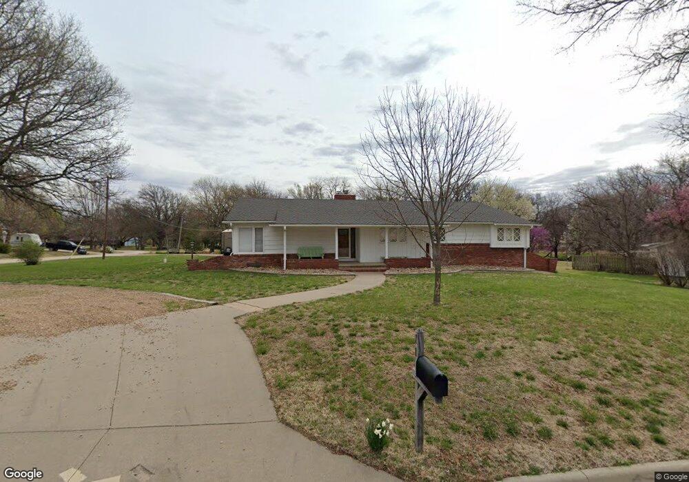
11 Louis Dr Mulvane, KS 67110
Estimated Value: $233,000 - $261,011
3
Beds
2
Baths
1,748
Sq Ft
$141/Sq Ft
Est. Value
About This Home
This home is located at 11 Louis Dr, Mulvane, KS 67110 and is currently estimated at $247,006, approximately $141 per square foot. 11 Louis Dr is a home located in Sedgwick County with nearby schools including Munson Primary School, Mulvane Grade School, and Mulvane Middle School.
Ownership History
Date
Name
Owned For
Owner Type
Purchase Details
Closed on
Sep 30, 1999
Sold by
Smith Stephen L and Smith Sherrie R
Bought by
Loper Kirk A and Loper Terri L
Current Estimated Value
Home Financials for this Owner
Home Financials are based on the most recent Mortgage that was taken out on this home.
Original Mortgage
$96,000
Outstanding Balance
$29,053
Interest Rate
7.86%
Estimated Equity
$217,953
Create a Home Valuation Report for This Property
The Home Valuation Report is an in-depth analysis detailing your home's value as well as a comparison with similar homes in the area
Home Values in the Area
Average Home Value in this Area
Purchase History
| Date | Buyer | Sale Price | Title Company |
|---|---|---|---|
| Loper Kirk A | -- | South Kansas Title Corp |
Source: Public Records
Mortgage History
| Date | Status | Borrower | Loan Amount |
|---|---|---|---|
| Open | Loper Kirk A | $96,000 | |
| Closed | Loper Kirk A | $24,600 |
Source: Public Records
Tax History Compared to Growth
Tax History
| Year | Tax Paid | Tax Assessment Tax Assessment Total Assessment is a certain percentage of the fair market value that is determined by local assessors to be the total taxable value of land and additions on the property. | Land | Improvement |
|---|---|---|---|---|
| 2025 | $4,030 | $27,106 | $6,509 | $20,597 |
| 2023 | $4,030 | $27,106 | $4,888 | $22,218 |
| 2022 | $3,581 | $24,174 | $4,612 | $19,562 |
| 2021 | $3,035 | $21,977 | $2,887 | $19,090 |
| 2020 | $2,780 | $20,344 | $2,887 | $17,457 |
| 2019 | $3,467 | $20,344 | $2,887 | $17,457 |
| 2018 | $3,235 | $19,378 | $2,151 | $17,227 |
| 2017 | $3,153 | $0 | $0 | $0 |
| 2016 | $3,075 | $0 | $0 | $0 |
| 2015 | $3,049 | $0 | $0 | $0 |
| 2014 | $2,767 | $0 | $0 | $0 |
Source: Public Records
Map
Nearby Homes
- 1532 N Rockwood Blvd
- 7130 E 111th St S
- 1417 Shelly Ct
- 1850 N Rock Rd
- 105 E Burlington Dr
- 158 Chestnut Dr
- 10100 S Rock Rd
- 1211 Sunset Dr
- 1601 N Prairie Run Cir
- 11145 Anthony Ln
- 407 E Hickory Ct
- 622 Edgemoor Dr
- 722 Westview Dr
- 610 Eastview Dr
- 1651 N Diamond Cir
- 1647 N Diamond Cir
- 1612 N Diamond Cir
- 1615 N Diamond Cir
- 1616 N Diamond Cir
- 1611 N Diamond Cir