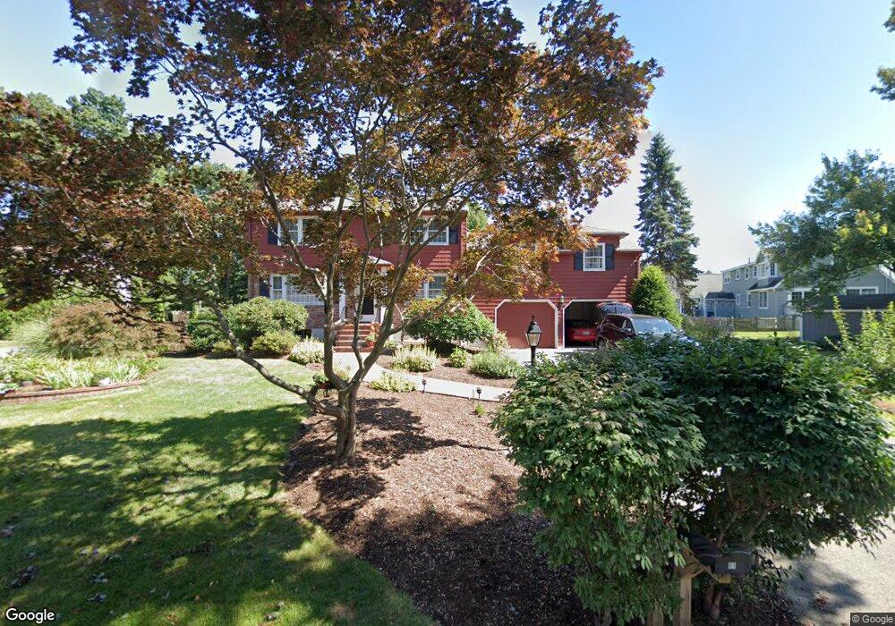
11 Russett Ln Andover, MA 01810
West Andover NeighborhoodEstimated Value: $1,148,500 - $1,305,000
4
Beds
3
Baths
3,190
Sq Ft
$389/Sq Ft
Est. Value
About This Home
This home is located at 11 Russett Ln, Andover, MA 01810 and is currently estimated at $1,242,125, approximately $389 per square foot. 11 Russett Ln is a home located in Essex County with nearby schools including Henry C. Sanborn Elementary School, Andover West Middle School, and Andover High School.
Create a Home Valuation Report for This Property
The Home Valuation Report is an in-depth analysis detailing your home's value as well as a comparison with similar homes in the area
Home Values in the Area
Average Home Value in this Area
Tax History Compared to Growth
Tax History
| Year | Tax Paid | Tax Assessment Tax Assessment Total Assessment is a certain percentage of the fair market value that is determined by local assessors to be the total taxable value of land and additions on the property. | Land | Improvement |
|---|---|---|---|---|
| 2024 | $11,363 | $882,200 | $444,500 | $437,700 |
| 2023 | $10,909 | $798,600 | $400,300 | $398,300 |
| 2022 | $10,254 | $702,300 | $348,100 | $354,200 |
| 2021 | $9,807 | $641,400 | $316,500 | $324,900 |
| 2020 | $9,438 | $628,800 | $308,900 | $319,900 |
| 2019 | $9,385 | $614,600 | $299,700 | $314,900 |
| 2018 | $9,063 | $579,500 | $288,300 | $291,200 |
| 2017 | $8,700 | $573,100 | $282,600 | $290,500 |
| 2016 | $8,507 | $574,000 | $282,600 | $291,400 |
| 2015 | $8,199 | $547,700 | $271,500 | $276,200 |
Source: Public Records
Map
Nearby Homes
- 4 Hazelwood Cir
- 18 Dale St Unit 4G
- 18 Bryan Ln Unit 18
- 105 Central St
- 103 Central St
- 14 Geneva Rd
- 15 Geneva Rd
- 58 Blanchard St
- 3 West Hollow
- 69 Blanchard St
- 47 Abbot St
- 14 Regis Rd
- 25 Timothy Dr
- 31 Porter Rd
- 22 Haggetts Pond Rd
- 4 Hammond Way
- 37 Crenshaw Ln Unit 37
- 56 Sunset Rock Rd
- 101 Bellevue Rd
- 5 Kensington Way Unit 5